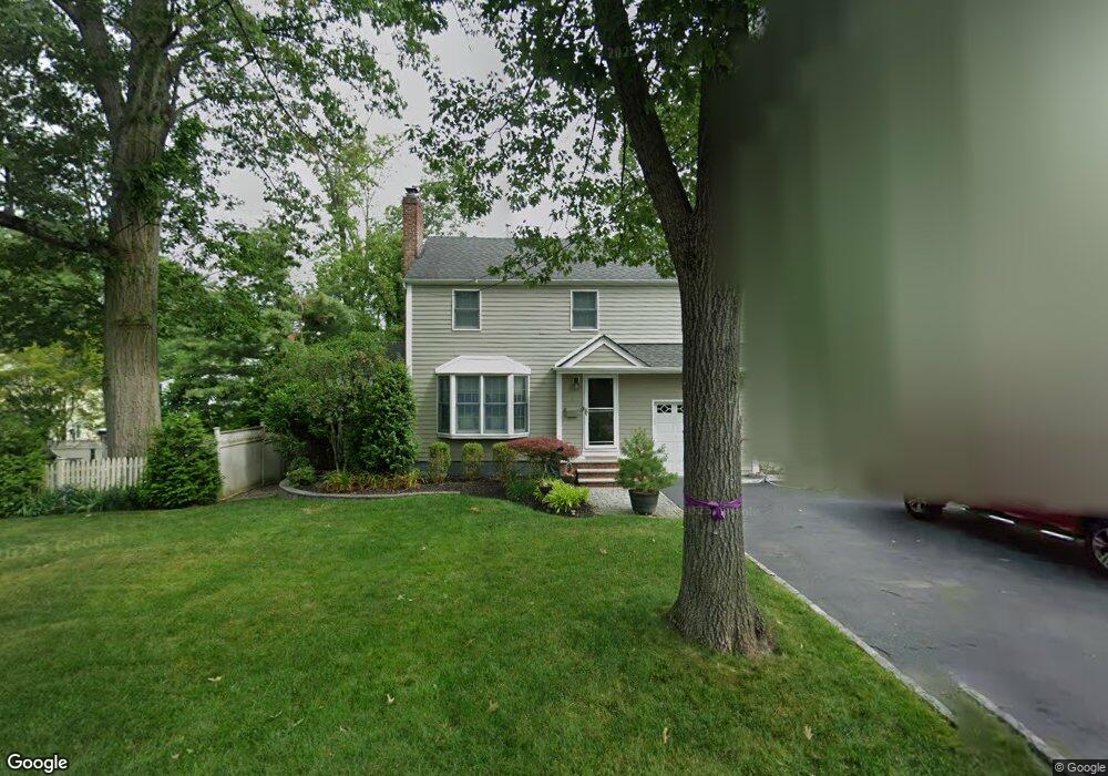
8 Webster Ave Summit, NJ 07901
Estimated Value: $989,142 - $1,272,000
Studio
--
Bath
1,780
Sq Ft
$646/Sq Ft
Est. Value
About This Home
This home is located at 8 Webster Ave, Summit, NJ 07901 and is currently estimated at $1,149,536, approximately $645 per square foot. 8 Webster Ave is a home located in Union County with nearby schools including L C Johnson Summit Middle School, Summit Sr High School, and Kent Place School.
Ownership History
Date
Name
Owned For
Owner Type
Purchase Details
Closed on
Feb 19, 2021
Sold by
Murphy Christopher P and Murphy Rebecca A
Bought by
Murphy Christopher P and Murphy Rebecca A
Current Estimated Value
Purchase Details
Closed on
Oct 1, 2004
Sold by
Wattick Michael
Bought by
Murphy Christopher and Preston Rebecca
Home Financials for this Owner
Home Financials are based on the most recent Mortgage that was taken out on this home.
Original Mortgage
$465,600
Interest Rate
5.81%
Purchase Details
Closed on
Jul 10, 2000
Sold by
Omalley John P and Omalley Marianne D
Bought by
Wattick Michael
Home Financials for this Owner
Home Financials are based on the most recent Mortgage that was taken out on this home.
Original Mortgage
$240,000
Interest Rate
8.25%
Create a Home Valuation Report for This Property
The Home Valuation Report is an in-depth analysis detailing your home's value as well as a comparison with similar homes in the area
Home Values in the Area
Average Home Value in this Area
Purchase History
| Date | Buyer | Sale Price | Title Company |
|---|---|---|---|
| Murphy Christopher P | -- | None Listed On Document | |
| Redacted Upon Request | -- | None Listed On Document | |
| Murphy Christopher | $582,000 | -- | |
| Wattick Michael | $420,000 | -- |
Source: Public Records
Mortgage History
| Date | Status | Borrower | Loan Amount |
|---|---|---|---|
| Previous Owner | Murphy Christopher | $465,600 | |
| Previous Owner | Wattick Michael | $240,000 |
Source: Public Records
Tax History
| Year | Tax Paid | Tax Assessment Tax Assessment Total Assessment is a certain percentage of the fair market value that is determined by local assessors to be the total taxable value of land and additions on the property. | Land | Improvement |
|---|---|---|---|---|
| 2025 | $12,153 | $279,000 | $141,100 | $137,900 |
| 2024 | $12,072 | $279,000 | $141,100 | $137,900 |
| 2023 | $12,072 | $279,000 | $141,100 | $137,900 |
| 2022 | $11,950 | $279,000 | $141,100 | $137,900 |
| 2021 | $12,044 | $279,000 | $141,100 | $137,900 |
| 2020 | $12,164 | $279,000 | $141,100 | $137,900 |
| 2019 | $12,178 | $279,000 | $141,100 | $137,900 |
| 2018 | $12,100 | $279,000 | $141,100 | $137,900 |
| 2017 | $12,178 | $279,000 | $141,100 | $137,900 |
| 2016 | $12,000 | $279,000 | $141,100 | $137,900 |
| 2015 | $11,765 | $279,000 | $141,100 | $137,900 |
| 2014 | $11,461 | $279,000 | $141,100 | $137,900 |
Source: Public Records
Map
Nearby Homes
- 215 Kent Place Blvd
- 8 Dunnder Dr
- 107 Kent Place Blvd
- 25 Bedford Rd
- 49 Norwood Ave
- 000 River Rd
- 55 River Rd
- 88 Beekman Rd
- 76 Woodland Ave
- 275 Woodland Ave
- 709 Springfield Ave Unit 4
- 709 Springfield Ave Unit 2
- 42 Locust Dr
- 26 Pihlman Place
- 49 Minton Ave
- 30 Coachlight Dr
- 23 Euclid Ave
- 6 Edgehill Ave
- 81 Summit Ave
- 11 Euclid Ave Unit 4D
Your Personal Tour Guide
Ask me questions while you tour the home.