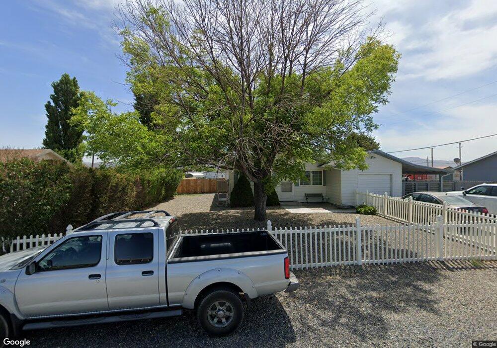
80 Cessna Ln Lovelock, NV 89419
Estimated Value: $249,000 - $412,000
3
Beds
2
Baths
1,175
Sq Ft
$254/Sq Ft
Est. Value
About This Home
This home is located at 80 Cessna Ln, Lovelock, NV 89419 and is currently estimated at $298,513, approximately $254 per square foot. 80 Cessna Ln is a home located in Pershing County with nearby schools including Pershing County Middle School and Pershing County High School.
Ownership History
Date
Name
Owned For
Owner Type
Purchase Details
Closed on
Dec 9, 2020
Sold by
Meissner Blaine A and Meissner Nancy A
Bought by
Gonzalez Alfonso Sergio
Current Estimated Value
Home Financials for this Owner
Home Financials are based on the most recent Mortgage that was taken out on this home.
Original Mortgage
$152,000
Interest Rate
2.67%
Mortgage Type
New Conventional
Purchase Details
Closed on
Jul 31, 2006
Bought by
Meissner Blaine and Meissner Nancy A
Home Financials for this Owner
Home Financials are based on the most recent Mortgage that was taken out on this home.
Original Mortgage
$55,000
Interest Rate
6.69%
Mortgage Type
New Conventional
Create a Home Valuation Report for This Property
The Home Valuation Report is an in-depth analysis detailing your home's value as well as a comparison with similar homes in the area
Purchase History
| Date | Buyer | Sale Price | Title Company |
|---|---|---|---|
| Gonzalez Alfonso Sergio | $160,000 | Western Title | |
| Meissner Blaine | -- | -- |
Source: Public Records
Mortgage History
| Date | Status | Borrower | Loan Amount |
|---|---|---|---|
| Previous Owner | Gonzalez Alfonso Sergio | $152,000 | |
| Previous Owner | Meissner Blaine | $55,000 |
Source: Public Records
Tax History
| Year | Tax Paid | Tax Assessment Tax Assessment Total Assessment is a certain percentage of the fair market value that is determined by local assessors to be the total taxable value of land and additions on the property. | Land | Improvement |
|---|---|---|---|---|
| 2025 | $1,264 | $35,989 | $5,250 | $30,739 |
| 2024 | $1,264 | $37,000 | $5,250 | $31,750 |
| 2023 | $1,264 | $34,956 | $5,250 | $29,706 |
| 2022 | $1,088 | $29,460 | $3,906 | $25,554 |
| 2021 | $1,042 | $29,140 | $3,906 | $25,234 |
| 2020 | $1,068 | $29,955 | $3,906 | $26,049 |
| 2019 | $1,061 | $29,743 | $3,906 | $25,837 |
| 2018 | $1,052 | $29,457 | $3,906 | $25,551 |
| 2017 | $951 | $26,182 | $4,200 | $21,982 |
| 2016 | $947 | $26,185 | $4,200 | $21,985 |
| 2015 | $930 | $26,295 | $4,200 | $22,095 |
| 2014 | $930 | $26,406 | $4,200 | $22,206 |
Source: Public Records
Map
Nearby Homes
- 43 Cliff Banks Ct
- 200 Raymond Rd
- 88 River Banks Ct
- 48 River Banks Ct
- 38 River Banks Ct
- 68 River Banks Ct
- 750 Airport Rd
- 0 Airport Rd
- 5105 N Meridian Rd
- 1645 Central Ave
- 750 16th St
- 1070 Cornell Ave
- APN 14th St
- T28 R31 Sec 27
- T33 R37 Sec 3
- 1460 Elmhurst Ave
- 1350 Elmhurst Ave
- 680 17th St
- 795 16th St
- 0 None Unit 250052017
- 70 Cessna Ln
- 140 Cessna Ln
- 135 Cessna Ln
- 125 Cessna Ln
- 90 Cessna Ln
- 75 Cessna Ln
- 60 Cessna Ln
- 85 Cessna Ln
- 85 Cessna Ln Unit 8
- 95 Cessna Ln
- 50 Cessna Ln
- 0 Cessna Ln Unit 200003220
- 0 Cessna Ln Unit 90001146
- 0 Cessna Ln Unit 60015517
- 0 Cessna Ln Unit 190012353
- 0 Cessna Ln Unit 220013507
- 0 Cessna Ln Unit 100011132
- 0 Cessna Ln Unit 10 200003220
- 101,105 Cessna Ln
- 110 Cessna Ln
Your Personal Tour Guide
Ask me questions while you tour the home.