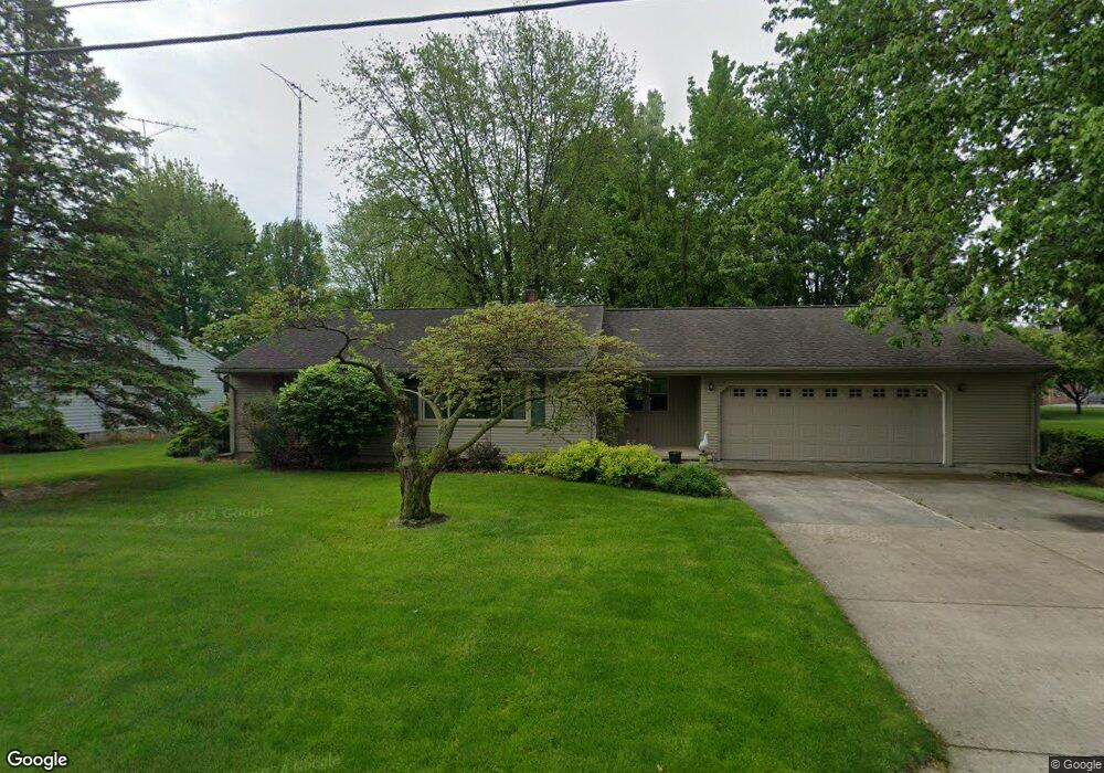
800 W Elmore Eastern Rd Elmore, OH 43416
Estimated Value: $167,365 - $215,000
3
Beds
1
Bath
1,694
Sq Ft
$110/Sq Ft
Est. Value
About This Home
This home is located at 800 W Elmore Eastern Rd, Elmore, OH 43416 and is currently estimated at $186,591, approximately $110 per square foot. 800 W Elmore Eastern Rd is a home located in Ottawa County with nearby schools including Woodmore Elementary School, Woodmore Middle School, and Woodmore High School.
Ownership History
Date
Name
Owned For
Owner Type
Purchase Details
Closed on
Apr 22, 2020
Sold by
Leist Julie A and Webb Laurel J
Bought by
Webb Hyayes C
Current Estimated Value
Purchase Details
Closed on
May 27, 2009
Sold by
Webb Hayes I and Webb Margaret H
Bought by
Webb Hayes I and Webb Margaret H
Purchase Details
Closed on
Dec 2, 2005
Sold by
Webb Hayes I and Webb Margaret H
Bought by
Webb Hayes I and Webb Margaret H
Create a Home Valuation Report for This Property
The Home Valuation Report is an in-depth analysis detailing your home's value as well as a comparison with similar homes in the area
Home Values in the Area
Average Home Value in this Area
Purchase History
| Date | Buyer | Sale Price | Title Company |
|---|---|---|---|
| Webb Hyayes C | $73,400 | None Available | |
| Webb Hayes I | -- | Attorney | |
| Webb Hayes I | -- | None Available |
Source: Public Records
Tax History
| Year | Tax Paid | Tax Assessment Tax Assessment Total Assessment is a certain percentage of the fair market value that is determined by local assessors to be the total taxable value of land and additions on the property. | Land | Improvement |
|---|---|---|---|---|
| 2024 | $2,612 | $47,779 | $13,619 | $34,160 |
| 2023 | $2,606 | $42,581 | $10,087 | $32,494 |
| 2022 | $2,496 | $42,581 | $10,087 | $32,494 |
| 2021 | $2,515 | $42,590 | $10,090 | $32,500 |
| 2020 | $2,048 | $32,890 | $5,320 | $27,570 |
| 2019 | $2,024 | $32,890 | $5,320 | $27,570 |
| 2018 | $1,431 | $32,890 | $5,320 | $27,570 |
| 2017 | $1,343 | $31,270 | $5,320 | $25,950 |
| 2016 | $1,313 | $31,270 | $5,320 | $25,950 |
| 2015 | $1,397 | $31,270 | $5,320 | $25,950 |
| 2014 | $674 | $29,860 | $5,320 | $24,540 |
| 2013 | $1,351 | $29,860 | $5,320 | $24,540 |
Source: Public Records
Map
Nearby Homes
- 348 E 4th St
- 0 W Portage River Rd S Unit 6130453
- 504 Rice St
- 159 Smith St
- 17151 W State Route 105
- 20240 W Portage River South Rd
- 1001 Oak St
- 620 Water St
- 2574 County Road 74
- 2460 County Road 62
- 13822 W Portage River South Rd
- 110 S Main St
- 1005 W College Ave
- 136 W Lincoln St
- 114 W Lincoln St
- 108 W 8th St
- 0 N Walker St
- 14245 W State Route 163
- 417 S Main St
- 207 E 11th St
- 810 W Elmore Eastern Rd
- 750 W Elmore Eastern Rd
- 805 Fremont St
- 747 Aspen Ave
- 815 Fremont St
- 739 Fremont St
- 755 Fremont St
- 533 Linden St
- 825 Fremont St
- Lot 38 Aspen Ave
- LOT 39 Aspen Ave
- LOT 40 Aspen Ave
- 737 Aspen Ave
- 718 W Elmore Eastern Rd
- 816 Ohio Ave
- 722 W Elmore Eastern Rd
- 826 Ohio Ave
- 830 W Elmore Eastern Rd
- 841 Fremont St
- 716 W Elmore Eastern Rd
Your Personal Tour Guide
Ask me questions while you tour the home.