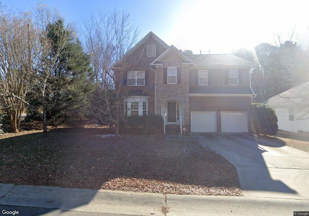
801 Martry Rd Durham, NC 27713
South Durham NeighborhoodEstimated Value: $630,000 - $688,000
About This Home
This home is located at 801 Martry Rd, Durham, NC 27713 and is currently estimated at $656,397, approximately $221 per square foot. 801 Martry Rd is a home located in Durham County with nearby schools including Lyons Farm Elementary, Lowe's Grove Middle, and Hillside High School.
Ownership History
We collect this data history from publicly available records. To have your information removed, we recommend requesting removal directly through your county’s website.
Purchase Details
Home Financials for this Owner
Home Financials are based on the most recent Mortgage that was taken out on this home.Home Values in the Area
Average Home Value in this Area
Purchase History
We collect this data history from publicly available records. To have your information removed, we recommend requesting removal directly through your county’s website.
| Date | Buyer | Sale Price | Title Company |
|---|---|---|---|
| $255,500 | -- |
Mortgage History
We collect this data history from publicly available records. To have your information removed, we recommend requesting removal directly through your county’s website.
| Date | Status | Borrower | Loan Amount |
|---|---|---|---|
| Open | $253,000 | ||
| Closed | $263,400 | ||
| Closed | $204,172 | ||
| Closed | $145,000 |
Tax History
We collect this data history from publicly available records. To have your information removed, we recommend requesting removal directly through your county’s website.
| Year | Tax Paid | Tax Assessment Tax Assessment Total Assessment is a certain percentage of the fair market value that is determined by local assessors to be the total taxable value of land and additions on the property. | Land | Improvement |
|---|---|---|---|---|
| 2025 | $5,696 | $574,640 | $148,500 | $426,140 |
| 2024 | $4,649 | $333,290 | $82,500 | $250,790 |
| 2023 | $4,366 | $333,290 | $82,500 | $250,790 |
| 2022 | $4,266 | $333,290 | $82,500 | $250,790 |
| 2021 | $4,246 | $333,290 | $82,500 | $250,790 |
| 2020 | $4,146 | $333,290 | $82,500 | $250,790 |
| 2019 | $4,146 | $333,290 | $82,500 | $250,790 |
| 2018 | $4,569 | $336,842 | $70,000 | $266,842 |
| 2017 | $4,536 | $336,842 | $70,000 | $266,842 |
| 2016 | $4,383 | $336,842 | $70,000 | $266,842 |
| 2015 | $4,238 | $306,164 | $63,200 | $242,964 |
| 2014 | $4,238 | $306,164 | $63,200 | $242,964 |
Map
- 707 Martry Rd
- 714 Adeline Ct
- 507 Stinhurst Dr
- 7409 Chesley Ln
- 7 Monteith Ct
- 218 Landreth Ct
- 102 Settlers Mill Ln
- 4916 Wineberry Dr
- 1013 Pondfield Way
- 5 Bobcat Ct
- 7 Bobcat Ct
- 84 Candytuff Ln
- 4517 Grandale Dr
- 605 Swift Creek Crossing
- 5320 Mccormick Rd
- 114 Wenonah Way
- 4403 Grandale Dr
- 124 Wicklow Ln
- 6353 Grandale Dr
- 517 Panthers Run Dr
- 803 Martry Rd
- 805 Martry Rd
- 807 Martry Rd
- 710 Martry Rd
- 8409 Herndon Rd
- 8429 Herndon Rd
- 8413 Herndon Rd
- 7412 Herndon Rd
- 7412 Herndon Rd Unit 1
- 6628 Herndon Rd
- 6708 Herndon Rd
- 6624 Herndon Rd
- 7504 Leapale Ln
- 7420 Herndon Rd
- 703 Martry Rd
- 901 Martry Rd
- 708 Martry Rd
- 7506 Leapale Ln
- 7602 Herndon Rd
- 706 Martry Rd
Ask me questions while you tour the home.