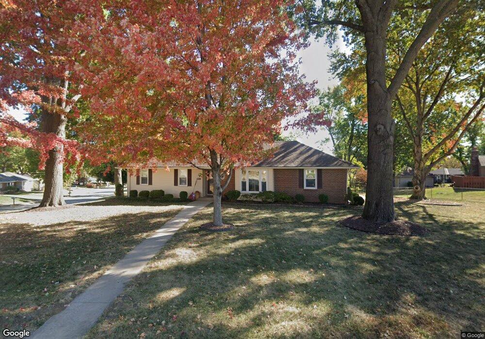
803 Glendale Rd Liberty, MO 64068
Estimated Value: $281,000 - $349,000
3
Beds
2
Baths
1,632
Sq Ft
$197/Sq Ft
Est. Value
About This Home
This home is located at 803 Glendale Rd, Liberty, MO 64068 and is currently estimated at $320,980, approximately $196 per square foot. 803 Glendale Rd is a home located in Clay County with nearby schools including Alexander Doniphan Elementary School, Discovery Middle School, and Liberty High School.
Ownership History
Date
Name
Owned For
Owner Type
Purchase Details
Closed on
Jun 22, 2022
Sold by
Iron Street Rei Llc
Bought by
Henslee Peggy Jo
Current Estimated Value
Purchase Details
Closed on
Apr 5, 2022
Sold by
Cooper Henry D
Bought by
Iron Street Rei Llc
Home Financials for this Owner
Home Financials are based on the most recent Mortgage that was taken out on this home.
Original Mortgage
$200,450
Interest Rate
4.67%
Mortgage Type
New Conventional
Create a Home Valuation Report for This Property
The Home Valuation Report is an in-depth analysis detailing your home's value as well as a comparison with similar homes in the area
Home Values in the Area
Average Home Value in this Area
Purchase History
| Date | Buyer | Sale Price | Title Company |
|---|---|---|---|
| Henslee Peggy Jo | -- | Thomson Affinity Title | |
| Iron Street Rei Llc | -- | Thomson Affinity Title |
Source: Public Records
Mortgage History
| Date | Status | Borrower | Loan Amount |
|---|---|---|---|
| Previous Owner | Iron Street Rei Llc | $200,450 | |
| Closed | Henslee Peggy Jo | $0 |
Source: Public Records
Tax History
| Year | Tax Paid | Tax Assessment Tax Assessment Total Assessment is a certain percentage of the fair market value that is determined by local assessors to be the total taxable value of land and additions on the property. | Land | Improvement |
|---|---|---|---|---|
| 2025 | $3,103 | $46,340 | -- | -- |
| 2024 | $3,103 | $40,340 | -- | -- |
| 2023 | $3,155 | $40,340 | $0 | $0 |
| 2022 | $2,858 | $36,080 | $0 | $0 |
| 2021 | $2,836 | $36,081 | $6,650 | $29,431 |
| 2020 | $2,645 | $31,600 | $0 | $0 |
| 2019 | $2,644 | $31,600 | $0 | $0 |
| 2018 | $2,363 | $27,720 | $0 | $0 |
| 2017 | $2,132 | $27,720 | $3,800 | $23,920 |
| 2016 | $2,132 | $25,250 | $3,800 | $21,450 |
| 2015 | $2,132 | $25,250 | $3,800 | $21,450 |
| 2014 | $2,149 | $25,250 | $3,800 | $21,450 |
Source: Public Records
Map
Nearby Homes
- 429 Pershing St
- 607 Glendale Rd
- 803 Melrose St
- 409 Wilshire Blvd
- Lot 2 Bent Oaks Dr
- 2116 Winding Woods Dr
- Lot 2A Oak Crest Dr
- 8816 NE 73rd Terrace
- 7521 N Stark Ave
- 8801 Orchard St
- 7436 N Lewis Ave
- 807 Conistor Ln
- 717 Riverwood Dr
- 1804 W Liberty Dr
- 1561 Parkside Dr
- 6900 Fulton Rd
- 7629 N Booth Ave
- 7645 N Booth Ave
- 7636 N Booth Ave
- 7644 N Booth Ave
- 424 Gordon Dr
- 436 Pershing St
- 432 Pershing St
- 422 Gordon Dr
- 800 Glendale Rd
- 709 Glendale Rd
- 428 Pershing St
- 804 Glendale Rd
- 423 Gordon Dr
- 420 Gordon Dr
- 708 Glendale Rd
- 424 Pershing St
- 705 Glendale Rd
- 421 Gordon Dr
- 504 Pershing Ave
- 901 Glendale Rd
- 805 Midjay Dr
- 418 Gordon Dr
- 809 Midjay Dr
- 433 Pershing St
Your Personal Tour Guide
Ask me questions while you tour the home.