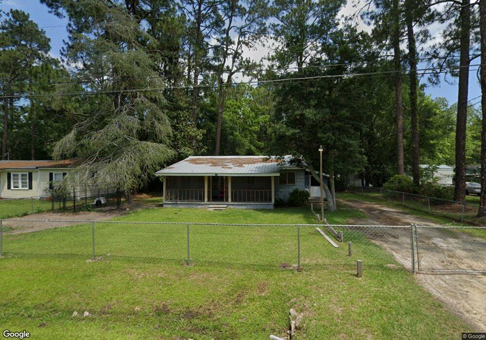
805 Holmes Dr Moultrie, GA 31768
Estimated Value: $72,000 - $158,000
Studio
1
Bath
953
Sq Ft
$108/Sq Ft
Est. Value
About This Home
This home is located at 805 Holmes Dr, Moultrie, GA 31768 and is currently estimated at $102,471, approximately $107 per square foot. 805 Holmes Dr is a home located in Colquitt County with nearby schools including Cox Elementary School, Willie J. Williams Middle School, and C.A. Gray Junior High School.
Ownership History
Date
Name
Owned For
Owner Type
Purchase Details
Closed on
Apr 21, 2023
Sold by
Oliver Samuel T
Bought by
Knight Kieria S
Current Estimated Value
Purchase Details
Closed on
Apr 11, 2019
Sold by
Cook Ronnie K
Bought by
Knight Kieria S and Oliver Samuel T
Home Financials for this Owner
Home Financials are based on the most recent Mortgage that was taken out on this home.
Original Mortgage
$22,000
Interest Rate
4.3%
Mortgage Type
New Conventional
Purchase Details
Closed on
Aug 14, 1979
Bought by
Cook Shelly C
Create a Home Valuation Report for This Property
The Home Valuation Report is an in-depth analysis detailing your home's value as well as a comparison with similar homes in the area
Purchase History
| Date | Buyer | Sale Price | Title Company |
|---|---|---|---|
| Knight Kieria S | -- | -- | |
| Knight Kieria S | $25,000 | -- | |
| Cook Shelly C | $13,500 | -- |
Source: Public Records
Mortgage History
| Date | Status | Borrower | Loan Amount |
|---|---|---|---|
| Previous Owner | Knight Kieria S | $22,000 |
Source: Public Records
Tax History
| Year | Tax Paid | Tax Assessment Tax Assessment Total Assessment is a certain percentage of the fair market value that is determined by local assessors to be the total taxable value of land and additions on the property. | Land | Improvement |
|---|---|---|---|---|
| 2025 | $416 | $31,867 | $1,496 | $30,371 |
| 2024 | $416 | $21,364 | $1,496 | $19,868 |
| 2023 | $408 | $13,483 | $1,496 | $11,987 |
| 2022 | $213 | $10,930 | $1,496 | $9,434 |
| 2021 | $172 | $9,075 | $1,496 | $7,579 |
| 2020 | $175 | $9,075 | $1,496 | $7,579 |
| 2019 | $318 | $11,578 | $1,496 | $10,082 |
| 2018 | $296 | $11,578 | $1,496 | $10,082 |
| 2017 | $315 | $11,578 | $1,496 | $10,082 |
| 2016 | $319 | $11,578 | $1,496 | $10,082 |
| 2015 | $314 | $11,282 | $1,200 | $10,082 |
| 2014 | $308 | $11,282 | $1,200 | $10,082 |
| 2013 | -- | $11,281 | $1,200 | $10,081 |
Source: Public Records
Map
Nearby Homes
- 1701 10th St SE
- 1820 10th St SE
- 44 Sloans Village Way SE
- 0 Jones Ln
- 1732 4th St SE
- 1821 3rd St SE
- 1836 4th St SE
- 304 Tallokas Rd
- 1907 4th St SE
- 220 13th Ave SE
- 2004 4th St SE
- 220 Dixie Dr
- 1817 S Main St
- 00 Southern Trail
- 1841 S Main St
- 1816 S Main St
- 1549 Ivy Ln
- 308 Hillcrest Ave
- 2720 Jacqueline Cir
- 301 Camellia Dr
- 807 Holmes Dr
- 801 Holmes Dr
- 1711 7th St SE
- 1714 10th St SE
- 705 Holmes Dr
- 1718 10th St SE
- 1710 10th St SE
- 804 Holmes Dr
- 806 Holmes Dr
- 708 Holmes Dr
- 808 Holmes Dr
- 701 Holmes Dr
- 1700 10th St SE
- 1715 10th St SE
- 1707 7th St SE
- 1805 10th St SE
- 1000 Holmes Dr
- 1819 Tallokas St
- 1817 Tallokas St
- 624 Holmes Dr
Your Personal Tour Guide
Ask me questions while you tour the home.