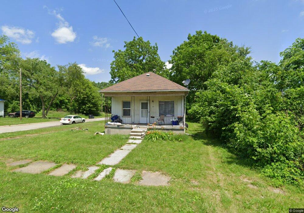
805 Pingree Ave Flint, MI 48503
South Parks NeighborhoodEstimated Value: $39,000 - $56,000
2
Beds
1
Bath
850
Sq Ft
$53/Sq Ft
Est. Value
About This Home
This home is located at 805 Pingree Ave, Flint, MI 48503 and is currently estimated at $45,110, approximately $53 per square foot. 805 Pingree Ave is a home located in Genesee County with nearby schools including Freeman Elementary School, Flint Southwestern Classical Academy, and International Academy of Flint (K-12).
Ownership History
Date
Name
Owned For
Owner Type
Purchase Details
Closed on
Jan 12, 2017
Sold by
Stair Philip G
Bought by
Guice Jon
Current Estimated Value
Purchase Details
Closed on
Jan 3, 2012
Sold by
The Genesee County Land Bank Authority
Bought by
Guice Jon
Purchase Details
Closed on
Dec 22, 2010
Sold by
Genesee County Treasurer
Bought by
Genesee County Land Bank
Purchase Details
Closed on
Sep 8, 2006
Sold by
Ellison Ola C
Bought by
Verkennes Jason
Purchase Details
Closed on
Oct 19, 2002
Sold by
Genesee County Treasurer
Bought by
Ellison Ola C
Create a Home Valuation Report for This Property
The Home Valuation Report is an in-depth analysis detailing your home's value as well as a comparison with similar homes in the area
Home Values in the Area
Average Home Value in this Area
Purchase History
We collect this data history from publicly available records. To have your information removed, we recommend requesting removal directly through your county’s website.
| Date | Buyer | Sale Price | Title Company |
|---|---|---|---|
| Guice Jon | $10,000 | None Available | |
| Guice Jon | $10,000 | None Available | |
| Genesee County Land Bank | -- | None Available | |
| Verkennes Jason | $45,500 | Metropolitan Title Company | |
| Ellison Ola C | $2,504 | -- |
Source: Public Records
Mortgage History
We collect this data history from publicly available records. To have your information removed, we recommend requesting removal directly through your county’s website.
| Date | Status | Borrower | Loan Amount |
|---|---|---|---|
| Closed | Guice Jon | $0 |
Source: Public Records
Tax History
| Year | Tax Paid | Tax Assessment Tax Assessment Total Assessment is a certain percentage of the fair market value that is determined by local assessors to be the total taxable value of land and additions on the property. | Land | Improvement |
|---|---|---|---|---|
| 2025 | $586 | $13,600 | $0 | $0 |
| 2024 | $544 | $11,500 | $0 | $0 |
| 2023 | $543 | $9,800 | $0 | $0 |
| 2022 | $0 | $8,500 | $0 | $0 |
| 2021 | $555 | $7,500 | $0 | $0 |
| 2020 | $515 | $7,300 | $0 | $0 |
| 2019 | $511 | $6,400 | $0 | $0 |
| 2018 | $479 | $5,000 | $0 | $0 |
| 2017 | $555 | $0 | $0 | $0 |
| 2016 | $552 | $0 | $0 | $0 |
| 2015 | -- | $0 | $0 | $0 |
| 2014 | -- | $0 | $0 | $0 |
| 2012 | -- | $0 | $0 | $0 |
Source: Public Records
Map
Nearby Homes
- 2010 Crocker Ave
- 2050 Ferris Ave
- 2041 Warner Ave
- 533 E 12th St Unit 535
- 1701 Park St
- 407 E 12th St
- 2221 Howard Ave
- 133 Orville St
- 2117 S Saginaw St
- 1610 Kent St
- 1771 Brookside Dr
- 1847 Barks St
- 149 E Linsey Blvd
- 810 E 8th St
- 1930 Chelan St
- 1144 Woodside Dr
- 2109 Church St
- 841 E 8th St
- 2610 Pewanaga Place
- 2007 Chelan St
- 717 Pingree Ave
- 815 Pingree Ave
- 802 Pingree Ave
- 1980 Crocker Ave
- 817 Pingree Ave
- 713 Pingree Ave
- 1961 Stanford Ave
- 1978 Crocker Ave
- 804 Pingree Ave
- 2005 Stanford Ave
- 2000 Stanford Ave
- 1951 Stanford Ave
- 2006 Crocker Ave
- 2006 Stanford Ave
- 830 Pingree Ave
- 2009 Stanford Ave
- 719 Stanley St
- 901 Pingree Ave
- 1968 Crocker Ave
- 2010 Stanford Ave
Your Personal Tour Guide
Ask me questions while you tour the home.