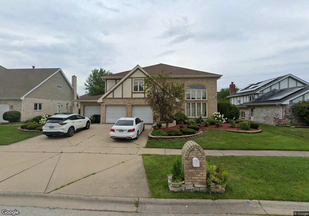
8050 Apache Trail Tinley Park, IL 60477
Central Tinley Park NeighborhoodEstimated Value: $545,406 - $625,000
4
Beds
3
Baths
3,633
Sq Ft
$159/Sq Ft
Est. Value
About This Home
This home is located at 8050 Apache Trail, Tinley Park, IL 60477 and is currently estimated at $578,102, approximately $159 per square foot. 8050 Apache Trail is a home located in Cook County with nearby schools including Millennium Elementary School, Virgil I Grissom Middle School, and Victor J Andrew High School.
Ownership History
Date
Name
Owned For
Owner Type
Purchase Details
Closed on
Sep 21, 2005
Sold by
Wozniak Anita
Bought by
Akel Khamis and Akel Amal
Current Estimated Value
Home Financials for this Owner
Home Financials are based on the most recent Mortgage that was taken out on this home.
Original Mortgage
$332,000
Interest Rate
5.98%
Mortgage Type
New Conventional
Purchase Details
Closed on
Feb 24, 1999
Sold by
Wozniak Anita L
Bought by
Anita Wozniak Trust
Purchase Details
Closed on
Apr 23, 1997
Sold by
Wozniak Glenn
Bought by
Wozniak Anita L
Create a Home Valuation Report for This Property
The Home Valuation Report is an in-depth analysis detailing your home's value as well as a comparison with similar homes in the area
Home Values in the Area
Average Home Value in this Area
Purchase History
| Date | Buyer | Sale Price | Title Company |
|---|---|---|---|
| Akel Khamis | $415,000 | Baird & Warner Title Service | |
| Anita Wozniak Trust | -- | -- | |
| Wozniak Anita L | -- | -- |
Source: Public Records
Mortgage History
| Date | Status | Borrower | Loan Amount |
|---|---|---|---|
| Previous Owner | Akel Khamis | $332,000 |
Source: Public Records
Tax History
| Year | Tax Paid | Tax Assessment Tax Assessment Total Assessment is a certain percentage of the fair market value that is determined by local assessors to be the total taxable value of land and additions on the property. | Land | Improvement |
|---|---|---|---|---|
| 2025 | $12,129 | $47,000 | $6,336 | $40,664 |
| 2024 | $12,129 | $47,000 | $6,336 | $40,664 |
| 2023 | $10,880 | $47,000 | $6,336 | $40,664 |
| 2022 | $10,880 | $33,939 | $5,544 | $28,395 |
| 2021 | $10,561 | $33,939 | $5,544 | $28,395 |
| 2020 | $10,363 | $33,939 | $5,544 | $28,395 |
| 2019 | $11,476 | $38,813 | $5,016 | $33,797 |
| 2018 | $11,228 | $38,813 | $5,016 | $33,797 |
| 2017 | $10,947 | $38,813 | $5,016 | $33,797 |
| 2016 | $11,982 | $38,574 | $4,488 | $34,086 |
| 2015 | $11,812 | $38,574 | $4,488 | $34,086 |
| 2014 | $11,729 | $38,574 | $4,488 | $34,086 |
| 2013 | $10,267 | $36,626 | $4,488 | $32,138 |
Source: Public Records
Map
Nearby Homes
- 7816 Marquette Dr S
- 7832 Joliet Dr S
- 8320 Heather Ln
- 18113 Mager Dr Unit 18113
- 7770 Bristol Park Dr Unit 2
- 18161 Mager Dr Unit 18161
- 7759 Bristol Park Dr Unit 2SE
- 7755 Bristol Park Dr Unit 4NE
- 17618 Dunn Rd
- 18037 Sippel Dr
- 7811 Bristol Park Dr N
- 18295 Kirby Dr Unit 2718295
- 19209 Buncrana Cir
- 7537 175th St Unit 534
- 7517 175th St Unit 331
- 7531 175th St Unit 422
- 7946 172nd Place
- 7946 172nd St
- 8718 Black Oak Ave
- 17807 Linden Dr
- 8155 Pottawattomi Trail
- 8040 Apache Trail
- 8100 Apache Trail
- 8055 Pottawattomi Trail
- 8045 Pottawattomi Trail
- 8105 Pottawattomi Trail
- 8030 Apache Trail
- 8110 Apache Trail
- 8035 Pottawattomi Trail
- 8115 Pottawattomi Trail
- 8055 Apache Trail
- 8065 Apache Trail
- 8045 Apache Trail
- 8120 Apache Trail
- 8115 Apache Trail
- 17840 Navajo Trace
- 17830 Navajo Trace
- 8035 Apache Trail
- 17820 Navajo Trace
- 8135 Apache Trail
Your Personal Tour Guide
Ask me questions while you tour the home.