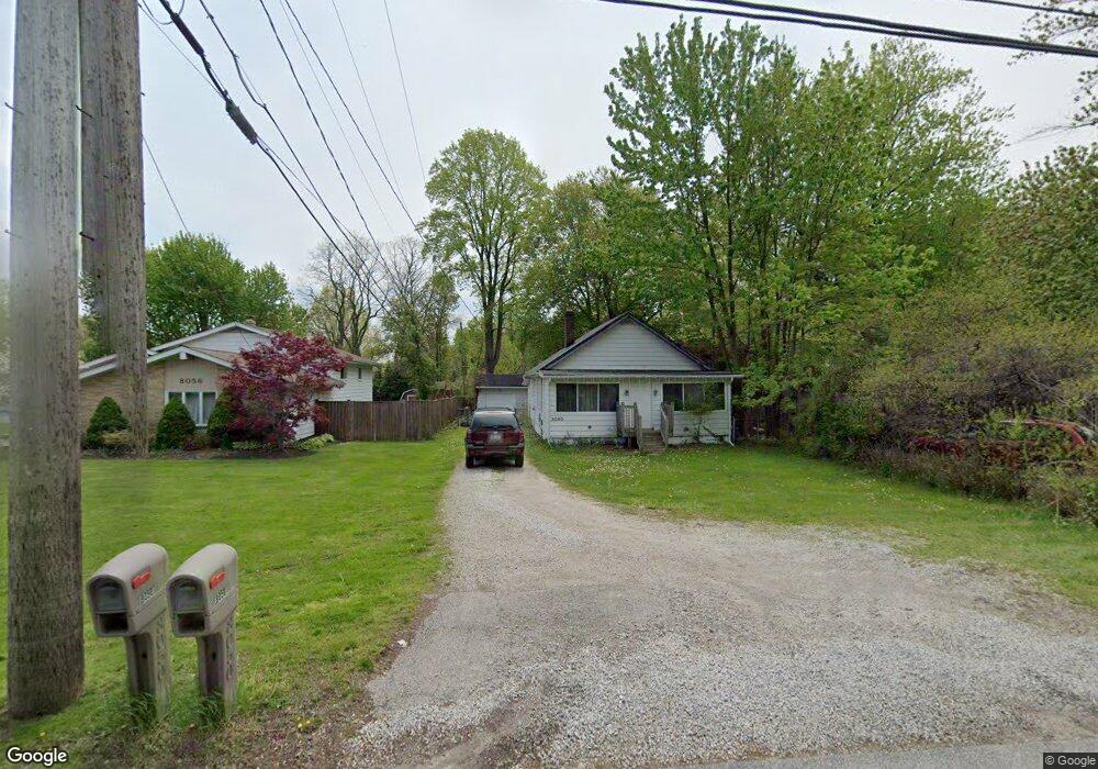
8050 Munson Rd Mentor, OH 44060
Mentor AreaEstimated Value: $154,000 - $197,000
About This Home
This home is located at 8050 Munson Rd, Mentor, OH 44060 and is currently estimated at $178,575, approximately $165 per square foot. 8050 Munson Rd is a home located in Lake County with nearby schools including Fairfax Elementary School, Memorial Middle School, and Mentor High School.
Ownership History
We collect this data history from publicly available records. To have your information removed, we recommend requesting removal directly through your county’s website.
Purchase Details
Home Financials for this Owner
Home Financials are based on the most recent Mortgage that was taken out on this home.Purchase Details
Home Financials for this Owner
Home Financials are based on the most recent Mortgage that was taken out on this home.Purchase Details
Home Financials for this Owner
Home Financials are based on the most recent Mortgage that was taken out on this home.Purchase Details
Home Values in the Area
Average Home Value in this Area
Purchase History
We collect this data history from publicly available records. To have your information removed, we recommend requesting removal directly through your county’s website.
| Date | Buyer | Sale Price | Title Company |
|---|---|---|---|
| -- | Landsel Title Agency Inc | ||
| $115,000 | Chicago Title Insurance Comp | ||
| -- | Midwest Title Agency | ||
| -- | -- |
Mortgage History
We collect this data history from publicly available records. To have your information removed, we recommend requesting removal directly through your county’s website.
| Date | Status | Borrower | Loan Amount |
|---|---|---|---|
| Open | $105,000 | ||
| Closed | $15,300 | ||
| Closed | $115,200 | ||
| Previous Owner | $113,223 | ||
| Previous Owner | $10,000 | ||
| Previous Owner | $101,700 | ||
| Previous Owner | $76,050 |
Tax History
We collect this data history from publicly available records. To have your information removed, we recommend requesting removal directly through your county’s website.
| Year | Tax Paid | Tax Assessment Tax Assessment Total Assessment is a certain percentage of the fair market value that is determined by local assessors to be the total taxable value of land and additions on the property. | Land | Improvement |
|---|---|---|---|---|
| 2025 | -- | $51,930 | $24,650 | $27,280 |
| 2024 | -- | $51,930 | $24,650 | $27,280 |
| 2023 | $4,121 | $39,660 | $17,420 | $22,240 |
| 2022 | $1,874 | $39,660 | $17,420 | $22,240 |
| 2021 | $1,872 | $39,660 | $17,420 | $22,240 |
| 2020 | $1,812 | $33,610 | $14,760 | $18,850 |
| 2019 | $1,814 | $33,610 | $14,760 | $18,850 |
| 2018 | $2,028 | $29,920 | $14,870 | $15,050 |
| 2017 | $2,061 | $29,920 | $14,870 | $15,050 |
| 2016 | $2,048 | $29,920 | $14,870 | $15,050 |
| 2015 | $1,499 | $29,920 | $14,870 | $15,050 |
| 2014 | $1,454 | $28,590 | $14,870 | $13,720 |
| 2013 | $1,455 | $28,590 | $14,870 | $13,720 |
Map
- 0 Collins Rd
- 8155 Concord Dr
- 8200 Sheltered Cove
- 6241 Mentor Park Blvd
- 6347 Meldon Dr
- 6082 Andrews Rd
- 8252 Plains Rd
- 8330 Quail Point Ln
- 8177 Dalton Ct
- 6210 Meadowbrook Dr
- 6305 Meadowbrook Dr
- 6216 Center St Unit 6216
- 6151 Center St Unit 203
- 5800 Springwood Ct
- 7753 Holly Dr
- 6221 Center St
- 6478 Fairfax Dr
- 8030 Grovewood Dr
- 7655 Manor Dr
- 6400 Center St Unit 88
- 8042 Munson Rd
- 8056 Munson Rd
- 8064 Munson Rd
- 8051 Munson Rd
- 8072 Munson Rd
- 6132 Melshore Dr
- 8043 Munson Rd
- 8067 Munson Rd
- 8035 Munson Rd
- 8032 Munson Rd
- 6144 Melshore Dr
- 8071 Munson Rd
- 6080 Harrison St
- 6149 Bryson Dr
- 6147 Bryson Dr
- 8088 Munson Rd
- 6081 Hyde St
- 6076 Harrison St
- 8075 Munson Rd
- 6063 Harrison St
Ask me questions while you tour the home.