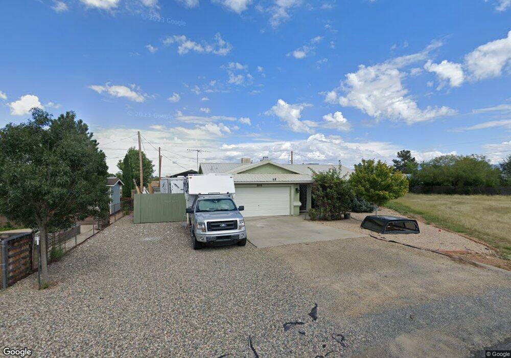
8058 E Candy Cir Prescott Valley, AZ 86314
Estimated Value: $380,487 - $401,000
3
Beds
2
Baths
1,380
Sq Ft
$283/Sq Ft
Est. Value
About This Home
This home is located at 8058 E Candy Cir, Prescott Valley, AZ 86314 and is currently estimated at $390,622, approximately $283 per square foot. 8058 E Candy Cir is a home located in Yavapai County with nearby schools including Granville Elementary School, Bradshaw Mountain Middle School, and Bradshaw Mountain High School.
Ownership History
Date
Name
Owned For
Owner Type
Purchase Details
Closed on
Nov 12, 2021
Sold by
Bennett Linda M
Bought by
Linda M Bennett Trust
Current Estimated Value
Purchase Details
Closed on
Sep 30, 2021
Sold by
Bennett Linda M
Bought by
Linda M Bennett Trust
Purchase Details
Closed on
Apr 27, 2018
Sold by
Bennett Dwight Goodwin
Bought by
Bennett Linda Marielle
Purchase Details
Closed on
May 24, 2013
Sold by
Bennett Dwight G and Bennett Linda M
Bought by
Bennett Linda M and Bennett Dwight G
Home Financials for this Owner
Home Financials are based on the most recent Mortgage that was taken out on this home.
Original Mortgage
$58,500
Outstanding Balance
$27,342
Interest Rate
3.5%
Mortgage Type
New Conventional
Estimated Equity
$363,280
Purchase Details
Closed on
May 8, 2013
Sold by
Bennett Linda M
Bought by
Bennett Linda M and Bennett Dwight G
Home Financials for this Owner
Home Financials are based on the most recent Mortgage that was taken out on this home.
Original Mortgage
$58,500
Outstanding Balance
$27,342
Interest Rate
3.5%
Mortgage Type
New Conventional
Estimated Equity
$363,280
Purchase Details
Closed on
Oct 31, 2003
Sold by
Bennett Dwight G
Bought by
Bennett Linda M
Purchase Details
Closed on
Oct 1, 2002
Sold by
Yoell Trevor A and Yoell Shannon L
Bought by
Bennett Dwight G and Bennett Linda M
Home Financials for this Owner
Home Financials are based on the most recent Mortgage that was taken out on this home.
Original Mortgage
$87,000
Interest Rate
6.05%
Mortgage Type
Seller Take Back
Purchase Details
Closed on
Nov 6, 1998
Sold by
De Jong Corp
Bought by
Yoell Trevor A and Yoell Shannon L
Home Financials for this Owner
Home Financials are based on the most recent Mortgage that was taken out on this home.
Original Mortgage
$76,155
Interest Rate
6.86%
Mortgage Type
FHA
Purchase Details
Closed on
Jun 15, 1998
Sold by
Mclaws Michael C and Mclaws Diana K
Bought by
Dejong Corp
Purchase Details
Closed on
Sep 28, 1995
Sold by
Adams James P and Adams Linda A
Bought by
Mclaws Michael C and Mclaws Diana K
Create a Home Valuation Report for This Property
The Home Valuation Report is an in-depth analysis detailing your home's value as well as a comparison with similar homes in the area
Purchase History
| Date | Buyer | Sale Price | Title Company |
|---|---|---|---|
| Linda M Bennett Trust | -- | None Available | |
| Linda M Bennett Trust | -- | None Available | |
| Bennett Linda Marielle | -- | None Available | |
| Bennett Linda M | -- | None Available | |
| Bennett Linda M | -- | Yavapai Title Agency Inc | |
| Bennett Linda M | -- | -- | |
| Bennett Dwight G | $117,000 | Transnation Title Insurance | |
| Yoell Trevor A | -- | Capital Title Agency | |
| Dejong Corp | $15,500 | Capital Title Agency | |
| Mclaws Michael C | $13,000 | First American Title Ins Co |
Source: Public Records
Mortgage History
| Date | Status | Borrower | Loan Amount |
|---|---|---|---|
| Open | Bennett Linda M | $58,500 | |
| Closed | Bennett Dwight G | $87,000 | |
| Previous Owner | Yoell Trevor A | $76,155 |
Source: Public Records
Tax History
| Year | Tax Paid | Tax Assessment Tax Assessment Total Assessment is a certain percentage of the fair market value that is determined by local assessors to be the total taxable value of land and additions on the property. | Land | Improvement |
|---|---|---|---|---|
| 2026 | $1,591 | $32,169 | -- | -- |
| 2024 | $1,476 | $33,659 | -- | -- |
| 2023 | $1,476 | $27,701 | $4,469 | $23,232 |
| 2022 | $1,452 | $22,285 | $3,080 | $19,205 |
| 2021 | $1,491 | $20,545 | $3,028 | $17,517 |
| 2020 | $1,439 | $0 | $0 | $0 |
| 2019 | $1,420 | $0 | $0 | $0 |
| 2018 | $1,358 | $0 | $0 | $0 |
| 2017 | $1,331 | $0 | $0 | $0 |
| 2016 | $1,289 | $0 | $0 | $0 |
| 2015 | $1,256 | $0 | $0 | $0 |
| 2014 | $1,185 | $0 | $0 | $0 |
Source: Public Records
Map
Nearby Homes
- 4441 N Tonto Way
- 4148 N Jay Ct
- 4501 N Tonto Way
- 4111 N Edith Ct
- 4531 N Sauter Dr W
- 7869 E Spouse Dr
- 7866 E Siesta Ln
- 3965 N Robert Rd
- 4616 N Granada Dr
- 7625 E Paseo Hermoso
- 4351 N Romero Cir W
- 4701 N Spring Dr
- 4517 N Katie Cir W
- 547 N Vermillion Dr
- 3821 N Robin Dr
- 38-A1 N Norman Rd
- 4285 N Verde Vista Dr
- 3981 N Robert Rd
- 4537 N Katie Cir W Unit East
- 7540 E Las Flores Ave
- 4329 N Miner Rd
- 4329 N Miner Rd Unit 3`
- 4315 N Miner Rd
- 4366 N Sauter Dr W
- 4372 N Sauter Dr W
- 4360 N Sauter Dr W
- 4343 N Miner
- 4378 N Sauter Dr W
- 4357 N Miner
- 4301 N Miner Rd
- 8079 E Candy Cir
- 8057 E Candy Cir
- 4369 N Miner Rd
- 4384 N Sauter Dr W
- 4354 N Sauter Dr W
- 4328 N Miner Rd Unit 783
- 4328 N Miner Rd
- 4273 N Miner Rd
- 4314 N Miner Rd
- 4385 N Miner Rd
Your Personal Tour Guide
Ask me questions while you tour the home.