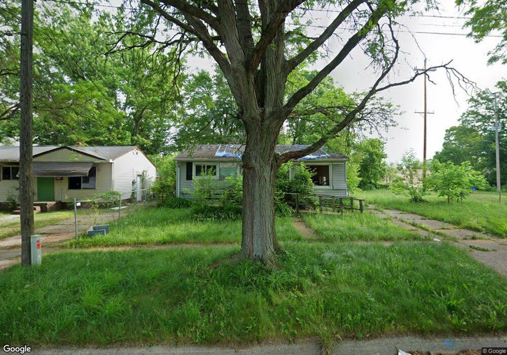
806 W Moore St Flint, MI 48504
Sterling and Myrtle NeighborhoodEstimated Value: $47,000 - $52,000
3
Beds
1
Bath
920
Sq Ft
$53/Sq Ft
Est. Value
About This Home
This home is located at 806 W Moore St, Flint, MI 48504 and is currently estimated at $49,000, approximately $53 per square foot. 806 W Moore St is a home located in Genesee County with nearby schools including Brownell STEM Academy, The New Standard Academy, and Eagle's Nest Academy.
Ownership History
Date
Name
Owned For
Owner Type
Purchase Details
Closed on
Dec 19, 2023
Sold by
Genesee County Treasurer
Bought by
Genesee Cnty Land Bk Authority
Current Estimated Value
Purchase Details
Closed on
Mar 5, 2019
Sold by
Genesee County Land Bank Authority
Bought by
Merriwether Adam and Merriwether Sharisse
Purchase Details
Closed on
Jan 15, 2016
Sold by
The Genesee County Land Bank Authority
Bought by
Merriwether Adam and Merriwether Sharisse
Purchase Details
Closed on
Dec 17, 2015
Sold by
Genesee County
Bought by
Genesee County Land Bank
Purchase Details
Closed on
May 31, 2007
Sold by
Merriwether Callie L and Merriwether Lyman R
Bought by
Merriwether Callie L and Whitlock Raechelle
Create a Home Valuation Report for This Property
The Home Valuation Report is an in-depth analysis detailing your home's value as well as a comparison with similar homes in the area
Home Values in the Area
Average Home Value in this Area
Purchase History
We collect this data history from publicly available records. To have your information removed, we recommend requesting removal directly through your county’s website.
| Date | Buyer | Sale Price | Title Company |
|---|---|---|---|
| Genesee Cnty Land Bk Authority | -- | None Listed On Document | |
| Merriwether Adam | $4,000 | None Available | |
| Merriwether Adam | $4,000 | None Available | |
| Genesee County Land Bank | -- | None Available | |
| Merriwether Callie L | -- | None Available |
Source: Public Records
Mortgage History
We collect this data history from publicly available records. To have your information removed, we recommend requesting removal directly through your county’s website.
| Date | Status | Borrower | Loan Amount |
|---|---|---|---|
| Closed | Merriwether Adam | $0 |
Source: Public Records
Tax History
| Year | Tax Paid | Tax Assessment Tax Assessment Total Assessment is a certain percentage of the fair market value that is determined by local assessors to be the total taxable value of land and additions on the property. | Land | Improvement |
|---|---|---|---|---|
| 2025 | -- | $0 | $0 | $0 |
| 2024 | $686 | $0 | $0 | $0 |
| 2023 | $633 | $8,900 | $0 | $0 |
| 2022 | $0 | $7,300 | $0 | $0 |
| 2021 | $653 | $7,100 | $0 | $0 |
| 2020 | $637 | $7,800 | $0 | $0 |
| 2019 | $2,443 | $8,100 | $0 | $0 |
| 2018 | $785 | $8,800 | $0 | $0 |
| 2017 | $840 | $0 | $0 | $0 |
| 2016 | $221 | $0 | $0 | $0 |
| 2015 | -- | $0 | $0 | $0 |
| 2014 | -- | $0 | $0 | $0 |
| 2012 | -- | $12,400 | $0 | $0 |
Source: Public Records
Map
Nearby Homes
- 4026 Race St
- 702/718 W Flint Park Blvd
- 4808 Edwards Ave
- 4816 Glenn Ave
- 510 W Bishop Ave
- 3722 Sterling St
- 3422 Race St
- 3918 Trumbull Ave
- 329 W Baltimore Blvd
- 4110 Leerda St
- 1102 Pasadena Ave
- 525 W Pulaski Ave
- 1013 W Pasadena Ave
- 124 W Flint Park Blvd
- 5215 Susan St
- 3207 Milbourne Ave
- 3808 Comstock Ave
- 3517 Leerda St
- 2013 Canniff St
- 3505 Leerda St
- 810 W Moore St
- 814 W Moore St
- 833 W Stewart Ave
- 837 W Stewart Ave
- 829 W Stewart Ave
- 841 W Stewart Ave
- 4137 Keyes St
- 818 W Moore St
- 815 W Moore St
- 734 W Moore St
- 845 W Stewart Ave
- 902 W Moore St
- 4134 Donnelly St
- 730 W Moore St
- 817 W Stewart Ave
- 4138 Keyes St
- 4130 Donnelly St
- 906 W Moore St
- 726 W Moore St
- 4134 Keyes St
Your Personal Tour Guide
Ask me questions while you tour the home.