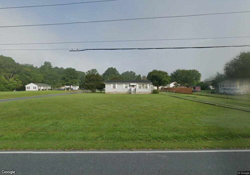
8076 Jersey Rd Salisbury, MD 21801
North Salisbury NeighborhoodEstimated Value: $170,000 - $214,000
3
Beds
1
Bath
864
Sq Ft
$222/Sq Ft
Est. Value
About This Home
This home is located at 8076 Jersey Rd, Salisbury, MD 21801 and is currently estimated at $191,656, approximately $221 per square foot. 8076 Jersey Rd is a home located in Wicomico County with nearby schools including Westside Primary School, Westside Intermediate School, and Salisbury Middle School.
Ownership History
Date
Name
Owned For
Owner Type
Purchase Details
Closed on
Mar 23, 2017
Sold by
Brewster Wendy L
Bought by
Morris Ray A and Morris Sharon A
Current Estimated Value
Purchase Details
Closed on
Jun 30, 2004
Sold by
Harris & Harris Properties Llc
Bought by
Brewster Wendy L
Purchase Details
Closed on
Jan 26, 2004
Sold by
Lasalle Bank N A
Bought by
Harris & Harris Properties Llc
Purchase Details
Closed on
Apr 10, 2003
Sold by
Warner Peggy J
Bought by
Lasalle Bank N A
Purchase Details
Closed on
Sep 11, 2000
Sold by
White Peggy J
Bought by
Warner Peggy J
Create a Home Valuation Report for This Property
The Home Valuation Report is an in-depth analysis detailing your home's value as well as a comparison with similar homes in the area
Home Values in the Area
Average Home Value in this Area
Purchase History
| Date | Buyer | Sale Price | Title Company |
|---|---|---|---|
| Morris Ray A | $53,279 | None Available | |
| Brewster Wendy L | $85,000 | -- | |
| Harris & Harris Properties Llc | $60,000 | -- | |
| Lasalle Bank N A | $60,000 | -- | |
| Warner Peggy J | -- | -- |
Source: Public Records
Mortgage History
| Date | Status | Borrower | Loan Amount |
|---|---|---|---|
| Closed | Warner Peggy J | -- |
Source: Public Records
Tax History
| Year | Tax Paid | Tax Assessment Tax Assessment Total Assessment is a certain percentage of the fair market value that is determined by local assessors to be the total taxable value of land and additions on the property. | Land | Improvement |
|---|---|---|---|---|
| 2025 | $1,011 | $104,033 | $0 | $0 |
| 2024 | $996 | $97,667 | $0 | $0 |
| 2023 | $911 | $91,300 | $30,100 | $61,200 |
| 2022 | $979 | $90,167 | $0 | $0 |
| 2021 | $970 | $89,033 | $0 | $0 |
| 2020 | $967 | $87,900 | $30,100 | $57,800 |
| 2019 | $980 | $87,900 | $30,100 | $57,800 |
| 2018 | $985 | $87,900 | $30,100 | $57,800 |
| 2017 | $1,164 | $105,000 | $0 | $0 |
| 2016 | $1,271 | $105,000 | $0 | $0 |
| 2015 | $1,271 | $105,000 | $0 | $0 |
| 2014 | $1,271 | $114,300 | $0 | $0 |
Source: Public Records
Map
Nearby Homes
- 8100 Jersey Rd
- 8014 Jersey Rd
- 29167 Doubletree Dr
- 7860 Bennett Park Dr
- 2404 & 2402 Paleo Ln
- LOT 1 Jersey Rd
- Lot 2 Jersey Rd
- Lot 3 Jersey Rd
- 1710 Wilson Ln Unit 1
- 0 Foskey Ln Unit 26936023
- 0 Foskey Ln Unit MDWC2022468
- 0 Foskey Ln Unit MDWC2017454
- 0 Foskey Ln Unit MDWC112230
- 426 Dorsey Ln
- 29592 Foskey Ln
- 28600 Naylor Mill Rd
- 1712 Severn St
- 516 Overbrook Dr
- 2130 Windsor Dr
- 1706 Severn St
- 8096 Jersey Rd
- 8062 Jersey Rd
- 8098 Burnt Branch Dr
- 8065 Jersey Rd
- 8099 Burnt Branch Dr
- 8102 Burnt Branch Dr
- 8107 Burnt Branch Dr
- 8116 Jersey Rd
- 8110 Burnt Branch Dr
- 29228 Doubletree Dr
- 8115 Burnt Branch Dr
- 8120 Jersey Rd
- 8122 Burnt Branch Dr
- 29224 Doubletree Dr
- 8131 Burnt Branch Dr
- 29225 Doubletree Dr
- 8132 Jersey Rd
- 8132 Burnt Branch Dr
- 29218 Doubletree Dr
- 8006 Jersey Rd
Your Personal Tour Guide
Ask me questions while you tour the home.