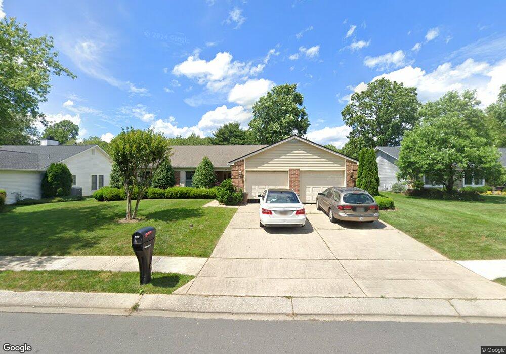
808 Bermuda Ct Annapolis, MD 21401
Parole NeighborhoodEstimated Value: $633,787 - $707,000
Studio
2
Baths
2,014
Sq Ft
$330/Sq Ft
Est. Value
About This Home
This home is located at 808 Bermuda Ct, Annapolis, MD 21401 and is currently estimated at $664,197, approximately $329 per square foot. 808 Bermuda Ct is a home located in Anne Arundel County with nearby schools including Rolling Knolls Elementary School, Wiley H. Bates Middle School, and Annapolis High School.
Ownership History
Date
Name
Owned For
Owner Type
Purchase Details
Closed on
Feb 5, 2013
Sold by
Peters Robert T and Peters Margaret M
Bought by
Peters Robert T and Peters Margaret M
Current Estimated Value
Purchase Details
Closed on
Jun 21, 2005
Sold by
King Helen Eileen
Bought by
Peters Robert T and Peters Margaret M
Home Financials for this Owner
Home Financials are based on the most recent Mortgage that was taken out on this home.
Original Mortgage
$340,000
Outstanding Balance
$177,729
Interest Rate
5.78%
Mortgage Type
Purchase Money Mortgage
Estimated Equity
$486,468
Purchase Details
Closed on
Feb 25, 2005
Sold by
Walcroft Helen M
Bought by
King Helen Eileen
Purchase Details
Closed on
Jun 16, 1998
Sold by
Walcroft James R
Bought by
Walcroft Helen M and Walcroft James R
Create a Home Valuation Report for This Property
The Home Valuation Report is an in-depth analysis detailing your home's value as well as a comparison with similar homes in the area
Home Values in the Area
Average Home Value in this Area
Purchase History
| Date | Buyer | Sale Price | Title Company |
|---|---|---|---|
| Peters Robert T | -- | None Available | |
| Peters Robert T | $425,000 | -- | |
| King Helen Eileen | -- | -- | |
| Walcroft Helen M | -- | -- |
Source: Public Records
Mortgage History
| Date | Status | Borrower | Loan Amount |
|---|---|---|---|
| Open | Peters Robert T | $340,000 |
Source: Public Records
Tax History
| Year | Tax Paid | Tax Assessment Tax Assessment Total Assessment is a certain percentage of the fair market value that is determined by local assessors to be the total taxable value of land and additions on the property. | Land | Improvement |
|---|---|---|---|---|
| 2025 | $5,253 | $519,133 | -- | -- |
| 2024 | $5,253 | $482,867 | $0 | $0 |
| 2023 | $5,088 | $446,600 | $220,800 | $225,800 |
| 2022 | $4,771 | $446,600 | $220,800 | $225,800 |
| 2020 | $4,592 | $454,700 | $230,800 | $223,900 |
| 2019 | $4,507 | $440,233 | $0 | $0 |
| 2018 | $4,317 | $425,767 | $0 | $0 |
| 2017 | $4,225 | $411,300 | $0 | $0 |
| 2016 | -- | $399,600 | $0 | $0 |
| 2015 | -- | $387,900 | $0 | $0 |
| 2014 | -- | $376,200 | $0 | $0 |
Source: Public Records
Map
Nearby Homes
- 1984 Marconi Cir
- 2568 Glen Cove
- 921 Boom Way
- 969 Running Brook Way
- 1011 Boom Ct
- 1955 Marconi Cir
- 1943 Marconi Cir
- 926 Perry Landing Ct
- 906 Perry Landing Ct
- 2646 Quiet Water Cove
- 2579 Hidden Cove Rd Unit 159
- 2576 Hidden Cove Rd Unit 154
- 928 Riversedge Cir
- 2568 Forest Knoll
- 869 Clubhouse Village View
- 2627 Compass Dr
- 2607 Compass Dr
- 591 Pinedale Dr
- 1918 Mackiebeth Ct
- 940 Astern Way Unit 102A
- 804 Bermuda Ct
- 935 Mastline Dr
- 933 Mastline Dr
- 937 Mastline Dr
- 807 Bermuda Ct
- 802 Bermuda Ct
- 931 Mastline Dr
- 814 Bermuda Ct
- 809 Bermuda Ct
- 800 Bermuda Ct
- 803 Bermuda Ct
- 929 Mastline Dr
- 811 Bermuda Ct
- 801 Bermuda Ct
- 932 Mastline Dr
- 936 Mastline Dr
- 930 Mastline Dr
- 927 Mastline Dr
- 813 Bermuda Ct
- 928 Mastline Dr
Your Personal Tour Guide
Ask me questions while you tour the home.