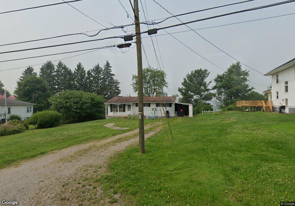
808 W Main St Barnesville, OH 43713
Estimated Value: $78,481 - $167,000
2
Beds
1
Bath
880
Sq Ft
$115/Sq Ft
Est. Value
About This Home
This home is located at 808 W Main St, Barnesville, OH 43713 and is currently estimated at $101,620, approximately $115 per square foot. 808 W Main St is a home located in Belmont County with nearby schools including Barnesville Elementary School, Barnesville Middle School, and Barnesville High School.
Ownership History
Date
Name
Owned For
Owner Type
Purchase Details
Closed on
Jun 10, 2019
Sold by
Bland Sheila R and U S Bank National Association
Bought by
Skinner Kody and Skinner Chelsey
Current Estimated Value
Purchase Details
Closed on
Dec 21, 2004
Sold by
Bland Russell L
Bought by
Bland Shella R
Purchase Details
Closed on
Jul 31, 1998
Sold by
Bland Russell L and Bland Sheila
Bought by
Bland Russell L and Bland Sheila
Purchase Details
Closed on
Aug 5, 1993
Sold by
Burkhart Teresa M
Bought by
Burkhart Teresa M
Purchase Details
Closed on
Jan 1, 1986
Sold by
Betts Lucille A
Bought by
Betts Lucille A
Create a Home Valuation Report for This Property
The Home Valuation Report is an in-depth analysis detailing your home's value as well as a comparison with similar homes in the area
Home Values in the Area
Average Home Value in this Area
Purchase History
We collect this data history from publicly available records. To have your information removed, we recommend requesting removal directly through your county’s website.
| Date | Buyer | Sale Price | Title Company |
|---|---|---|---|
| Skinner Kody | $48,000 | None Available | |
| Bland Shella R | -- | None Available | |
| Bland Russell L | $38,900 | -- | |
| Burkhart Teresa M | $21,500 | -- | |
| Betts Lucille A | -- | -- |
Source: Public Records
Tax History
| Year | Tax Paid | Tax Assessment Tax Assessment Total Assessment is a certain percentage of the fair market value that is determined by local assessors to be the total taxable value of land and additions on the property. | Land | Improvement |
|---|---|---|---|---|
| 2025 | $619 | $18,360 | $2,810 | $15,550 |
| 2023 | $676 | $19,540 | $2,250 | $17,290 |
| 2022 | $676 | $19,544 | $2,250 | $17,294 |
| 2021 | $678 | $19,544 | $2,250 | $17,294 |
| 2020 | $591 | $16,290 | $1,880 | $14,410 |
| 2019 | $596 | $16,290 | $1,880 | $14,410 |
| 2018 | $506 | $16,290 | $1,880 | $14,410 |
| 2017 | $470 | $12,980 | $1,670 | $11,310 |
| 2016 | $443 | $12,980 | $1,670 | $11,310 |
| 2015 | $442 | $12,980 | $1,670 | $11,310 |
| 2014 | $435 | $12,610 | $1,520 | $11,090 |
| 2013 | $433 | $12,690 | $1,520 | $11,170 |
Source: Public Records
Map
Nearby Homes
- 132 W Highland Ave
- 0 County Road 114
- TBD W Main St
- 501 W Main St
- 62280 Fairview Rd
- 617 Park St
- 202 Walton Ave
- 217 Hunts Ave
- 117 Greenmount Ave
- 152 E Main St
- 62239 Hillcrest Rd
- 434 E Main St
- 501 E Main St
- 613 E Main St
- 126 Oak St
- 724 E Main St
- 0 Brown Peavine Rd Unit Tract 17
- 111 Pine Ln
- 0 Fairmont Ave Unit 5163774
- 0 Fairmont Ave Unit 5163784
- 812 W Main St
- 804 W Main St
- 818 W Main St
- 813 W Main St
- 803 W Main St
- 712 W Main St
- 820 W Main St
- 709 W Main St
- 107 W Highland Ave
- 809 W Main St
- 809 W Main St
- 706 W Main St
- 902 W Main St
- 109 W Highland Ave
- 110 Pultney Ave
- 114 Pultney Ave
- 111 W Highland Ave
- 118 Pultney Ave
- 115 W Highland Ave
- 646 W Main St
Your Personal Tour Guide
Ask me questions while you tour the home.