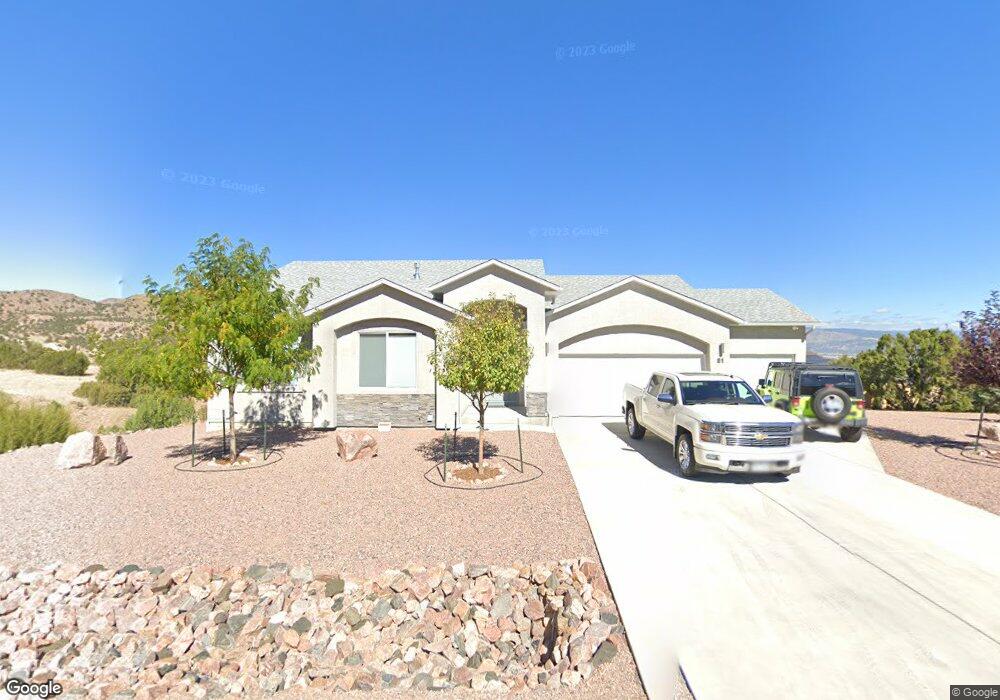
81 Eagle Crest Loop Unit na Cañon City, CO 81212
--
Bed
--
Bath
--
Sq Ft
23,958
Sq Ft Lot
About This Home
This home is located at 81 Eagle Crest Loop Unit na, Cañon City, CO 81212. 81 Eagle Crest Loop Unit na is a home located in Fremont County with nearby schools including Lincoln School of Science & Technology, Canon City Middle School, and Canon City High School.
Create a Home Valuation Report for This Property
The Home Valuation Report is an in-depth analysis detailing your home's value as well as a comparison with similar homes in the area
Tax History
| Year | Tax Paid | Tax Assessment Tax Assessment Total Assessment is a certain percentage of the fair market value that is determined by local assessors to be the total taxable value of land and additions on the property. | Land | Improvement |
|---|---|---|---|---|
| 2025 | $2,464 | $28,260 | $0 | $0 |
Source: Public Records
Map
Nearby Homes
- 140 N Osprey Ct
- 156 Osprey Ct
- 156 S Osprey Ct
- 68 Wild Rose Ct
- 124 Eagle Crest Loop
- 137 Wild Rose Dr
- 135 Wild Rose Dr
- 131 Wild Rose Dr
- 123 Wild Rose Dr
- 46 Fox Run Ct
- 304 Storm Ridge Dr
- 42 Fox Run
- 129 Mourning Dove Dr
- 115 Bobwhite Loop
- 29 Kyndra Ct
- 133 Blue Grouse Dr
- TBD Wild Rose Dr
- 333 Storm Ridge Dr
- 486 Greenhorn Dr
- 507 Greenhorn Dr
- 81 Eagle Crest Loop
- 145 Osprey Ct
- 145 Osprey Ct Unit 19
- 145 N Osprey Ct
- 82 Eagle Crest Loop
- 151 Osprey Ct
- 142 N Osprey Ct Unit LOT C
- 84 Eagle Crest Loop
- 84 Eagle Crest Loop Unit 56
- 136 Osprey Ct
- 150 Osprey Ct
- 136 Osprey Ct Unit C
- 150 Osprey Ct Unit 65
- 137 N Osprey Ct
- 153 S Osprey Ct
- 153 S Osprey Ct Unit 59
- 77 Eagle Crest Loop
- 89 Eagle Crest Loop
- 76 Eagle Crest Loop
- 155 Osprey Ct
Your Personal Tour Guide
Ask me questions while you tour the home.