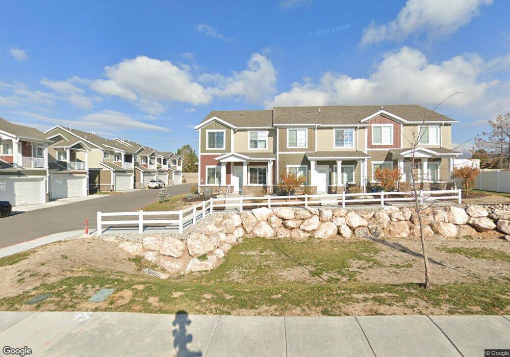
810 E 775 N Unit 5 Layton, UT 84041
Estimated Value: $388,904 - $410,000
3
Beds
1
Bath
1,649
Sq Ft
$245/Sq Ft
Est. Value
About This Home
This home is located at 810 E 775 N Unit 5, Layton, UT 84041 and is currently estimated at $403,976, approximately $244 per square foot. 810 E 775 N Unit 5 is a home located in Davis County with nearby schools including King Elementary School, Central Davis Junior High School, and Layton High School.
Ownership History
Date
Name
Owned For
Owner Type
Purchase Details
Closed on
Apr 23, 2014
Sold by
Parr Frances E
Bought by
Wittner Sydney A and Wittner Timothy
Current Estimated Value
Home Financials for this Owner
Home Financials are based on the most recent Mortgage that was taken out on this home.
Original Mortgage
$131,100
Outstanding Balance
$99,585
Interest Rate
4.32%
Mortgage Type
New Conventional
Estimated Equity
$304,391
Purchase Details
Closed on
Mar 16, 2009
Sold by
Parr John H and Parr Frances E
Bought by
Parr John H and Parr Frances E
Create a Home Valuation Report for This Property
The Home Valuation Report is an in-depth analysis detailing your home's value as well as a comparison with similar homes in the area
Home Values in the Area
Average Home Value in this Area
Purchase History
| Date | Buyer | Sale Price | Title Company |
|---|---|---|---|
| Wittner Sydney A | -- | Founders Title Co L | |
| Parr John H | -- | None Available |
Source: Public Records
Mortgage History
| Date | Status | Borrower | Loan Amount |
|---|---|---|---|
| Open | Wittner Sydney A | $131,100 |
Source: Public Records
Tax History
| Year | Tax Paid | Tax Assessment Tax Assessment Total Assessment is a certain percentage of the fair market value that is determined by local assessors to be the total taxable value of land and additions on the property. | Land | Improvement |
|---|---|---|---|---|
| 2025 | $1,860 | $195,250 | $100,178 | $95,072 |
| 2024 | $1,789 | $189,201 | $116,837 | $72,364 |
| 2023 | $1,685 | $314,000 | $139,920 | $174,080 |
| 2022 | $1,739 | $176,000 | $73,674 | $102,326 |
| 2021 | $1,557 | $235,000 | $102,544 | $132,456 |
| 2020 | $1,395 | $202,000 | $86,619 | $115,381 |
| 2019 | $1,375 | $195,000 | $82,576 | $112,424 |
| 2018 | $1,229 | $175,000 | $82,576 | $92,424 |
| 2016 | $972 | $71,391 | $26,164 | $45,227 |
| 2015 | $914 | $63,746 | $26,164 | $37,582 |
| 2014 | $1,033 | $73,620 | $26,501 | $47,119 |
| 2013 | -- | $78,329 | $18,612 | $59,717 |
Source: Public Records
Map
Nearby Homes
- 782 E 900 N
- 828 Valeria Dr
- 566 Miller Ave
- 831 Valeria Dr
- 861 E 575 N
- 537 Kirk St
- 578 Valeria Dr
- 997 E 825 N
- 556 N Fairfield Rd Unit A2
- 556 N Fairfield Rd Unit D1
- 556 N Fairfield Rd Unit D2
- 556 N Fairfield Rd Unit A3
- 556 N Fairfield Rd Unit D3
- 556 N Fairfield Rd Unit D4
- 556 N Fairfield Rd Unit A1
- 556 N Fairfield Rd Unit A4
- 1033 E 825 N
- 508 N Adamswood Rd
- 586 Wasatch Dr
- 1242 E Snowcreek Dr
- 810 Aspen East Dr
- 800 Aspen East Dr
- 820 Aspen East Dr
- 803 E 750 N
- 786 Aspen Dr E
- 750 Dixie St
- 786 Aspen East Dr
- 799 E 750 N
- 801 Maplewood Cir
- 827 Aspen East Dr
- 774 Aspen East Dr
- 774 Aspen E
- 730 N 800 E
- 823 E 700 N
- 774 E 775 N
- 834 Aspen East Dr
- 816 Maplewood Cir
- 730 Dixie St
- 765 E 750 N
- 777 Aspen East Dr
Your Personal Tour Guide
Ask me questions while you tour the home.