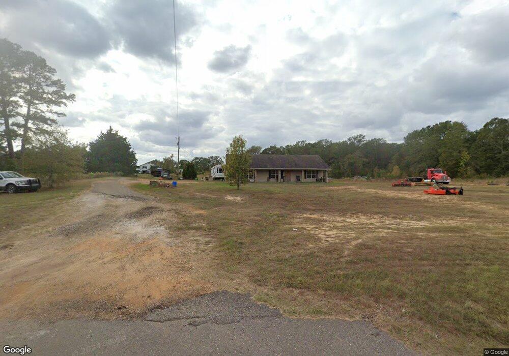
810 Highway 556 Choudrant, LA 71227
Estimated Value: $175,000 - $194,000
2
Beds
2
Baths
1,240
Sq Ft
$147/Sq Ft
Est. Value
About This Home
This home is located at 810 Highway 556, Choudrant, LA 71227 and is currently estimated at $182,667, approximately $147 per square foot. 810 Highway 556 is a home located in Lincoln Parish with nearby schools including Choudrant Elementary School, Choudrant High School, and Ruston Junior High School.
Ownership History
Date
Name
Owned For
Owner Type
Purchase Details
Closed on
Jan 20, 2015
Sold by
Oliver Christy Barrett
Bought by
Max Barrett Enterprises Llc
Current Estimated Value
Home Financials for this Owner
Home Financials are based on the most recent Mortgage that was taken out on this home.
Original Mortgage
$119,523
Outstanding Balance
$90,924
Interest Rate
3.97%
Mortgage Type
New Conventional
Estimated Equity
$91,743
Purchase Details
Closed on
Mar 31, 2010
Sold by
Shepherd Mary Barrett Reagan and Barrett Max Bradley
Bought by
Oliver Christy Barrett
Home Financials for this Owner
Home Financials are based on the most recent Mortgage that was taken out on this home.
Original Mortgage
$150,000
Interest Rate
5%
Mortgage Type
Purchase Money Mortgage
Create a Home Valuation Report for This Property
The Home Valuation Report is an in-depth analysis detailing your home's value as well as a comparison with similar homes in the area
Purchase History
We collect this data history from publicly available records. To have your information removed, we recommend requesting removal directly through your county’s website.
| Date | Buyer | Sale Price | Title Company |
|---|---|---|---|
| Max Barrett Enterprises Llc | $117,197 | None Available | |
| Oliver Christy Barrett | $121,039 | None Available |
Source: Public Records
Mortgage History
We collect this data history from publicly available records. To have your information removed, we recommend requesting removal directly through your county’s website.
| Date | Status | Borrower | Loan Amount |
|---|---|---|---|
| Open | Max Barrett Enterprises Llc | $119,523 | |
| Previous Owner | Oliver Christy Barrett | $150,000 |
Source: Public Records
Tax History
| Year | Tax Paid | Tax Assessment Tax Assessment Total Assessment is a certain percentage of the fair market value that is determined by local assessors to be the total taxable value of land and additions on the property. | Land | Improvement |
|---|---|---|---|---|
| 2025 | $1,545 | $19,064 | $2,305 | $16,759 |
| 2024 | $1,545 | $19,064 | $2,305 | $16,759 |
| 2023 | $1,400 | $16,519 | $2,377 | $14,142 |
| 2022 | $1,375 | $16,323 | $2,377 | $13,946 |
| 2021 | $1,354 | $16,323 | $2,377 | $13,946 |
| 2020 | $1,214 | $14,515 | $2,377 | $12,138 |
| 2019 | $1,286 | $15,205 | $2,377 | $12,828 |
| 2018 | $1,287 | $15,205 | $2,377 | $12,828 |
| 2017 | $1,290 | $15,205 | $2,377 | $12,828 |
| 2016 | $1,315 | $0 | $0 | $0 |
| 2015 | $1,357 | $14,543 | $1,732 | $12,811 |
| 2013 | $1,377 | $14,543 | $1,732 | $12,811 |
Source: Public Records
Map
Nearby Homes
- 586 Walker Rd
- 579 Walker Rd
- 0 N Depot St
- 5116 Highway 145
- 156 Aswell St
- 1732 Highway 80
- 118 Silverthorne Dr
- 0 Bradford Rd
- 1271 Emory Rd
- 111 Douglas Ln
- 117 Douglas Ln
- 2375 Butler Rd
- 0 Olive Dr
- Crocker Rd
- Crocker Road Lot Unit Wp001
- Street Address Par Road 48
- 116 Par Road 48
- 00 Cheatwood Rd
- 0 Old Snipe Rd Unit 11669563
- 00 Par Road 43
- 856 Highway 556
- 740 Highway 556
- 572 Highway 556
- 639 Highway 556
- 0000 Louisiana 556 Unit 20+/- ACRE TRACT
- 1126 Highway 556
- 129 Taylor Rd
- 131 Taylor Rd
- 1537 Pleasant Grove Rd
- 521 Highway 556
- 181 Taylor Rd
- 1180 Highway 556
- 1553 Pleasant Grove Rd
- 510 Highway 556
- 1218 Highway 556
- 1552 Pleasant Grove Rd
- 1511 Pleasant Grove Rd
- 1511 Pleasant Grove Rd
- 1447 Pleasant Grove Rd
- 1613 Pleasant Grove Rd
Your Personal Tour Guide
Ask me questions while you tour the home.