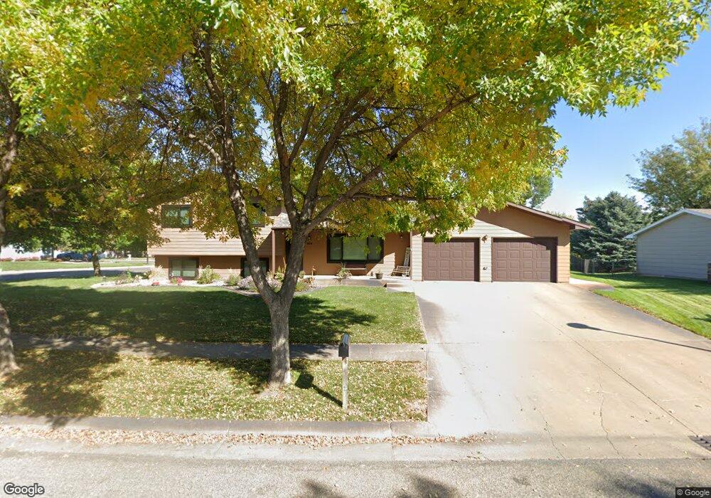
812 Currant Dr Pierre, SD 57501
Estimated Value: $264,000 - $350,000
About This Home
This home is located at 812 Currant Dr, Pierre, SD 57501 and is currently estimated at $295,871, approximately $250 per square foot. 812 Currant Dr is a home with nearby schools including T.F. Riggs High School and Pierre SDA School.
Ownership History
We collect this data history from publicly available records. To have your information removed, we recommend requesting removal directly through your county’s website.
Purchase Details
Home Financials for this Owner
Home Financials are based on the most recent Mortgage that was taken out on this home.Home Values in the Area
Average Home Value in this Area
Purchase History
We collect this data history from publicly available records. To have your information removed, we recommend requesting removal directly through your county’s website.
| Date | Buyer | Sale Price | Title Company |
|---|---|---|---|
| $170,000 | -- |
Mortgage History
We collect this data history from publicly available records. To have your information removed, we recommend requesting removal directly through your county’s website.
| Date | Status | Borrower | Loan Amount |
|---|---|---|---|
| Open | $119,900 |
Tax History
We collect this data history from publicly available records. To have your information removed, we recommend requesting removal directly through your county’s website.
| Year | Tax Paid | Tax Assessment Tax Assessment Total Assessment is a certain percentage of the fair market value that is determined by local assessors to be the total taxable value of land and additions on the property. | Land | Improvement |
|---|---|---|---|---|
| 2025 | $3,267 | $269,467 | $50,833 | $218,634 |
| 2024 | $3,259 | $259,056 | $50,833 | $208,223 |
| 2023 | $2,964 | $251,788 | $48,644 | $203,144 |
| 2022 | $2,792 | $215,615 | $46,328 | $169,287 |
| 2021 | $2,735 | $192,513 | $41,364 | $151,149 |
| 2020 | $2,799 | $186,906 | $40,159 | $146,747 |
| 2019 | $2,794 | $186,906 | $40,159 | $146,747 |
| 2018 | $2,678 | $181,462 | $38,989 | $142,473 |
| 2017 | -- | $172,821 | $37,132 | $135,689 |
| 2016 | $2,801 | $172,821 | $37,132 | $135,689 |
| 2015 | -- | $167,787 | $36,050 | $131,737 |
| 2014 | -- | $162,900 | $35,000 | $127,900 |
| 2013 | -- | $162,900 | $35,000 | $127,900 |
| 2011 | -- | $148,630 | $33,135 | $115,495 |
Map
- 1013 Winchester Dr
- 0 Woodview Dr
- 828 Cherry Dr
- 1217 Hilgers Dr
- 1816 Flag Mountain Dr
- 700 N Taylor Ave
- 130 Hampton Dr
- 102 Village Dr
- 131 Hampton Dr
- 1606 Hilltop Dr
- 404 Yucca Dr
- 109 Baja Dr
- Lot 13R N Garfield Ave
- 313 N Taylor Ave
- 2105 Buffalo St
- 1814 Camden Ct
- 303 N Jackson Ave
- 1600 E Cabot St
- 1220 E Broadway Ave
- 2400 E Capitol Ave
- 1017 Winchester Dr
- 1009 Winchester Dr
- 808 Currant Dr
- 904 Cambridge Dr
- 816 Currant Dr
- 1109 N Harrison Ave
- 1005 Winchester Dr
- 1008 Winchester Dr
- 804 Currant Dr
- 1006 Winchester Dr
- 1105 N Harrison Ave
- 1113 N Harrison Ave
- 1117 N Harrison Ave
- 1016 Winchester Dr
- 1002 Winchester Dr
- 1101 N Harrison Ave
- 1001 Winchester Dr
- 908 Cambridge Dr
- 813 Currant Dr
- 809 Currant Dr
Ask me questions while you tour the home.