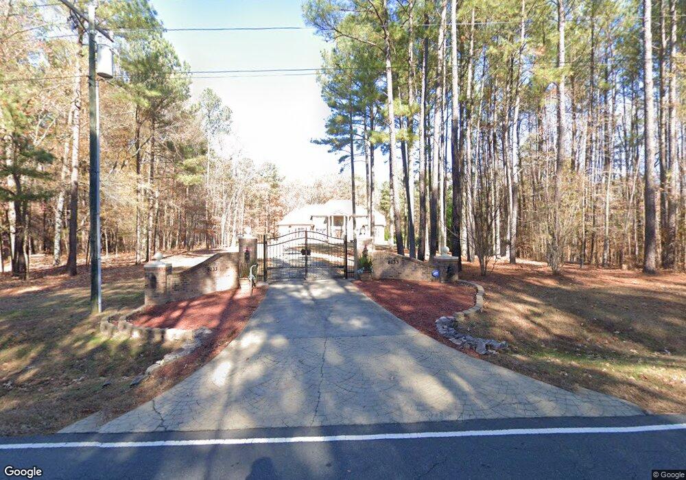
8133 Wake Rd Durham, NC 27713
South Durham NeighborhoodEstimated Value: $1,787,285 - $3,302,000
5
Beds
7
Baths
9,434
Sq Ft
$270/Sq Ft
Est. Value
About This Home
This home is located at 8133 Wake Rd, Durham, NC 27713 and is currently estimated at $2,544,643, approximately $269 per square foot. 8133 Wake Rd is a home located in Chatham County with nearby schools including North Chatham Elementary School, Margaret B. Pollard Middle School, and Kestrel Heights School.
Ownership History
Date
Name
Owned For
Owner Type
Purchase Details
Closed on
Feb 23, 2007
Sold by
Key Shirley C
Bought by
Thompson James H and Thompson Morilene J
Current Estimated Value
Home Financials for this Owner
Home Financials are based on the most recent Mortgage that was taken out on this home.
Original Mortgage
$468,000
Outstanding Balance
$279,831
Interest Rate
6.22%
Mortgage Type
Construction
Estimated Equity
$2,264,812
Create a Home Valuation Report for This Property
The Home Valuation Report is an in-depth analysis detailing your home's value as well as a comparison with similar homes in the area
Home Values in the Area
Average Home Value in this Area
Purchase History
We collect this data history from publicly available records. To have your information removed, we recommend requesting removal directly through your county’s website.
| Date | Buyer | Sale Price | Title Company |
|---|---|---|---|
| Thompson James H | $100,000 | None Available |
Source: Public Records
Mortgage History
We collect this data history from publicly available records. To have your information removed, we recommend requesting removal directly through your county’s website.
| Date | Status | Borrower | Loan Amount |
|---|---|---|---|
| Open | Thompson James H | $468,000 |
Source: Public Records
Tax History
| Year | Tax Paid | Tax Assessment Tax Assessment Total Assessment is a certain percentage of the fair market value that is determined by local assessors to be the total taxable value of land and additions on the property. | Land | Improvement |
|---|---|---|---|---|
| 2025 | $11,736 | $1,736,844 | $203,215 | $1,533,629 |
| 2024 | $11,736 | $1,131,474 | $158,572 | $972,902 |
| 2023 | $9,209 | $1,131,474 | $158,572 | $972,902 |
| 2022 | $8,545 | $1,131,474 | $158,572 | $972,902 |
| 2021 | $8,545 | $1,131,474 | $158,572 | $972,902 |
| 2020 | $6,980 | $923,811 | $123,119 | $800,692 |
| 2019 | $6,980 | $923,811 | $123,119 | $800,692 |
| 2018 | $6,524 | $923,811 | $123,119 | $800,692 |
| 2017 | $6,471 | $923,811 | $123,119 | $800,692 |
| 2016 | $6,466 | $903,291 | $102,599 | $800,692 |
| 2015 | $6,450 | $903,291 | $102,599 | $800,692 |
| 2014 | -- | $903,291 | $102,599 | $800,692 |
| 2013 | -- | $903,291 | $102,599 | $800,692 |
Source: Public Records
Map
Nearby Homes
- 5 Silverbell Ct
- 2005 Lambert Rd Unit 56
- 2007 Lambert Rd Unit 57
- 2009 Lambert Rd Unit 58
- 2011 Lambert Rd Unit 59
- 2013 Lambert Rd Unit 60
- 322 Perfect Moment Dr
- 5904 Lyon Farm Dr
- 266 Perfect Moment Dr
- 8 Silverwood Ct
- 603 Goldflower Dr
- 7 Silverwood Ct
- 162 Gathering Place
- 421 Rosemont Dr
- 5834 Shamrock Rd
- 5708 Dedmon Ct
- 149 Perfect Moment Dr
- 5805 Newhall Rd
- 367 Royal Sunset Dr
- 1010 Queensbury Cir
Your Personal Tour Guide
Ask me questions while you tour the home.