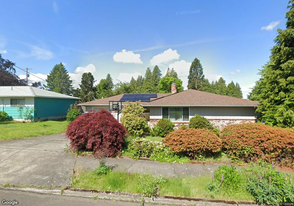
815 SE 214th Ave Gresham, OR 97030
North Central NeighborhoodEstimated Value: $447,941 - $493,000
3
Beds
2
Baths
1,770
Sq Ft
$266/Sq Ft
Est. Value
About This Home
This home is located at 815 SE 214th Ave, Gresham, OR 97030 and is currently estimated at $470,735, approximately $265 per square foot. 815 SE 214th Ave is a home located in Multnomah County with nearby schools including North Gresham Elementary School, Clear Creek Middle School, and Gresham High School.
Ownership History
Date
Name
Owned For
Owner Type
Purchase Details
Closed on
Aug 15, 2016
Sold by
Mounts Stephen
Bought by
Robinson Tony and Robinson Rebecca Mace
Current Estimated Value
Home Financials for this Owner
Home Financials are based on the most recent Mortgage that was taken out on this home.
Original Mortgage
$260,500
Outstanding Balance
$117,663
Interest Rate
3.48%
Mortgage Type
New Conventional
Estimated Equity
$353,072
Purchase Details
Closed on
May 7, 2002
Sold by
Mounts Jack
Bought by
Mounts Jack and Mounts Audrey J
Create a Home Valuation Report for This Property
The Home Valuation Report is an in-depth analysis detailing your home's value as well as a comparison with similar homes in the area
Home Values in the Area
Average Home Value in this Area
Purchase History
| Date | Buyer | Sale Price | Title Company |
|---|---|---|---|
| Robinson Tony | $300,500 | Wfg Title | |
| Mounts Jack | -- | -- |
Source: Public Records
Mortgage History
| Date | Status | Borrower | Loan Amount |
|---|---|---|---|
| Open | Robinson Tony | $260,500 |
Source: Public Records
Tax History
| Year | Tax Paid | Tax Assessment Tax Assessment Total Assessment is a certain percentage of the fair market value that is determined by local assessors to be the total taxable value of land and additions on the property. | Land | Improvement |
|---|---|---|---|---|
| 2025 | $4,795 | $235,630 | -- | -- |
| 2024 | $4,590 | $228,770 | -- | -- |
| 2023 | $4,182 | $222,110 | $0 | $0 |
| 2022 | $4,065 | $215,650 | $0 | $0 |
| 2021 | $3,963 | $209,370 | $0 | $0 |
| 2020 | $3,729 | $203,280 | $0 | $0 |
| 2019 | $3,631 | $197,360 | $0 | $0 |
| 2018 | $3,462 | $191,620 | $0 | $0 |
| 2017 | $3,322 | $186,040 | $0 | $0 |
| 2016 | $2,929 | $180,630 | $0 | $0 |
Source: Public Records
Map
Nearby Homes
- 21400 SE Stark St Unit 2
- 21532 SE Alder St
- 21260 SE Stark St
- 21016 SE Stark St Unit 71
- 21016 SE Stark St Unit 69
- 21525 SE Oak St
- 209 SE 214th Ave
- 132 SE 214th Ave
- 21553 SE Ankeny Terrace
- 210 SE 218th Ave
- 21033 SE Clay Ct
- 2013 NW Bella Vista Dr
- 1811 NW 19th St
- 1861 NW Wonderview Ave
- 1035 SE 225th Ave
- 150 NE 202nd Ave
- 1596 NW Riverview Ave
- 522 SE 199th Ave
- 19776 SE Stark St Unit 147
- 0 SE Burnside St
- 811 SE 214th Ave
- 833 SE 214th Ave
- 816 SE 213th Place
- 828 SE 213th Place
- 810 SE 213th Place
- 21337 SE Yamhill St
- 818 SE 214th Ave
- 717 SE 214th Ave
- 812 SE 214th Ave
- 910 SE 213th Place
- 21324 SE Alder St
- 910 SE 214th Ave
- 720 SE 214th Ave
- 707 SE 214th Ave
- 827 SE 213th Place
- 809 SE 213th Place
- 714 SE 214th Ave
- 1005 SE 214th Ave
- 901 SE 213th Place
- 21330 SE Yamhill St
Your Personal Tour Guide
Ask me questions while you tour the home.