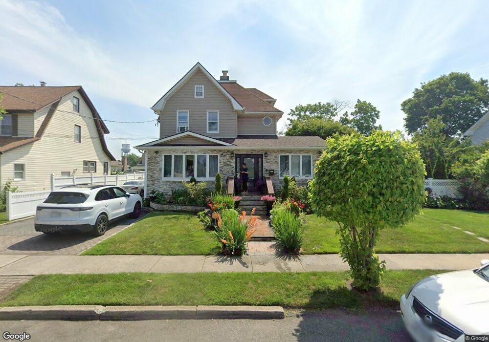
82 Shonnard Ave Freeport, NY 11520
Estimated Value: $678,231 - $709,000
About This Home
This home is located at 82 Shonnard Ave, Freeport, NY 11520 and is currently estimated at $693,616, approximately $374 per square foot. 82 Shonnard Ave is a home located in Nassau County with nearby schools including Columbus Avenue School, Caroline G. Atkinson Intermediate School, and John W Dodd Middle School.
Ownership History
We collect this data history from publicly available records. To have your information removed, we recommend requesting removal directly through your county’s website.
Purchase Details
Purchase Details
Home Financials for this Owner
Home Financials are based on the most recent Mortgage that was taken out on this home.Purchase Details
Home Financials for this Owner
Home Financials are based on the most recent Mortgage that was taken out on this home.Home Values in the Area
Average Home Value in this Area
Purchase History
We collect this data history from publicly available records. To have your information removed, we recommend requesting removal directly through your county’s website.
| Date | Buyer | Sale Price | Title Company |
|---|---|---|---|
| $335,000 | -- | ||
| -- | -- | ||
| $95,000 | -- | ||
| $95,000 | -- |
Mortgage History
We collect this data history from publicly available records. To have your information removed, we recommend requesting removal directly through your county’s website.
| Date | Status | Borrower | Loan Amount |
|---|---|---|---|
| Previous Owner | $125,000 | ||
| Previous Owner | $76,000 |
Tax History
We collect this data history from publicly available records. To have your information removed, we recommend requesting removal directly through your county’s website.
| Year | Tax Paid | Tax Assessment Tax Assessment Total Assessment is a certain percentage of the fair market value that is determined by local assessors to be the total taxable value of land and additions on the property. | Land | Improvement |
|---|---|---|---|---|
| 2026 | $6,245 | $419 | $172 | $247 |
| 2025 | $6,245 | $419 | $172 | $247 |
| 2024 | $868 | $419 | $172 | $247 |
| 2023 | $6,719 | $419 | $172 | $247 |
| 2022 | $6,719 | $419 | $172 | $247 |
| 2021 | $13,095 | $402 | $165 | $237 |
| 2020 | $9,773 | $762 | $408 | $354 |
| 2019 | $9,875 | $762 | $408 | $354 |
| 2018 | $9,597 | $762 | $0 | $0 |
| 2017 | $7,770 | $762 | $408 | $354 |
| 2016 | $8,914 | $762 | $408 | $354 |
| 2015 | $1,101 | $762 | $408 | $354 |
| 2014 | $1,101 | $762 | $408 | $354 |
| 2013 | $1,040 | $762 | $408 | $354 |
Map
- 58 Shonnard Ave
- 96 N Columbus Ave
- 98 N Columbus Ave
- 25 Rutland Rd
- 42 Willow Ave
- 154 E Dean St
- 48 Hillside Ave
- 173 E Seaman Ave
- 261 Rutland Rd
- 101 Harris Ave
- 67 E Dean St
- 50 Leonard Ave
- 398 Babylon Turnpike
- 70 N Grove St Unit 1N
- 188 Woodside Ave
- 8 Garden Place
- 400 N Columbus Ave
- 216 N Ocean Ave
- 100 Brooklyn Ave Unit 4V
- 117 Woodside Ave
- 98 Shonnard Ave
- 100 Shonnard Ave
- 90 Shonnard Ave
- 101 Harrison Ave
- 104 Shonnard Ave
- 93 Harrison Ave
- 105 Harrison Ave
- 86 Shonnard Ave
- 99 Shonnard Ave
- 110 Shonnard Ave
- 103 Shonnard Ave
- 89 Harrison Ave
- 91 Shonnard Ave
- 105 Shonnard Ave
- 116 Shonnard Ave
- 107 Shonnard Ave
- 89 Shonnard Ave
- 115 Harrison Ave
- 85 Harrison Ave
- 100 Harrison Ave
Ask me questions while you tour the home.