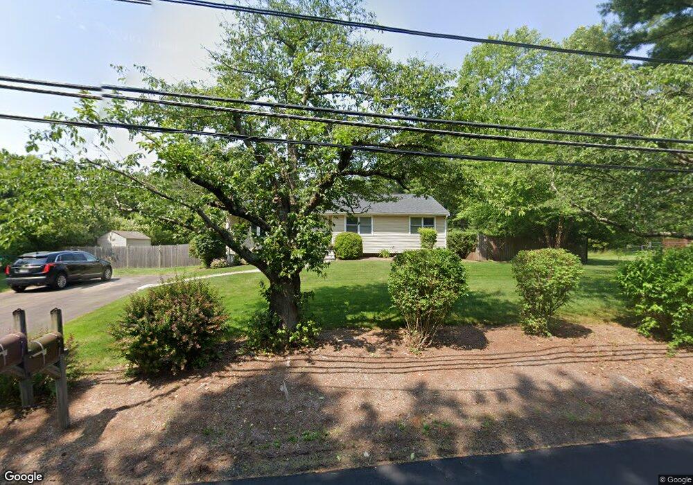
820 Maple St Mansfield, MA 02048
Estimated Value: $657,421 - $767,000
3
Beds
3
Baths
1,728
Sq Ft
$415/Sq Ft
Est. Value
About This Home
This home is located at 820 Maple St, Mansfield, MA 02048 and is currently estimated at $716,605, approximately $414 per square foot. 820 Maple St is a home located in Bristol County with nearby schools including Jordan/Jackson Elementary School, Everett W. Robinson Elementary School, and Harold L. Qualters Middle School.
Ownership History
Date
Name
Owned For
Owner Type
Purchase Details
Closed on
Jun 24, 2008
Sold by
Jopling Andrea S and Rotenberg Andrea S
Bought by
Rotenberg Andrea S and Rotenberg Jason
Current Estimated Value
Home Financials for this Owner
Home Financials are based on the most recent Mortgage that was taken out on this home.
Original Mortgage
$192,000
Interest Rate
6.1%
Mortgage Type
Purchase Money Mortgage
Purchase Details
Closed on
Dec 27, 1993
Sold by
Kradin Robert David and Kradin Darian Lynne
Bought by
Jopling Brian W and Jopling Andrea S
Home Financials for this Owner
Home Financials are based on the most recent Mortgage that was taken out on this home.
Original Mortgage
$117,500
Interest Rate
7%
Mortgage Type
Purchase Money Mortgage
Purchase Details
Closed on
Mar 25, 1988
Sold by
Mousa Samir
Bought by
Kradin Robert D
Home Financials for this Owner
Home Financials are based on the most recent Mortgage that was taken out on this home.
Original Mortgage
$122,250
Interest Rate
9.82%
Mortgage Type
Purchase Money Mortgage
Create a Home Valuation Report for This Property
The Home Valuation Report is an in-depth analysis detailing your home's value as well as a comparison with similar homes in the area
Home Values in the Area
Average Home Value in this Area
Purchase History
| Date | Buyer | Sale Price | Title Company |
|---|---|---|---|
| Rotenberg Andrea S | -- | -- | |
| Jopling Brian W | $146,900 | -- | |
| Kradin Robert D | $163,000 | -- |
Source: Public Records
Mortgage History
| Date | Status | Borrower | Loan Amount |
|---|---|---|---|
| Open | Kradin Robert D | $196,000 | |
| Closed | Rotenberg Andrea S | $192,000 | |
| Previous Owner | Kradin Robert D | $115,000 | |
| Previous Owner | Kradin Robert D | $117,500 | |
| Previous Owner | Kradin Robert D | $122,250 |
Source: Public Records
Tax History
| Year | Tax Paid | Tax Assessment Tax Assessment Total Assessment is a certain percentage of the fair market value that is determined by local assessors to be the total taxable value of land and additions on the property. | Land | Improvement |
|---|---|---|---|---|
| 2025 | $6,851 | $520,200 | $241,800 | $278,400 |
| 2024 | $6,341 | $469,700 | $241,800 | $227,900 |
| 2023 | $6,212 | $440,900 | $241,800 | $199,100 |
| 2022 | $6,012 | $396,300 | $223,800 | $172,500 |
| 2021 | $4,267 | $383,000 | $195,900 | $187,100 |
| 2020 | $3,987 | $368,100 | $186,600 | $181,500 |
| 2019 | $3,227 | $346,200 | $155,400 | $190,800 |
| 2018 | $2,273 | $316,800 | $148,200 | $168,600 |
| 2017 | $4,833 | $321,800 | $144,000 | $177,800 |
| 2016 | $4,925 | $319,600 | $137,100 | $182,500 |
| 2015 | $4,498 | $290,200 | $137,100 | $153,100 |
Source: Public Records
Map
Nearby Homes
- 890 Maple St
- 26 Fredric Ln
- 53 Elyse Rd
- 73 Elyse Rd
- 261 East St
- 4 Erick Rd Unit 90
- 6 Erick Rd Unit 53
- 21 Erick Rd Unit 32
- 3 Willow St
- 631 East St Unit L101
- 3 Angela Dr
- 8 Scarlet Ct
- 34 Kevins Way
- 15 Coach Rd
- 26 Kathleen Grant Rd
- 251 Poquanticut Ave
- 117 Allen Rd
- 9 Independence Dr Unit 9
- 30 Twin Brooks Dr
- 619 N Main St
Your Personal Tour Guide
Ask me questions while you tour the home.