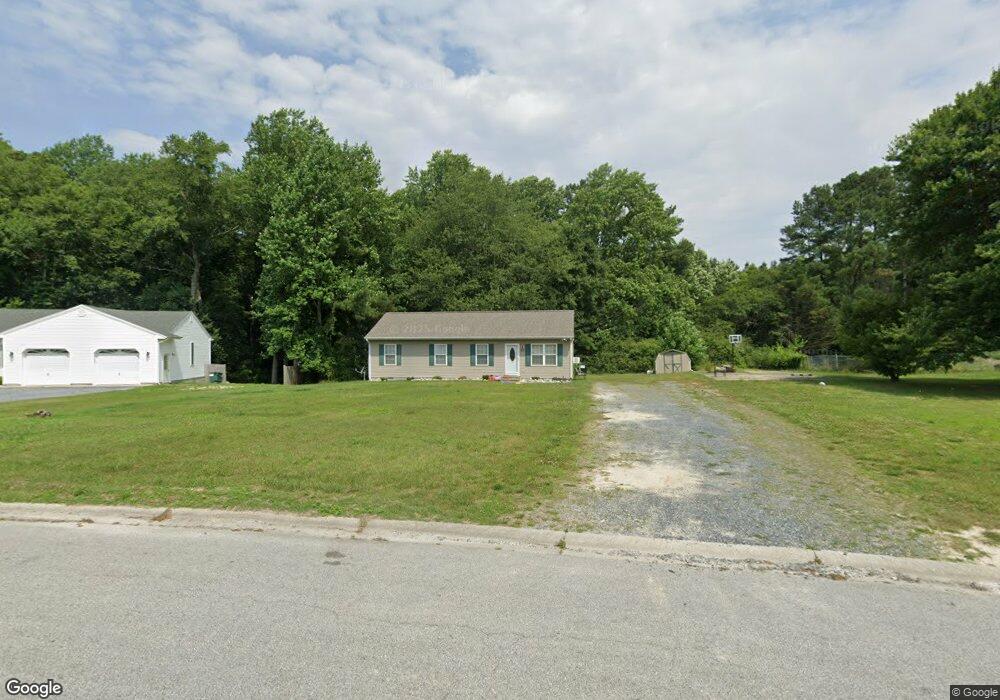
8228 Burnt Branch Dr Salisbury, MD 21801
North Salisbury NeighborhoodEstimated Value: $173,000 - $228,000
Studio
2
Baths
1,008
Sq Ft
$197/Sq Ft
Est. Value
About This Home
This home is located at 8228 Burnt Branch Dr, Salisbury, MD 21801 and is currently estimated at $198,938, approximately $197 per square foot. 8228 Burnt Branch Dr is a home located in Wicomico County with nearby schools including Westside Primary School, Westside Intermediate School, and Salisbury Middle School.
Ownership History
Date
Name
Owned For
Owner Type
Purchase Details
Closed on
Oct 13, 2015
Sold by
Jones Stephen Michael
Bought by
Jones Stephen Michael and Jones Ronald Alan
Current Estimated Value
Purchase Details
Closed on
May 29, 2003
Sold by
Hart Jeffrey B and Hart Iris
Bought by
Hardy Teresa Y
Create a Home Valuation Report for This Property
The Home Valuation Report is an in-depth analysis detailing your home's value as well as a comparison with similar homes in the area
Home Values in the Area
Average Home Value in this Area
Purchase History
| Date | Buyer | Sale Price | Title Company |
|---|---|---|---|
| Jones Stephen Michael | -- | Attorney | |
| Hardy Teresa Y | $94,500 | -- |
Source: Public Records
Mortgage History
| Date | Status | Borrower | Loan Amount |
|---|---|---|---|
| Closed | Hardy Teresa Y | -- |
Source: Public Records
Tax History
| Year | Tax Paid | Tax Assessment Tax Assessment Total Assessment is a certain percentage of the fair market value that is determined by local assessors to be the total taxable value of land and additions on the property. | Land | Improvement |
|---|---|---|---|---|
| 2025 | $1,095 | $107,100 | $0 | $0 |
| 2024 | $1,080 | $100,500 | $0 | $0 |
| 2023 | $937 | $93,900 | $31,200 | $62,700 |
| 2022 | $1,061 | $92,733 | $0 | $0 |
| 2021 | $1,048 | $91,567 | $0 | $0 |
| 2020 | $1,048 | $90,400 | $31,200 | $59,200 |
| 2019 | $1,061 | $90,400 | $31,200 | $59,200 |
| 2018 | $1,073 | $90,400 | $31,200 | $59,200 |
| 2017 | $1,192 | $107,600 | $0 | $0 |
| 2016 | -- | $107,600 | $0 | $0 |
| 2015 | $1,253 | $107,600 | $0 | $0 |
| 2014 | $1,253 | $116,900 | $0 | $0 |
Source: Public Records
Map
Nearby Homes
- 29167 Doubletree Dr
- 8100 Jersey Rd
- 8014 Jersey Rd
- LOT 1 Jersey Rd
- Lot 2 Jersey Rd
- Lot 3 Jersey Rd
- 7860 Bennett Park Dr
- 0 Foskey Ln Unit 26936023
- 0 Foskey Ln Unit MDWC2022468
- 0 Foskey Ln Unit MDWC2017454
- 0 Foskey Ln Unit MDWC112230
- 29592 Foskey Ln
- 0 Jersey Rd Unit MDWC2021618
- 1710 Wilson Ln Unit 1
- 426 Dorsey Ln
- 29826 Connelly Mill Rd
- 28600 Naylor Mill Rd
- 1505 Jersey Rd
- 1706 Severn St
- 516 Overbrook Dr
- 8212 Burnt Branch Dr
- 8234 Burnt Branch Dr
- 8206 Burnt Branch Dr
- 8215 Burnt Branch Dr
- 8209 Burnt Branch Dr
- 8238 Burnt Branch Dr
- 8221 Burnt Branch Dr
- 8198 Burnt Branch Dr
- 8235 Burnt Branch Dr
- 8246 Burnt Branch Dr
- 8195 Burnt Branch Dr
- 29156 Doubletree Dr
- 29164 Doubletree Dr
- 29178 Doubletree Dr
- 8188 Burnt Branch Dr
- 8239 Burnt Branch Dr
- 8179 Burnt Branch Dr
- 8252 Burnt Branch Dr
- 8245 Burnt Branch Dr
- 8180 Burnt Branch Dr
Your Personal Tour Guide
Ask me questions while you tour the home.