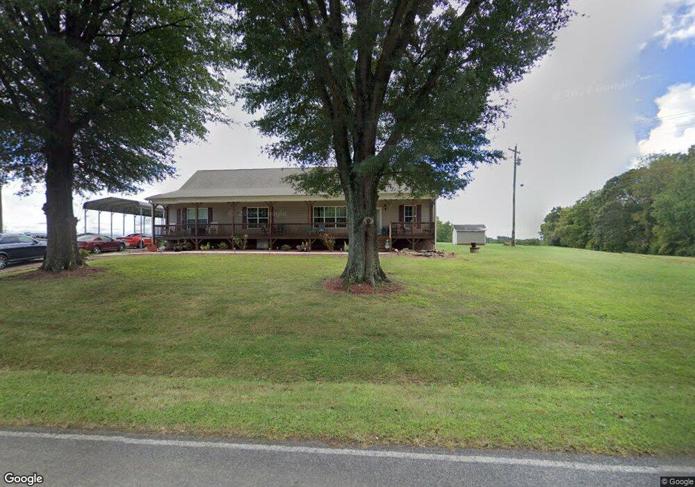
826 Radar Rd Ararat, NC 27007
Estimated Value: $313,000 - $447,000
3
Beds
3
Baths
2,160
Sq Ft
$176/Sq Ft
Est. Value
About This Home
This home is located at 826 Radar Rd, Ararat, NC 27007 and is currently estimated at $379,667, approximately $175 per square foot. 826 Radar Rd is a home located in Surry County with nearby schools including Shoals Elementary School, Pilot Mountain Middle School, and East Surry High School.
Ownership History
Date
Name
Owned For
Owner Type
Purchase Details
Closed on
Nov 13, 2017
Sold by
Sawyers Gary Ray
Bought by
Sawyers Gary Ray and Sawyers Coty F
Current Estimated Value
Home Financials for this Owner
Home Financials are based on the most recent Mortgage that was taken out on this home.
Original Mortgage
$191,000
Outstanding Balance
$161,343
Interest Rate
4.25%
Mortgage Type
Adjustable Rate Mortgage/ARM
Estimated Equity
$218,324
Purchase Details
Closed on
May 1, 1991
Purchase Details
Closed on
Oct 1, 1956
Create a Home Valuation Report for This Property
The Home Valuation Report is an in-depth analysis detailing your home's value as well as a comparison with similar homes in the area
Purchase History
| Date | Buyer | Sale Price | Title Company |
|---|---|---|---|
| Sawyers Gary Ray | -- | None Available | |
| -- | $22,000 | -- | |
| -- | -- | -- |
Source: Public Records
Mortgage History
| Date | Status | Borrower | Loan Amount |
|---|---|---|---|
| Open | Sawyers Gary Ray | $191,000 |
Source: Public Records
Tax History
| Year | Tax Paid | Tax Assessment Tax Assessment Total Assessment is a certain percentage of the fair market value that is determined by local assessors to be the total taxable value of land and additions on the property. | Land | Improvement |
|---|---|---|---|---|
| 2025 | $1,755 | $296,910 | $17,000 | $279,910 |
| 2024 | $1,478 | $231,380 | $14,000 | $217,380 |
| 2023 | $1,409 | $224,320 | $14,000 | $210,320 |
| 2022 | $1,409 | $224,250 | $14,000 | $210,250 |
| 2021 | $1,434 | $224,250 | $14,000 | $210,250 |
| 2020 | $1,467 | $218,720 | $13,000 | $205,720 |
| 2019 | $1,464 | $218,720 | $0 | $0 |
| 2018 | $1,438 | $218,720 | $0 | $0 |
| 2017 | $358 | $13,000 | $0 | $0 |
| 2016 | $358 | $49,140 | $0 | $0 |
| 2013 | -- | $51,510 | $0 | $0 |
Source: Public Records
Map
Nearby Homes
- 167 Buck Hollow Trail
- TBD Sidden St
- 2115 Ararat Rd
- 112 Balcony Ln
- 1319 S Old Us Highway 52
- 106 Grants Home Trail
- x Green Meadow Ln Unit 5 Ac S
- Lot 5 Morosko Ln
- Lot 6 Morosko Ln
- 2098 Park Dr
- 000 Old Childress Ave
- 138 Arthur Needham Rd
- 000 Holly Springs Rd
- 876 Rock Hill Church Rd
- TBD Holly Springs Rd
- 277 Simpson Mill Rd
- TBD Marbury Trail
- 0000 Lynnhaven Rd
- Tbd Farmbrook Rd
- 2198 S Mckinney Rd
- 848 Radar Rd
- 849 Radar Rd
- 878 Radar Rd
- 883 Radar Rd
- 761 Radar Rd
- 184 Wimbledon Ln
- 157 Wimbledon Ln
- 270 Hunter Ridge Ln
- 0 Masters Trail
- 254 Hunter Ridge Ln
- 254 Hunter Ridge Ln
- #8 Hunter Ridge Ln
- 109 Wimbledon Ln
- 202 Hunter Ridge Ln
- #13 Hunter Ridge Ln
- 190 Hunter Ridge Ln
- 0 New Frontier Trail
- 0 Hunter Ridge Ln Unit 1054768
- 243 Hunter Ridge Ln
- 169 Silas Ridge Ln
Your Personal Tour Guide
Ask me questions while you tour the home.