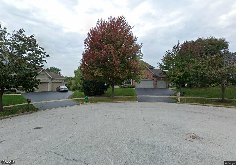
827 Boyd Ct Batavia, IL 60510
Southeast Batavia NeighborhoodEstimated Value: $643,654 - $740,000
5
Beds
4
Baths
3,105
Sq Ft
$218/Sq Ft
Est. Value
About This Home
This home is located at 827 Boyd Ct, Batavia, IL 60510 and is currently estimated at $678,164, approximately $218 per square foot. 827 Boyd Ct is a home located in Kane County with nearby schools including Hoover Wood Elementary School, Sam Rotolo Middle School, and Batavia Sr High School.
Ownership History
Date
Name
Owned For
Owner Type
Purchase Details
Closed on
Nov 17, 2004
Sold by
Ryan Thomas E and Butler Ryan Nancy L
Bought by
Michael Brian P and Michael Elizabeth A
Current Estimated Value
Home Financials for this Owner
Home Financials are based on the most recent Mortgage that was taken out on this home.
Original Mortgage
$389,600
Interest Rate
5.9%
Mortgage Type
Purchase Money Mortgage
Purchase Details
Closed on
Mar 8, 1995
Sold by
First National Bank Of Evergreen Park
Bought by
Ryan Thomas E and Butler Ryan Nancy L
Home Financials for this Owner
Home Financials are based on the most recent Mortgage that was taken out on this home.
Original Mortgage
$203,150
Interest Rate
8.97%
Create a Home Valuation Report for This Property
The Home Valuation Report is an in-depth analysis detailing your home's value as well as a comparison with similar homes in the area
Home Values in the Area
Average Home Value in this Area
Purchase History
| Date | Buyer | Sale Price | Title Company |
|---|---|---|---|
| Michael Brian P | $487,000 | Chicago Title Insurance Co | |
| Ryan Thomas E | $303,500 | Chicago Title Insurance Co |
Source: Public Records
Mortgage History
| Date | Status | Borrower | Loan Amount |
|---|---|---|---|
| Previous Owner | Michael Brian P | $389,600 | |
| Previous Owner | Ryan Thomas E | $203,150 | |
| Closed | Michael Brian P | $48,700 |
Source: Public Records
Tax History
| Year | Tax Paid | Tax Assessment Tax Assessment Total Assessment is a certain percentage of the fair market value that is determined by local assessors to be the total taxable value of land and additions on the property. | Land | Improvement |
|---|---|---|---|---|
| 2024 | $14,463 | $190,928 | $32,155 | $158,773 |
| 2023 | $14,183 | $173,287 | $29,184 | $144,103 |
| 2022 | $13,617 | $161,951 | $27,275 | $134,676 |
| 2021 | $13,084 | $153,596 | $25,868 | $127,728 |
| 2020 | $12,765 | $150,644 | $25,371 | $125,273 |
| 2019 | $12,564 | $145,311 | $24,473 | $120,838 |
| 2018 | $12,622 | $145,894 | $23,541 | $122,353 |
| 2017 | $12,324 | $141,083 | $22,765 | $118,318 |
| 2016 | $12,068 | $136,974 | $22,102 | $114,872 |
| 2015 | -- | $133,855 | $21,599 | $112,256 |
| 2014 | -- | $129,642 | $20,919 | $108,723 |
| 2013 | -- | $135,089 | $28,487 | $106,602 |
Source: Public Records
Map
Nearby Homes
- 1220 Davey Dr
- 1109 Edwards Dr
- 1208 Thrun Dr
- 492 Bond Dr
- 1136 Pine Ct
- Lot 4 Manchester Ave
- 940 Orchard Ct
- 860 S River St
- 701 Viking Dr
- 1692 Sauk Dr
- 1687 Sauk Dr
- 635 Kingsbury Ct Unit 4
- 418 Churchill Ct
- 221 Sauk Dr
- 823 Columbia Cir
- 1098 Cleveland Ave
- 570 Violet Ln
- 1011 Napa Ln
- Lot 1 Center St
- 261 Johnson Woods Dr
- 847 Boyd Ct
- 1310 Davey Dr
- 1240 Davey Dr Unit 2
- 828 Boyd Ct
- 1330 Davey Dr Unit 2
- 826 Burnham Ln
- 1225 Burnham Ln
- 848 Boyd Ct
- 1215 Burnham Ln
- 836 Burnham Ln
- 868 Boyd Ct
- 1350 Davey Dr
- 1210 Davey Dr
- 811 Norcross Dr
- 821 Norcross Dr
- 1305 Burnham Ln
- 831 Norcross Dr
- 1245 Davey Dr
- 1380 Davey Dr Unit 2
- 1311 Davey Dr
Your Personal Tour Guide
Ask me questions while you tour the home.