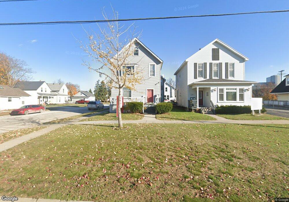
828 Huron Ave Port Huron, MI 48060
Estimated Value: $141,316 - $528,000
1
Bed
1
Bath
2,280
Sq Ft
$119/Sq Ft
Est. Value
About This Home
This home is located at 828 Huron Ave, Port Huron, MI 48060 and is currently estimated at $271,579, approximately $119 per square foot. 828 Huron Ave is a home located in St. Clair County with nearby schools including H.D. Crull Elementary School, Holland Woods Middle School, and Port Huron Northern High School.
Ownership History
Date
Name
Owned For
Owner Type
Purchase Details
Closed on
Feb 12, 2026
Sold by
Mdk Realty Llc
Bought by
Jkg Ventures Llc
Current Estimated Value
Purchase Details
Closed on
Jul 31, 2024
Sold by
Keith Christine A
Bought by
Mdk Realty Llc
Purchase Details
Closed on
Oct 13, 2020
Sold by
Keith Christine A
Bought by
Keith Christine A and Christine A Keith Trust
Purchase Details
Closed on
Jan 29, 2020
Sold by
Keith Michael D
Bought by
Keith Christine A
Purchase Details
Closed on
Dec 11, 2019
Sold by
Keith Michael D
Bought by
Keith Christine A
Purchase Details
Closed on
Aug 20, 2003
Sold by
Keith Dorothy Lou and Keith Donald L
Bought by
Keith Michael David
Create a Home Valuation Report for This Property
The Home Valuation Report is an in-depth analysis detailing your home's value as well as a comparison with similar homes in the area
Home Values in the Area
Average Home Value in this Area
Purchase History
| Date | Buyer | Sale Price | Title Company |
|---|---|---|---|
| Jkg Ventures Llc | $175,000 | Huron Title | |
| Mdk Realty Llc | -- | None Listed On Document | |
| Keith Christine A | -- | None Listed On Document | |
| Keith Christine A | -- | -- | |
| Keith Christine A | -- | -- | |
| Keith Michael David | $90,000 | None Available |
Source: Public Records
Tax History
| Year | Tax Paid | Tax Assessment Tax Assessment Total Assessment is a certain percentage of the fair market value that is determined by local assessors to be the total taxable value of land and additions on the property. | Land | Improvement |
|---|---|---|---|---|
| 2025 | $4,743 | $79,100 | $0 | $0 |
| 2024 | $2,334 | $72,700 | $0 | $0 |
| 2023 | $2,211 | $62,600 | $0 | $0 |
| 2022 | $2,229 | $54,200 | $0 | $0 |
| 2020 | $2,136 | $47,200 | $47,200 | $0 |
| 2019 | $1,663 | $31,400 | $0 | $0 |
| 2018 | $1,626 | $31,400 | $0 | $0 |
| 2017 | $1,470 | $30,200 | $0 | $0 |
| 2016 | $1,279 | $30,200 | $0 | $0 |
| 2015 | $1,325 | $30,800 | $30,800 | $0 |
| 2014 | $1,325 | $31,300 | $31,300 | $0 |
| 2013 | -- | $30,800 | $0 | $0 |
Source: Public Records
Map
Nearby Homes
- 805 Pine Grove Ave
- 201 Beers St Unit 53
- 201 Beers St Unit 61
- 201 Beers St Unit 44
- 201 Beers St Unit 63
- 201 Beers St Unit 34
- 1018 Erie St
- 917 Saint Clair St
- 1109 Rawlins St
- 1209 10th Ave
- 1409 Kearney St
- 1509 Lincoln Ave
- 1134 Water St
- 1433 Poplar St
- 443 11th St
- 1523 Elk St
- 1607 Elk St
- 1203 Varney St
- 1012 8th St
- 1102 Lapeer Ave
- 902 Huron Ave
- 408 Stanton St
- 906 Huron Ave
- 411 Stanton St
- 823 Michigan St
- 409 Stanton St
- 901 Michigan St
- 907 Michigan St
- 910 Huron Ave Unit 912
- 901 Huron Ave
- 901 Huron Ave Unit 1
- 901 Huron Ave Unit 3
- 901 Huron Ave Unit 2
- 828 Michigan St
- 904 Michigan St
- 824 Michigan St
- 0 Michigan St
- 912 Michigan St
- 914 Michigan St
- 921 Michigan St
Your Personal Tour Guide
Ask me questions while you tour the home.