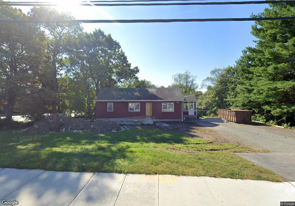
83 Main St Medway, MA 02053
Estimated Value: $567,296
3
Beds
1
Bath
1,174
Sq Ft
$483/Sq Ft
Est. Value
About This Home
This home is located at 83 Main St, Medway, MA 02053 and is currently estimated at $567,296, approximately $483 per square foot. 83 Main St is a home located in Norfolk County with nearby schools including John D. McGovern Elementary School, Burke-Memorial Elementary, and Medway Middle School.
Ownership History
Date
Name
Owned For
Owner Type
Purchase Details
Closed on
Mar 8, 2023
Sold by
Dem Rlty Enterprises Llc
Bought by
Baima Paul and Baima Luna
Current Estimated Value
Purchase Details
Closed on
Jun 25, 2021
Sold by
Parr 4 Llc
Bought by
Dem Rlty Enterprises Llc
Home Financials for this Owner
Home Financials are based on the most recent Mortgage that was taken out on this home.
Original Mortgage
$472,000
Interest Rate
2.9%
Mortgage Type
Purchase Money Mortgage
Purchase Details
Closed on
Apr 15, 2014
Sold by
Cenedella Ft and Cenedella
Bought by
Parr 4 Llc
Home Financials for this Owner
Home Financials are based on the most recent Mortgage that was taken out on this home.
Original Mortgage
$223,000
Interest Rate
4.37%
Mortgage Type
Commercial
Create a Home Valuation Report for This Property
The Home Valuation Report is an in-depth analysis detailing your home's value as well as a comparison with similar homes in the area
Home Values in the Area
Average Home Value in this Area
Purchase History
| Date | Buyer | Sale Price | Title Company |
|---|---|---|---|
| Baima Paul | $499,900 | None Available | |
| Dem Rlty Enterprises Llc | $469,900 | None Available | |
| Parr 4 Llc | $297,500 | -- |
Source: Public Records
Mortgage History
| Date | Status | Borrower | Loan Amount |
|---|---|---|---|
| Previous Owner | Dem Rlty Enterprises Llc | $472,000 | |
| Previous Owner | Parr 4 Llc | $223,000 |
Source: Public Records
Tax History
| Year | Tax Paid | Tax Assessment Tax Assessment Total Assessment is a certain percentage of the fair market value that is determined by local assessors to be the total taxable value of land and additions on the property. | Land | Improvement |
|---|---|---|---|---|
| 2025 | $6,414 | $450,100 | $292,700 | $157,400 |
| 2024 | $6,481 | $450,100 | $292,700 | $157,400 |
| 2023 | $7,184 | $450,700 | $292,700 | $158,000 |
| 2022 | $6,769 | $399,800 | $261,400 | $138,400 |
| 2021 | $5,444 | $311,800 | $228,700 | $83,100 |
| 2020 | $5,171 | $295,500 | $212,400 | $83,100 |
| 2019 | $5,015 | $295,500 | $212,400 | $83,100 |
| 2018 | $5,060 | $286,500 | $212,400 | $74,100 |
| 2017 | $5,458 | $304,600 | $212,400 | $92,200 |
| 2016 | $3,664 | $202,300 | $93,100 | $109,200 |
| 2015 | $3,690 | $202,300 | $93,100 | $109,200 |
| 2014 | $3,753 | $199,200 | $101,600 | $97,600 |
Source: Public Records
Map
Nearby Homes
- 8 Gable Way
- 50 Main St
- 33 Gorwin Dr
- 280 Village St Unit F1
- 236 Village St
- 253 Village St
- 176 Main St Unit 3
- 25 Howe St
- 20 Broad St Unit 1
- 20 Broad St Unit 6
- 20 Broad St Unit A
- 20 Broad St Unit 4
- 23 Howe St
- 10 Barber St
- 14 Sanford St Unit 47
- 38 Oakland St
- 84 Winthrop St
- 1391 Pond St
- 32 Ohlson Cir
- 22 Milford St
- 85 Main St
- 89 Main St Unit 101
- 89 Main St Unit D
- 89 Main St Unit 214
- 89 Main St Unit 111
- 89 Main St Unit 109
- 89 Main St Unit 205
- 89 Main St Unit B
- 89 Main St Unit 107
- 89 Main St Unit 204
- 89 Main St Unit 302
- 89 Main St Unit 215
- 89 Main St Unit 206
- 89 Main St Unit 300
- 89 Main St Unit 306
- 89 Main St Unit C/D
- 89 Main St Unit 100
- 89 Main St Unit 203
- 89 Main St Unit 213
- 89 Main St Unit 308
Your Personal Tour Guide
Ask me questions while you tour the home.