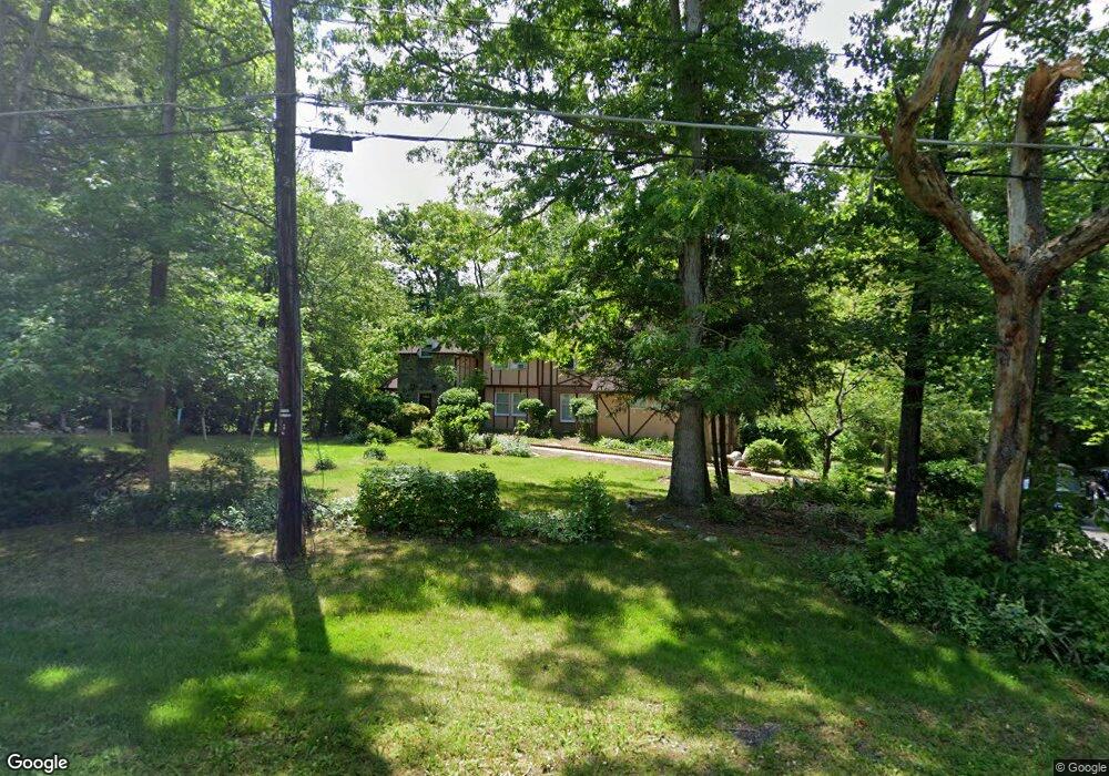
8319 Echo Ln Clinton, MD 20735
Estimated Value: $568,188 - $697,000
Studio
3
Baths
3,537
Sq Ft
$177/Sq Ft
Est. Value
About This Home
This home is located at 8319 Echo Ln, Clinton, MD 20735 and is currently estimated at $625,047, approximately $176 per square foot. 8319 Echo Ln is a home located in Prince George's County with nearby schools including Melwood Elementary School, James Madison Middle School, and Frederick Douglass High School.
Ownership History
Date
Name
Owned For
Owner Type
Purchase Details
Closed on
Feb 6, 2023
Sold by
Hammond Henry E
Bought by
Hammond Henry E and Hammond Lisa Maxine
Current Estimated Value
Purchase Details
Closed on
Feb 18, 2018
Sold by
Hammond Tanjia B and Hammond Henry E
Bought by
Hammond Henry E
Purchase Details
Closed on
Jan 28, 1998
Sold by
Hammond Henry E
Bought by
Hammond Henry E and Hammond Tanja B
Purchase Details
Closed on
Aug 5, 1982
Sold by
Wassiliew Adolf G
Bought by
Hammond Henry E
Create a Home Valuation Report for This Property
The Home Valuation Report is an in-depth analysis detailing your home's value as well as a comparison with similar homes in the area
Home Values in the Area
Average Home Value in this Area
Purchase History
| Date | Buyer | Sale Price | Title Company |
|---|---|---|---|
| Hammond Henry E | -- | -- | |
| Hammond Henry E | -- | None Listed On Document | |
| Hammond Henry E | -- | None Available | |
| Hammond Henry E | -- | -- | |
| Hammond Henry E | $18,500 | -- |
Source: Public Records
Tax History
| Year | Tax Paid | Tax Assessment Tax Assessment Total Assessment is a certain percentage of the fair market value that is determined by local assessors to be the total taxable value of land and additions on the property. | Land | Improvement |
|---|---|---|---|---|
| 2025 | $8,253 | $611,400 | $113,300 | $498,100 |
| 2024 | $8,253 | $597,167 | -- | -- |
| 2023 | $6,482 | $582,933 | $0 | $0 |
| 2022 | $6,324 | $568,700 | $108,100 | $460,600 |
| 2021 | $15,189 | $553,433 | $0 | $0 |
| 2020 | $14,662 | $538,167 | $0 | $0 |
| 2019 | $7,488 | $522,900 | $104,600 | $418,300 |
| 2018 | $7,151 | $488,967 | $0 | $0 |
| 2017 | $6,434 | $455,033 | $0 | $0 |
| 2016 | -- | $421,100 | $0 | $0 |
| 2015 | $5,831 | $421,100 | $0 | $0 |
| 2014 | $5,831 | $421,100 | $0 | $0 |
Source: Public Records
Map
Nearby Homes
- 10104 Dangerfield Rd
- 9401 Cheltenham Ave
- 9104 Rama Ct
- 8206 Dangerfield Place
- 9003 Eldon Dr
- 9106 Helmsley Dr
- 7804 New Ascot Ln
- 8518 Cedar Chase Dr
- 9015 Helmsley Dr
- 8719 Brazke Ct
- 7604 Fox Hunt Ct
- 9306 Foxcroft Ave
- 0 Dangerfield Rd
- 8826 Creekway Dr
- 8617 Woodyard Rd
- 9602 Stuart Ln
- 9745 Quiet Brook Ln
- 9915 Quiet Brook Ln
- 7705 Old Alexandria Ferry Rd
- 7506 Castle Rock Dr
- 8310 Echo Ln
- 8401 Echo Ln
- 8400 Echo Ln
- 8311 Echo Ln
- 8403 Echo Ln
- 8306 Echo Ln
- 9306 Dangerfield Rd
- 9110 Townsend Ln
- 9204 Dangerfield Rd
- 8402 Echo Ln
- 9108 Townsend Ln
- 9200 Dangerfield Rd
- 9308 Dangerfield Rd
- 9208 Dangerfield Rd
- 9210 Dangerfield Rd
- 8407 Echo Ln
- 9106 Townsend Ln
- 9304 Dangerfield Rd
- 9300 Dangerfield Rd
- 9110 Dangerfield Rd
Your Personal Tour Guide
Ask me questions while you tour the home.