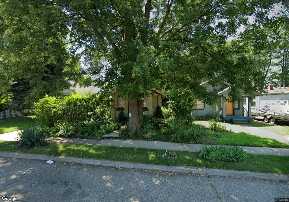
832 E 10 Mile Rd Ferndale, MI 48220
Estimated Value: $138,000 - $191,000
About This Home
This home is located at 832 E 10 Mile Rd, Ferndale, MI 48220 and is currently estimated at $160,056, approximately $203 per square foot. 832 E 10 Mile Rd is a home located in Oakland County with nearby schools including Ferndale Lower Elementary Campus, Ferndale Upper Elementary Campus, and Ferndale Middle School.
Ownership History
We collect this data history from publicly available records. To have your information removed, we recommend requesting removal directly through your county’s website.
Purchase Details
Purchase Details
Home Financials for this Owner
Home Financials are based on the most recent Mortgage that was taken out on this home.Purchase Details
Purchase Details
Purchase Details
Home Values in the Area
Average Home Value in this Area
Purchase History
We collect this data history from publicly available records. To have your information removed, we recommend requesting removal directly through your county’s website.
| Date | Buyer | Sale Price | Title Company |
|---|---|---|---|
| $42,000 | None Available | ||
| $78,500 | None Available | ||
| $83,700 | -- | ||
| -- | -- | ||
| -- | Philip F Greco Title Company |
Mortgage History
We collect this data history from publicly available records. To have your information removed, we recommend requesting removal directly through your county’s website.
| Date | Status | Borrower | Loan Amount |
|---|---|---|---|
| Previous Owner | $83,600 |
Tax History
We collect this data history from publicly available records. To have your information removed, we recommend requesting removal directly through your county’s website.
| Year | Tax Paid | Tax Assessment Tax Assessment Total Assessment is a certain percentage of the fair market value that is determined by local assessors to be the total taxable value of land and additions on the property. | Land | Improvement |
|---|---|---|---|---|
| 2025 | $1,731 | $62,330 | $0 | $0 |
| 2024 | $1,686 | $60,110 | $0 | $0 |
| 2023 | $1,625 | $54,430 | $0 | $0 |
| 2022 | $1,605 | $48,890 | $0 | $0 |
| 2021 | $1,600 | $45,580 | $0 | $0 |
| 2020 | $1,535 | $40,420 | $0 | $0 |
| 2019 | $1,545 | $34,540 | $0 | $0 |
| 2018 | $1,540 | $28,450 | $0 | $0 |
| 2017 | $1,518 | $26,660 | $0 | $0 |
| 2016 | $1,495 | $23,030 | $0 | $0 |
| 2015 | -- | $21,420 | $0 | $0 |
| 2014 | -- | $17,920 | $0 | $0 |
| 2011 | -- | $22,450 | $0 | $0 |
Map
- 3291 Minerva St
- 1510 Etowah Ave
- 1408 Mohawk Ave
- 3060 Minerva St
- 1303 Mohawk Ave
- 3040 Inman St
- 1306 Owana Ave
- 1513 Anne Dr Unit 21
- 1212 Wyandotte Ave
- 1517 Mclean Ave
- 59 Wellesley Dr
- 722 E Parent Ave
- 3024 Wolcott St
- 1514 S Wilson Ave
- 1218 Hoffman Ave
- 3139 Grayson St
- 1510 Maryland Club Dr
- 1548 Maryland Club Dr Unit 86
- 1566 Maryland Club Dr
- 3197 Goodrich St
- 810 E Ten Mile Rd
- 800 E 10 Mile Rd
- 810 E 10 Mile Rd
- 818 E 10 Mile Rd
- 750 E 10 Mile Rd
- 3350 Minerva St
- 826 E 10 Mile Rd
- 832 E Ten Mile Rd
- 740 E 10 Mile Rd
- 3344 Minerva St
- 740 E Ten Mile Rd
- 836 E 10 Mile Rd
- 842 E Ten Mile Rd
- 736 E 10 Mile Rd
- 3336 Minerva St
- 3351 Horton St
- 3345 Minerva St
- 726 E 10 Mile Rd
- 3345 Horton St
- 850 E Ten Mile
Ask me questions while you tour the home.