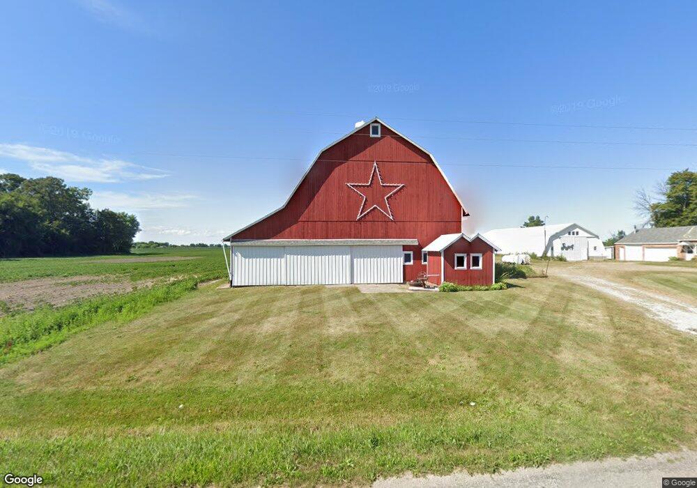
834 W Wilder Rd Auburn, MI 48611
Estimated Value: $211,000 - $246,000
Studio
--
Bath
1,719
Sq Ft
$134/Sq Ft
Est. Value
About This Home
This home is located at 834 W Wilder Rd, Auburn, MI 48611 and is currently estimated at $231,112, approximately $134 per square foot. 834 W Wilder Rd is a home located in Bay County with nearby schools including Auburn Elementary School, Western Middle School, and Bay City Western High School.
Ownership History
Date
Name
Owned For
Owner Type
Purchase Details
Closed on
Dec 19, 2019
Sold by
Wegener Carl F and Hopfinger Linda L
Bought by
Burns June M
Current Estimated Value
Home Financials for this Owner
Home Financials are based on the most recent Mortgage that was taken out on this home.
Original Mortgage
$64,000
Outstanding Balance
$43,437
Interest Rate
3.6%
Mortgage Type
New Conventional
Estimated Equity
$187,675
Purchase Details
Closed on
Apr 30, 2007
Sold by
Wegener Edgar E and Wegener Loretta M
Bought by
Wegener Edgar E
Purchase Details
Closed on
Dec 15, 2005
Sold by
Wegener Edgar E and Wegener Loretta M
Bought by
Wegener Edgar E and Edgar E Wegener Trust
Create a Home Valuation Report for This Property
The Home Valuation Report is an in-depth analysis detailing your home's value as well as a comparison with similar homes in the area
Home Values in the Area
Average Home Value in this Area
Purchase History
| Date | Buyer | Sale Price | Title Company |
|---|---|---|---|
| Burns June M | $130,000 | Liberty Title | |
| Wegener Edgar E | -- | None Available | |
| Wegener Edgar E | -- | -- |
Source: Public Records
Mortgage History
| Date | Status | Borrower | Loan Amount |
|---|---|---|---|
| Open | Burns June M | $64,000 |
Source: Public Records
Tax History
| Year | Tax Paid | Tax Assessment Tax Assessment Total Assessment is a certain percentage of the fair market value that is determined by local assessors to be the total taxable value of land and additions on the property. | Land | Improvement |
|---|---|---|---|---|
| 2025 | $1,655 | $89,450 | $0 | $0 |
| 2024 | $1,608 | $85,950 | $0 | $0 |
| 2023 | $1,530 | $74,000 | $0 | $0 |
| 2022 | $2,738 | $69,350 | $0 | $0 |
| 2021 | $2,538 | $64,900 | $64,900 | $0 |
| 2020 | $2,364 | $64,050 | $64,050 | $0 |
| 2019 | $2,079 | $57,300 | $0 | $0 |
| 2018 | $1,989 | $55,500 | $0 | $0 |
| 2017 | $1,947 | $56,050 | $0 | $0 |
| 2016 | $1,953 | $61,000 | $0 | $61,000 |
| 2015 | $1,986 | $57,400 | $0 | $57,400 |
| 2014 | $1,986 | $57,400 | $0 | $57,400 |
Source: Public Records
Map
Nearby Homes
- 0 W North Union Rd Unit 50166876
- 1285 Wheeler Rd
- 316 Maple St
- 3697 S 11 Mile Rd
- 201 Grant St
- 117 Francis St
- 1415 W North Union Rd
- 0 S 8 Mile Unit 50196502
- Parcel D W North Union Rd
- Parcel E W North Union Rd
- Parcel G W North Union Rd
- Parcel I W North Union Rd
- Parcel F W North Union Rd
- 312 Church St
- 4760 Putt Ln
- 211 Church St
- 312 Chip Rd
- 512 Willow Bend
- 267 W Midland Rd
- 0 S Auburn Rd
- 890 W Wilder Rd
- 778 W Wilder Rd
- 670 W Wilder Rd
- 3837 Garfield Rd
- 4131 Garfield Rd
- 652 W Wilder Rd
- 636 W Wilder Rd
- 4132 Garfield Rd
- 4193 Garfield Rd
- 4208 Garfield Rd
- 4221 Garfield Rd
- 3753 Garfield Rd
- 4243 Garfield Rd
- 3727 Garfield Rd
- 3740 Garfield Rd
- 3711 Garfield Rd
- 1164 Wilder Rd
- 3695 Garfield Rd
- 4291 Garfield Rd
- 3688 Garfield Rd
Your Personal Tour Guide
Ask me questions while you tour the home.