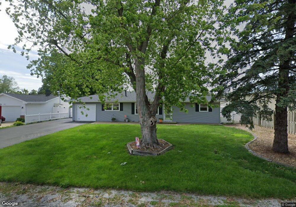
835 Baker Dr Mount Zion, IL 62549
Mount Zion AreaEstimated Value: $139,714 - $150,000
About This Home
This home is located at 835 Baker Dr, Mount Zion, IL 62549 and is currently estimated at $146,679, approximately $127 per square foot. 835 Baker Dr is a home located in Macon County with nearby schools including McGaughey Elementary School, Mt. Zion Elementary School, and Mt. Zion Intermediate School.
Ownership History
We collect this data history from publicly available records. To have your information removed, we recommend requesting removal directly through your county’s website.
Purchase Details
Purchase Details
Home Financials for this Owner
Home Financials are based on the most recent Mortgage that was taken out on this home.Purchase Details
Home Values in the Area
Average Home Value in this Area
Purchase History
We collect this data history from publicly available records. To have your information removed, we recommend requesting removal directly through your county’s website.
| Date | Buyer | Sale Price | Title Company |
|---|---|---|---|
| -- | None Available | ||
| -- | None Available | ||
| $66,000 | -- |
Mortgage History
We collect this data history from publicly available records. To have your information removed, we recommend requesting removal directly through your county’s website.
| Date | Status | Borrower | Loan Amount |
|---|---|---|---|
| Closed | $40,000 | ||
| Closed | $45,358 | ||
| Open | $90,639 | ||
| Previous Owner | $91,998 | ||
| Previous Owner | $84,500 |
Tax History
We collect this data history from publicly available records. To have your information removed, we recommend requesting removal directly through your county’s website.
| Year | Tax Paid | Tax Assessment Tax Assessment Total Assessment is a certain percentage of the fair market value that is determined by local assessors to be the total taxable value of land and additions on the property. | Land | Improvement |
|---|---|---|---|---|
| 2025 | $1,795 | $46,800 | $4,839 | $41,961 |
| 2024 | $1,821 | $43,964 | $4,839 | $39,125 |
| 2023 | $1,905 | $40,890 | $4,501 | $36,389 |
| 2022 | $1,931 | $38,783 | $4,269 | $34,514 |
| 2021 | $2,444 | $36,334 | $4,000 | $32,334 |
| 2020 | $2,245 | $39,772 | $4,158 | $35,614 |
| 2019 | $2,245 | $39,772 | $4,158 | $35,614 |
| 2018 | $2,169 | $38,757 | $4,052 | $34,705 |
| 2017 | $2,134 | $38,012 | $3,974 | $34,038 |
| 2016 | $2,108 | $37,351 | $3,905 | $33,446 |
| 2015 | $2,035 | $30,054 | $3,866 | $26,188 |
| 2014 | $1,962 | $30,054 | $3,866 | $26,188 |
| 2013 | $1,985 | $30,054 | $3,866 | $26,188 |
Map
- 0 State Route 121 Hwy Unit 6259158
- 624 Woodland Dr
- 520 Bell St
- 600 Lawrence Dr
- Lot 20 Jeffrey Ln
- 775 Pearl Ct
- 1135 Finley Ave
- 355 S Henderson St
- 410 N Kruse Rd
- 140 Lexington Cir
- 1130 S Wildwood Dr
- 228-248 W Main St
- 6350 Derby Dr
- 6680 John Dr
- 6 Blakeridge Place
- 435 Desert Rose Ct
- Lot 32 Janine Way
- 2 Blakeridge Place
- Lot 3 Fletcher Ln
- Lot 1 Fletcher Ln
- 825 Baker Dr
- 815 Baker Dr
- 820 Baker Dr
- 820 N State Route 121 Unit 121
- 830 Baker Dr
- 810 N State Route 121 Unit 121
- 805 Baker Dr
- 810 Baker Dr
- 200 E Roberts Dr
- 800 Baker Dr
- 100 E Roberts Dr
- 835 Mintler Dr
- 230 E Roberts Dr
- 845 Mintler Dr
- 825 Mintler Dr
- 855 Mintler Dr
- 815 Mintler Dr
- 805 East Dr
- 830 East Dr
- 865 Mintler Dr
Ask me questions while you tour the home.