
Seller's Agent in 2023
Patty Speakman
Compass Real Estate
(307) 880-1795
336 Total Sales

Estimated Value: $639,000
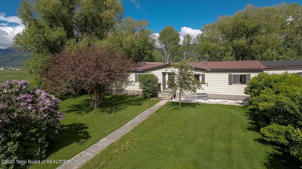
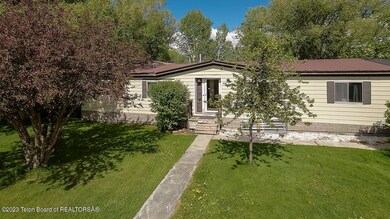
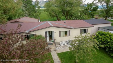
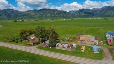
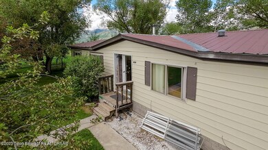
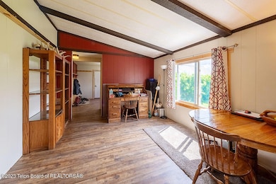
11.5 acres of green pasture in Thayne. This property has irrigation, it has several improvements including a well, septic, and manufactured home. There are several out buildings as well. The mature trees add privacy. The property is zoned mixed use so there are several possibilities. You could build your dream home, subdivide, or run your own little farm plus many more ideas. Enjoy country living while being close to town.
Last Agent to Sell the Property
Compass Real Estate License #10559 Listed on: 06/28/2023
| Date | Buyer | Sale Price | Title Company |
|---|---|---|---|
| Chad Dana | -- | -- |
| Date | Event | Price | List to Sale | Price per Sq Ft |
|---|---|---|---|---|
| 12/07/2023 12/07/23 | Sold | -- | -- | -- |
| 10/19/2023 10/19/23 | Pending | -- | -- | -- |
| 06/28/2023 06/28/23 | For Sale | $765,000 | -- | $459 / Sq Ft |
| Year | Tax Paid | Tax Assessment Tax Assessment Total Assessment is a certain percentage of the fair market value that is determined by local assessors to be the total taxable value of land and additions on the property. | Land | Improvement |
|---|---|---|---|---|
| 2025 | $1,086 | $14,885 | $13,410 | $1,475 |
| 2024 | $1,086 | $17,399 | $15,487 | $1,912 |
| 2023 | $246 | $3,942 | $2,114 | $1,828 |
| 2022 | $207 | $3,320 | $1,814 | $1,506 |
| 2021 | $206 | $3,283 | $1,995 | $1,288 |
| 2020 | $185 | $3,144 | $1,889 | $1,255 |
| 2019 | $184 | $3,081 | $1,826 | $1,255 |
| 2018 | $186 | $3,100 | $1,901 | $1,199 |
| 2017 | $311 | $5,207 | $4,023 | $1,184 |
| 2016 | -- | $4,025 | $1,850 | $2,175 |
| 2015 | -- | $4,967 | $1,783 | $3,184 |
| 2014 | -- | $4,623 | $1,548 | $3,075 |
Seller's Agent in 2023
Patty Speakman
Compass Real Estate
(307) 880-1795
336 Total Sales
Buyer's Agent in 2023
Barbara Allen
Jackson Hole Sotheby's International Realty
(307) 413-3510
15 Total Sales
Source: Teton Board of REALTORS®
MLS Number: 23-1353
APN: 3418-183-00-016.00
Ask me questions while you tour the home.