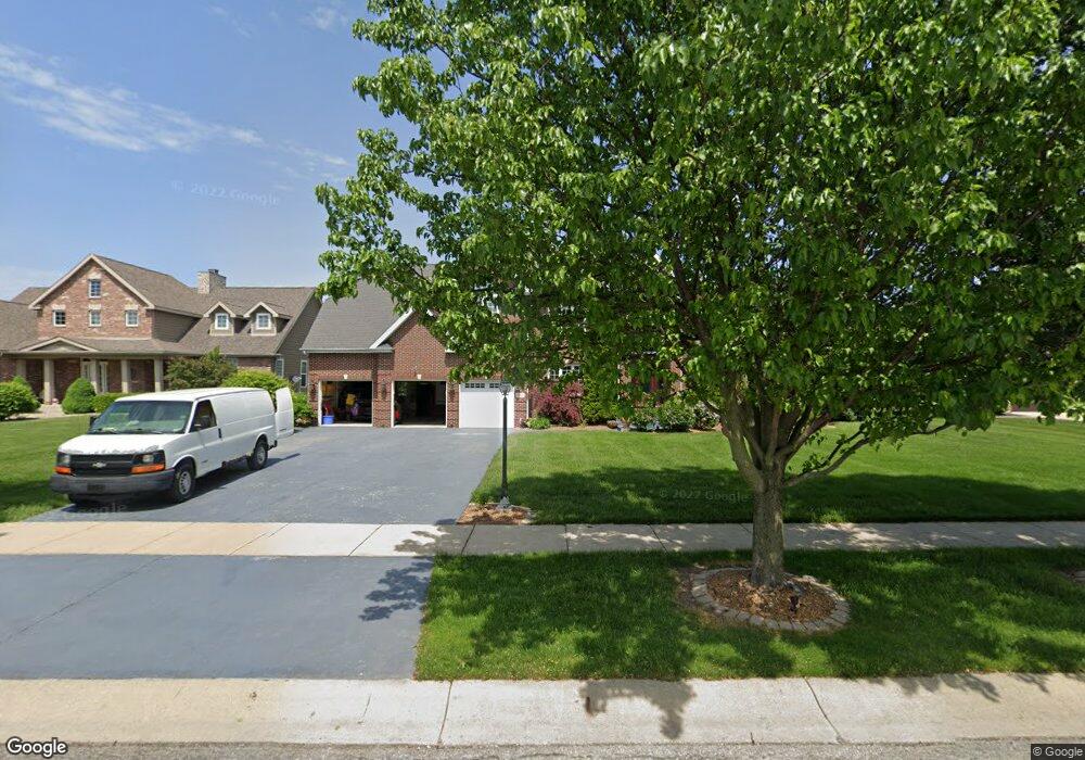
842 Kendall Ct Crown Point, IN 46307
Estimated Value: $622,000 - $654,000
4
Beds
4
Baths
2,988
Sq Ft
$214/Sq Ft
Est. Value
About This Home
This home is located at 842 Kendall Ct, Crown Point, IN 46307 and is currently estimated at $639,177, approximately $213 per square foot. 842 Kendall Ct is a home located in Lake County with nearby schools including Timothy Ball Elementary School, Robert Taft Middle School, and Crown Point High School.
Ownership History
Date
Name
Owned For
Owner Type
Purchase Details
Closed on
Aug 31, 2009
Sold by
Glover Harry W
Bought by
Glover Harry W and Glover Tracey
Current Estimated Value
Purchase Details
Closed on
Jul 21, 2006
Sold by
Flamini Jim
Bought by
Glover Harry W
Home Financials for this Owner
Home Financials are based on the most recent Mortgage that was taken out on this home.
Original Mortgage
$300,000
Outstanding Balance
$176,057
Interest Rate
6.73%
Mortgage Type
Purchase Money Mortgage
Estimated Equity
$463,120
Create a Home Valuation Report for This Property
The Home Valuation Report is an in-depth analysis detailing your home's value as well as a comparison with similar homes in the area
Home Values in the Area
Average Home Value in this Area
Purchase History
| Date | Buyer | Sale Price | Title Company |
|---|---|---|---|
| Glover Harry W | -- | None Available | |
| Glover Harry W | -- | None Available | |
| Glover Harry W | -- | Ticor Title Schererville |
Source: Public Records
Mortgage History
| Date | Status | Borrower | Loan Amount |
|---|---|---|---|
| Open | Glover Harry W | $300,000 |
Source: Public Records
Tax History
| Year | Tax Paid | Tax Assessment Tax Assessment Total Assessment is a certain percentage of the fair market value that is determined by local assessors to be the total taxable value of land and additions on the property. | Land | Improvement |
|---|---|---|---|---|
| 2025 | $5,647 | $541,300 | $120,000 | $421,300 |
| 2024 | $13,508 | $516,000 | $120,000 | $396,000 |
| 2023 | $5,602 | $491,500 | $120,000 | $371,500 |
| 2022 | $5,460 | $476,600 | $120,000 | $356,600 |
| 2021 | $5,794 | $508,000 | $102,000 | $406,000 |
| 2020 | $5,571 | $486,600 | $102,000 | $384,600 |
| 2019 | $5,633 | $487,900 | $102,000 | $385,900 |
| 2018 | $7,381 | $484,500 | $102,000 | $382,500 |
| 2017 | $6,852 | $447,300 | $102,000 | $345,300 |
| 2016 | $7,130 | $458,900 | $102,000 | $356,900 |
| 2014 | $6,786 | $460,200 | $102,000 | $358,200 |
| 2013 | $6,823 | $458,200 | $102,000 | $356,200 |
Source: Public Records
Map
Nearby Homes
- 11241 Oak Ridge Ct
- 11200 Oak Ridge Ct
- 900 Easy St
- 771 Kenmare Pkwy
- 324 Maple St
- 1465 Mybeck Place
- 740 Meadow Ln
- 316 Oak Cir
- 1555 Chalone Ct
- 3910 W 106th Ln
- 1718 Silver Hawk Dr
- 350 Cochran Dr
- 1436 Bohling Place
- 10607 Lane St
- 901 Veterans Ln
- 805 Veterans Ln
- 862 Veterans Ln
- 802 Veterans Ln
- 10813 Lane St
- 600 W North St
- 834 Kendall Ct
- 850 Kendall Ct
- 11180 Oak Ridge Ct
- 11160 Oak Ridge Ct
- 11173 Oak Ridge Ct
- 11197 Oak Ridge Ct
- 11219 Oak Ridge Ct
- 11220 Oak Ridge Ct
- 11197 Oakridge Ct
- 826 Kendall Ct
- 1262 Mondavi Ct
- 1254 Mondavi Ct
- 864 Kendall Ct
- 818 Kendall Ct
- 1263 Mondavi Ct
- 827 Kendall Ct
- 1246 Mondavi Ct
- 1255 Mondavi Ct
- 819 Kendall Ct
- 810 Kendall Ct
Your Personal Tour Guide
Ask me questions while you tour the home.