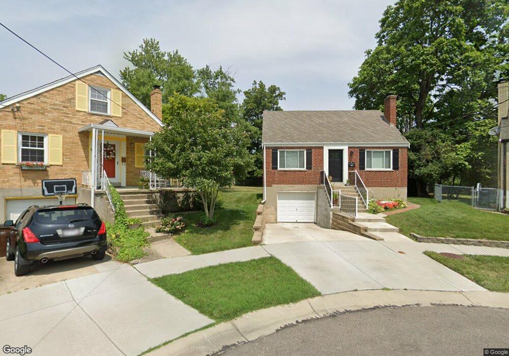
8457 Lyness Dr Cincinnati, OH 45239
Estimated Value: $148,000 - $200,089
2
Beds
1
Bath
1,199
Sq Ft
$144/Sq Ft
Est. Value
About This Home
This home is located at 8457 Lyness Dr, Cincinnati, OH 45239 and is currently estimated at $172,772, approximately $144 per square foot. 8457 Lyness Dr is a home located in Hamilton County with nearby schools including White Oak Middle School, Colerain High School, and Cincinnati Achievement Academy.
Ownership History
Date
Name
Owned For
Owner Type
Purchase Details
Closed on
Dec 4, 2018
Sold by
Uhlman Kenneth L and Uhlman Sherry S
Bought by
Uhlman Kenneth L and Uhlman Sherry S
Current Estimated Value
Purchase Details
Closed on
May 29, 2015
Sold by
Uhlman Cecilia
Bought by
Uhlman Kenneth L
Home Financials for this Owner
Home Financials are based on the most recent Mortgage that was taken out on this home.
Original Mortgage
$58,795
Interest Rate
3.63%
Mortgage Type
New Conventional
Create a Home Valuation Report for This Property
The Home Valuation Report is an in-depth analysis detailing your home's value as well as a comparison with similar homes in the area
Home Values in the Area
Average Home Value in this Area
Purchase History
| Date | Buyer | Sale Price | Title Company |
|---|---|---|---|
| Uhlman Kenneth L | -- | None Available | |
| Uhlman Kenneth L | $61,890 | Attorney |
Source: Public Records
Mortgage History
| Date | Status | Borrower | Loan Amount |
|---|---|---|---|
| Closed | Uhlman Kenneth L | $58,795 |
Source: Public Records
Tax History
| Year | Tax Paid | Tax Assessment Tax Assessment Total Assessment is a certain percentage of the fair market value that is determined by local assessors to be the total taxable value of land and additions on the property. | Land | Improvement |
|---|---|---|---|---|
| 2025 | $2,352 | $40,828 | $8,785 | $32,043 |
| 2023 | $2,193 | $40,828 | $8,785 | $32,043 |
| 2022 | $1,685 | $25,561 | $6,899 | $18,662 |
| 2021 | $1,670 | $25,561 | $6,899 | $18,662 |
| 2020 | $1,688 | $25,561 | $6,899 | $18,662 |
| 2019 | $1,533 | $21,662 | $5,845 | $15,817 |
| 2018 | $1,375 | $21,662 | $5,845 | $15,817 |
| 2017 | $1,303 | $21,662 | $5,845 | $15,817 |
| 2016 | $1,411 | $23,167 | $8,050 | $15,117 |
| 2015 | $879 | $23,167 | $8,050 | $15,117 |
| 2014 | $880 | $23,167 | $8,050 | $15,117 |
| 2013 | $955 | $25,183 | $8,750 | $16,433 |
Source: Public Records
Map
Nearby Homes
- 2736 Barthas Place
- 8278 Lyness Dr
- 2655 Barthas Place
- 2701 Hennge Dr
- 2750 W Galbraith Rd
- 8265 Haskell Dr
- 8228 Haskell Dr
- 2807 W Galbraith Rd
- 3069 Sovereign Dr
- 8628 Paisley Dr
- 2335 Bluelark Dr
- 8526 Neptune Dr
- 2680 Royal Glen Dr
- 8241 Georgianna Dr
- 2564 Altura Dr
- 2351 Mercury Ave
- 3269 Warfield Ave
- 8949 Pippin Rd
- 8729 Morningstar Ln
- 7560 Pippin Rd
- 8449 Lyness Dr
- 8456 Lyness Dr
- 8443 Lyness Dr
- 8462 Jackies Dr
- 8456 Jackies Dr
- 8448 Lyness Dr
- 8448 Jackies Dr
- 8435 Lyness Dr
- 8442 Lyness Dr
- 8442 Jackies Dr
- 8434 Lyness Dr
- 8429 Lyness Dr
- 8434 Jackies Dr
- 8428 Lyness Dr
- 8428 Jackies Dr
- 8421 Lyness Dr
- 8449 Royal Heights Dr
- 6254 Mellowbrook Ct
- 8420 Lyness Dr
- 8457 Jackies Dr
Your Personal Tour Guide
Ask me questions while you tour the home.