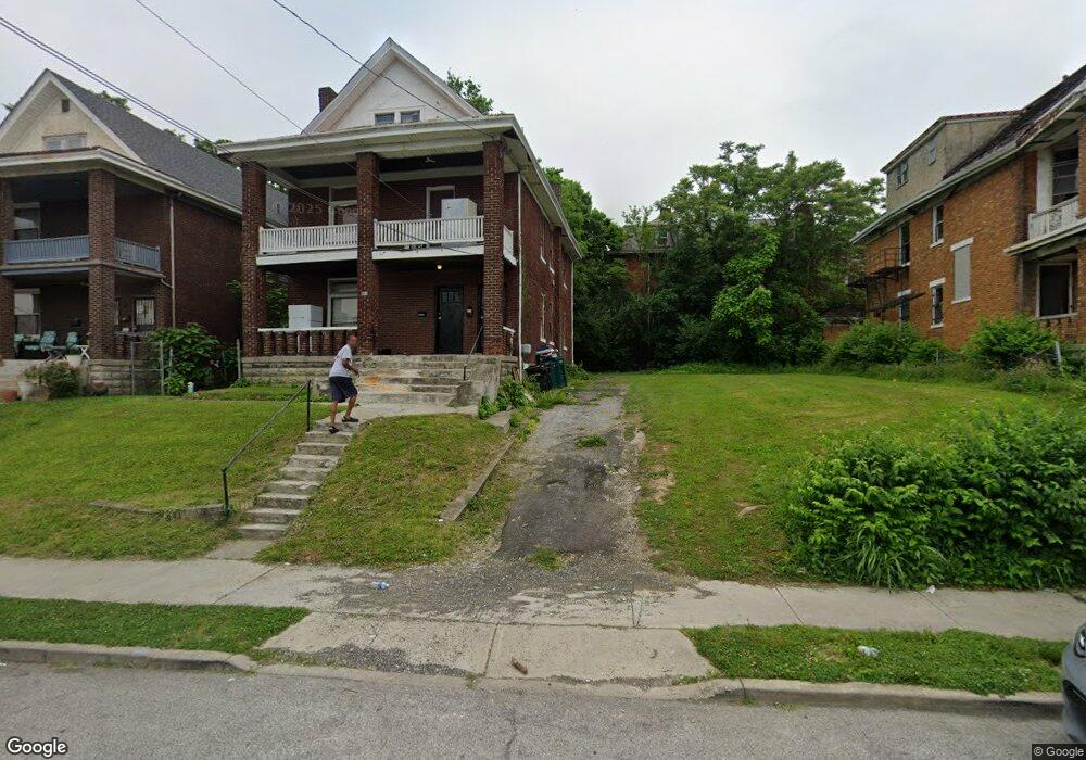
847 Blair Ave Cincinnati, OH 45229
Avondale NeighborhoodEstimated Value: $295,000
5
Beds
3
Baths
2,726
Sq Ft
$108/Sq Ft
Est. Value
About This Home
This home is located at 847 Blair Ave, Cincinnati, OH 45229 and is currently priced at $295,000, approximately $108 per square foot. 847 Blair Ave is a home located in Hamilton County with nearby schools including South Avondale School, Robert A. Taft Information Technology High School, and Clark Montessori High School.
Ownership History
Date
Name
Owned For
Owner Type
Purchase Details
Closed on
Aug 16, 2021
Sold by
Hamilton County
Bought by
Hamilton County Land Reutilization Corp
Current Estimated Value
Purchase Details
Closed on
May 13, 2003
Sold by
The Bank One Na
Bought by
Howard Robert L and Howard Joyce A
Home Financials for this Owner
Home Financials are based on the most recent Mortgage that was taken out on this home.
Original Mortgage
$48,000
Interest Rate
5.3%
Mortgage Type
Unknown
Purchase Details
Closed on
Feb 14, 2003
Sold by
Washington Michael W
Bought by
Bank One Na
Purchase Details
Closed on
Dec 5, 1996
Sold by
Mason Mattie and Hall Mattie
Bought by
Washington Michael W
Home Financials for this Owner
Home Financials are based on the most recent Mortgage that was taken out on this home.
Original Mortgage
$65,075
Interest Rate
7.85%
Create a Home Valuation Report for This Property
The Home Valuation Report is an in-depth analysis detailing your home's value as well as a comparison with similar homes in the area
Home Values in the Area
Average Home Value in this Area
Purchase History
We collect this data history from publicly available records. To have your information removed, we recommend requesting removal directly through your county’s website.
| Date | Buyer | Sale Price | Title Company |
|---|---|---|---|
| Hamilton County Land Reutilization Corp | -- | None Available | |
| Hamilton County Land Reutilization Corporatio | -- | Anness Charles | |
| Howard Robert L | $66,500 | Resource Title Agency Inc | |
| Bank One Na | $56,000 | -- | |
| Washington Michael W | $68,500 | -- |
Source: Public Records
Mortgage History
We collect this data history from publicly available records. To have your information removed, we recommend requesting removal directly through your county’s website.
| Date | Status | Borrower | Loan Amount |
|---|---|---|---|
| Previous Owner | Howard Robert L | $48,000 | |
| Previous Owner | Washington Michael W | $65,075 | |
| Closed | Howard Robert L | $11,800 |
Source: Public Records
Tax History
| Year | Tax Paid | Tax Assessment Tax Assessment Total Assessment is a certain percentage of the fair market value that is determined by local assessors to be the total taxable value of land and additions on the property. | Land | Improvement |
|---|---|---|---|---|
| 2025 | -- | $3,504 | $3,504 | -- |
| 2024 | -- | $3,504 | $3,504 | -- |
| 2023 | $392 | $3,504 | $3,504 | $0 |
| 2022 | $392 | $3,476 | $3,476 | $0 |
| 2021 | $250 | $3,476 | $3,476 | $0 |
| 2020 | $250 | $3,476 | $3,476 | $0 |
| 2019 | $854 | $3,248 | $3,248 | $0 |
| 2018 | $257 | $3,248 | $3,248 | $0 |
| 2017 | $247 | $3,248 | $3,248 | $0 |
| 2016 | $267 | $3,441 | $3,441 | $0 |
| 2015 | $602 | $3,441 | $3,441 | $0 |
| 2014 | $241 | $3,441 | $3,441 | $0 |
| 2013 | $244 | $3,441 | $3,441 | $0 |
Source: Public Records
Map
Nearby Homes
- 816 Windham Ave
- 855 Rockdale Ave
- 567 Stewart Place
- 834 Rockdale Ave
- 837 Hutchins Ave
- 835 Lexington Ave
- 3440 Harvey Ave
- 871 Hutchins Ave
- 3550 van Antwerp Place
- 899 Lexington Ave
- 434 Northern Ave
- 693 Gholson Ave
- 3565 Harvey Ave
- 1011 Foraker Ave
- 3636 Reading Rd
- 694 Gholson Ave
- 3586 Alaska Ave
- 527 Glenwood Ave
- 3206 Gilbert Ave
- 810 S Fred Shuttlesworth Cir
Your Personal Tour Guide
Ask me questions while you tour the home.