Estimated Value: $235,000 - $470,000
Studio
--
Bath
--
Sq Ft
24,829
Sq Ft Lot
About This Home
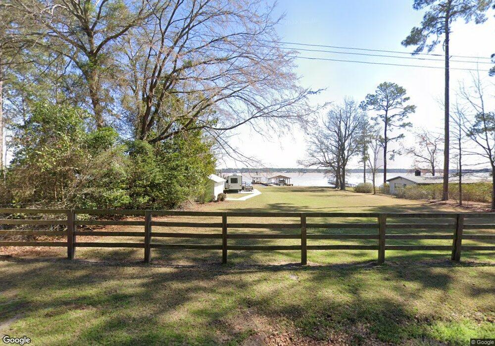
This home is located at 847 Flintside Dr, Cobb, GA 31735 and is currently estimated at $367,826. 847 Flintside Dr is a home located in Sumter County with nearby schools including Sumter County Primary School, Sumter County Elementary School, and Sumter County Middle School.
Ownership History
Date
Name
Owned For
Owner Type
Purchase Details
Closed on
Apr 16, 2018
Sold by
Hopkins Carol G
Bought by
Blanton Brian Dewayne
Current Estimated Value
Home Financials for this Owner
Home Financials are based on the most recent Mortgage that was taken out on this home.
Original Mortgage
$65,000
Interest Rate
4.44%
Mortgage Type
New Conventional
Purchase Details
Closed on
Jul 20, 2000
Sold by
Hopkins John Charle
Bought by
Hopkins Caril G
Purchase Details
Closed on
Jul 29, 1991
Sold by
Hopkins C W
Bought by
Hopkins John Charle
Purchase Details
Closed on
Jul 1, 1963
Bought by
Hopkins C W
Create a Home Valuation Report for This Property
The Home Valuation Report is an in-depth analysis detailing your home's value as well as a comparison with similar homes in the area
Purchase History
| Date | Buyer | Sale Price | Title Company |
|---|---|---|---|
| Blanton Brian Dewayne | $73,000 | -- | |
| Hopkins Caril G | -- | -- | |
| Hopkins John Charle | -- | -- | |
| Hopkins C W | -- | -- |
Source: Public Records
Mortgage History
| Date | Status | Borrower | Loan Amount |
|---|---|---|---|
| Closed | Blanton Brian Dewayne | $65,000 |
Source: Public Records
Tax History
| Year | Tax Paid | Tax Assessment Tax Assessment Total Assessment is a certain percentage of the fair market value that is determined by local assessors to be the total taxable value of land and additions on the property. | Land | Improvement |
|---|---|---|---|---|
| 2025 | $2,369 | $73,520 | $58,400 | $15,120 |
| 2024 | $2,369 | $73,520 | $58,400 | $15,120 |
| 2023 | $2,297 | $73,520 | $58,400 | $15,120 |
| 2022 | $2,297 | $73,520 | $58,400 | $15,120 |
| 2021 | $2,302 | $73,520 | $58,400 | $15,120 |
| 2020 | $2,380 | $73,520 | $58,400 | $15,120 |
| 2019 | $968 | $66,020 | $58,400 | $7,620 |
| 2018 | $2,126 | $66,020 | $58,400 | $7,620 |
| 2017 | $2,126 | $66,020 | $58,400 | $7,620 |
| 2016 | $2,172 | $67,420 | $58,400 | $9,020 |
| 2015 | -- | $57,720 | $48,640 | $9,080 |
| 2014 | $1,831 | $57,720 | $48,640 | $9,080 |
| 2013 | -- | $57,720 | $48,640 | $9,080 |
Source: Public Records
Map
Nearby Homes
- 0 Lot #3 & Part Lot#4 Unit 59461
- 687 Flintside Dr
- 655 Flintside Dr
- 631 Flintside Dr
- 127 Landing Rd
- 141 Landing Rd
- 147 Landing Rd
- 153 Landing Rd
- 228 Cedar Point Cir
- 850 Scenic Route
- 475 N Cedar Creek Rd
- Lot 1, 2 Scenic Route
- 580 Scenic Route
- Lot 3,4 Scenic Route
- 115 Ellis Ct
- 418 Flintside Dr
- 251 N Cedar Creek Rd
- 600 Scenic Route
- 119 Wolfs Thick Rd
- 103 Cedar Slough Ct
- 851 Flintside Dr
- 845 Flintside Dr
- 843 Flintside Dr
- 835 Flintside Dr
- 838 Flintside Dr
- 108 4th St
- 831 Flintside Dr
- 831 Flintside Dr Unit 8
- 160 6th St
- 104 4th St
- 827 Flintside Dr
- 156 6th St
- 154 6th St
- 822 Flintside Dr
- 108B 3rd St
- 823 Flintside Dr
- 140 6th St
- 112 3rd St
- 130 6th St
- Lot 193 Southern Shores
Your Personal Tour Guide
Ask me questions while you tour the home.