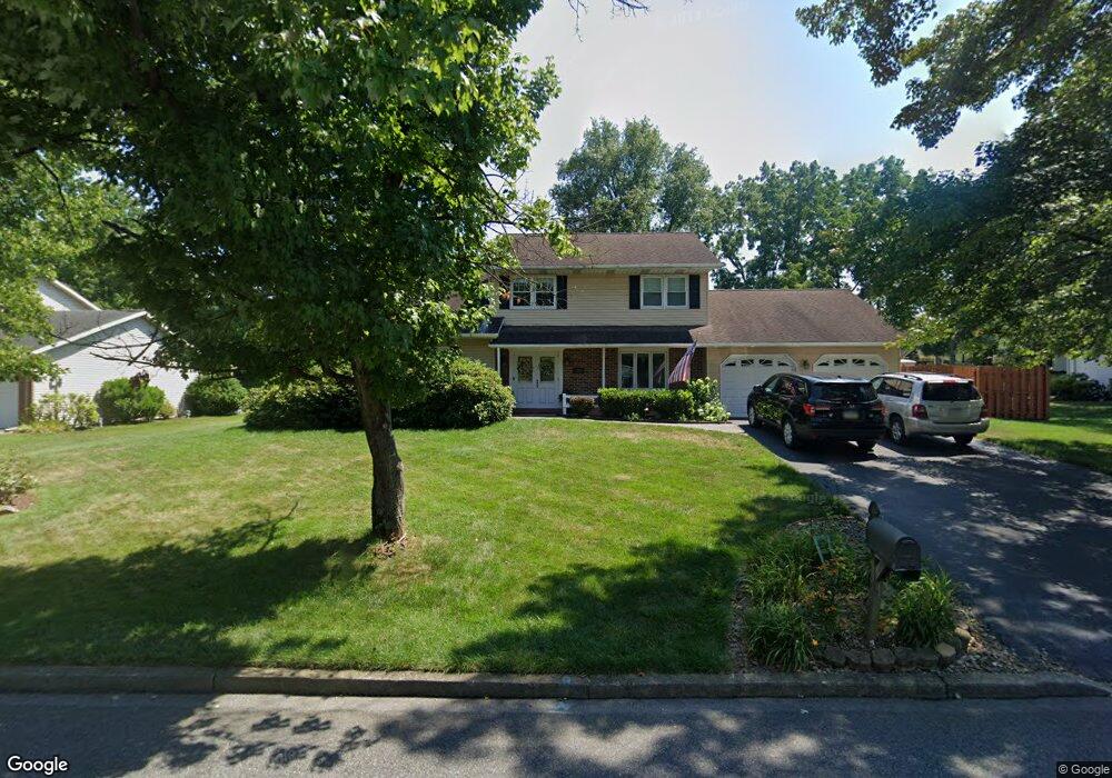
849 Blair Rd Bethlehem, PA 18017
Estimated Value: $465,034 - $520,000
About This Home
This home is located at 849 Blair Rd, Bethlehem, PA 18017 and is currently estimated at $501,259, approximately $249 per square foot. 849 Blair Rd is a home located in Northampton County with nearby schools including Asa Packer Elementary School, Nitschmann Middle School, and Liberty High School.
Ownership History
We collect this data history from publicly available records. To have your information removed, we recommend requesting removal directly through your county’s website.
Purchase Details
Home Financials for this Owner
Home Financials are based on the most recent Mortgage that was taken out on this home.Purchase Details
Purchase Details
Home Values in the Area
Average Home Value in this Area
Purchase History
We collect this data history from publicly available records. To have your information removed, we recommend requesting removal directly through your county’s website.
| Date | Buyer | Sale Price | Title Company |
|---|---|---|---|
| $270,000 | None Available | ||
| $136,000 | -- | ||
| $85,000 | -- |
Mortgage History
We collect this data history from publicly available records. To have your information removed, we recommend requesting removal directly through your county’s website.
| Date | Status | Borrower | Loan Amount |
|---|---|---|---|
| Open | $190,000 |
Tax History
We collect this data history from publicly available records. To have your information removed, we recommend requesting removal directly through your county’s website.
| Year | Tax Paid | Tax Assessment Tax Assessment Total Assessment is a certain percentage of the fair market value that is determined by local assessors to be the total taxable value of land and additions on the property. | Land | Improvement |
|---|---|---|---|---|
| 2026 | $816 | $75,600 | $28,700 | $46,900 |
| 2025 | $816 | $75,600 | $28,700 | $46,900 |
| 2024 | $5,511 | $75,600 | $28,700 | $46,900 |
| 2023 | $5,530 | $75,600 | $28,700 | $46,900 |
| 2022 | $5,478 | $75,600 | $28,700 | $46,900 |
| 2021 | $5,433 | $75,600 | $28,700 | $46,900 |
| 2020 | $5,440 | $75,600 | $28,700 | $46,900 |
| 2019 | $5,418 | $75,600 | $28,700 | $46,900 |
| 2018 | $5,311 | $75,600 | $28,700 | $46,900 |
| 2017 | $5,273 | $75,600 | $28,700 | $46,900 |
| 2016 | -- | $75,600 | $28,700 | $46,900 |
| 2015 | -- | $75,600 | $28,700 | $46,900 |
| 2014 | -- | $75,600 | $28,700 | $46,900 |
Map
- 951 W MacAda Rd
- 801 Yorkshire Rd
- 896 Briarstone Rd
- 1275 W MacAda Rd
- 2840 Jacksonville Rd
- 1220 Oakwood Dr
- 1345 W MacAda Rd
- 1535 Ciara Dr
- 1189 Bluestone Dr
- 1371 Stoke Park Rd
- 2618 Ambassador Dr
- 1045 Resolution Dr
- 1011 Resolution Dr
- 1051 Resolution Dr
- 1271 Stafore Dr
- 200 Bella Vista Dr
- 3524 Browning Ln
- 0 Rosewood Dr Unit 766427
- 0 Rosewood Dr Unit 777695
- 3135 Center St
Ask me questions while you tour the home.