87 Circle Dr Wrentham, MA 02093
Wrentham AreaEstimated Value: $344,000 - $621,000
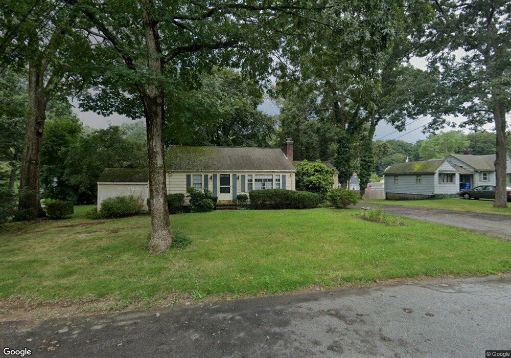
About This Home
This home is located at 87 Circle Dr, Wrentham, MA 02093 and is currently estimated at $486,816, approximately $515 per square foot. 87 Circle Dr is a home located in Norfolk County with nearby schools including Delaney Elementary School and Charles E Roderick.
Ownership History
We collect this data history from publicly available records. To have your information removed, we recommend requesting removal directly through your county’s website.
Purchase Details
Purchase Details
Purchase Details
Purchase History
We collect this data history from publicly available records. To have your information removed, we recommend requesting removal directly through your county’s website.
| Date | Buyer | Sale Price | Title Company |
|---|---|---|---|
| -- | None Available | ||
| $239,900 | -- | ||
| $100,000 | -- |
Tax History
We collect this data history from publicly available records. To have your information removed, we recommend requesting removal directly through your county’s website.
| Year | Tax Paid | Tax Assessment Tax Assessment Total Assessment is a certain percentage of the fair market value that is determined by local assessors to be the total taxable value of land and additions on the property. | Land | Improvement |
|---|---|---|---|---|
| 2025 | $5,287 | $456,200 | $259,600 | $196,600 |
| 2024 | $4,927 | $410,600 | $259,600 | $151,000 |
| 2023 | $4,664 | $369,600 | $236,000 | $133,600 |
| 2022 | $4,690 | $343,100 | $220,200 | $122,900 |
| 2021 | $4,352 | $309,300 | $192,200 | $117,100 |
| 2020 | $4,177 | $293,100 | $171,000 | $122,100 |
| 2019 | $4,109 | $291,000 | $171,000 | $120,000 |
| 2018 | $4,185 | $293,900 | $171,000 | $122,900 |
| 2017 | $3,959 | $277,800 | $167,700 | $110,100 |
| 2016 | $3,870 | $271,000 | $162,900 | $108,100 |
| 2015 | $3,735 | $249,300 | $156,600 | $92,700 |
| 2014 | $3,674 | $240,000 | $150,600 | $89,400 |
Map
- 95 Circle Dr
- 78 Franklin St
- 18 Shears St
- 151 Dedham St
- 47 Sleepy Hollow Ln
- 35 Jones St
- 15 Lorraine Metcalf Dr
- 371 & 377 Franklin St
- 430 Franklin St
- 28 Park St
- 140 King James Way
- 18 A St
- 424 Dedham St
- 165 Harvard Ln
- 35 Fairbanks Dr
- 287 Taunton St
- 9 Earle Stewart Ln Unit Lot 1
- 25 Charles Samuel Way
- 11 Earle Stewart Ln Unit Lot 2
- 14 Earle Stewart Ln
- 53 Circle Dr
- 92 Circle Dr
- 45 Circle Dr
- 66 Circle Dr
- 58 Circle Dr
- 27 Circle Dr
- 100 Circle Dr
- 50 Circle Dr
- 72 Circle Dr
- 15 Kevin Joes Way
- 42 Circle Dr
- 106 Circle Dr
- 112 Circle Dr
- LOT 25 Manchester Dr
- LOT 13 Hales Pond Ln
- LOT 23 Manchester Dr
- B Old Quarry Rd
- 34 Circle Dr
- 10 Kevin Joes Way
- 25 Kevin Joes Way
Ask me questions while you tour the home.