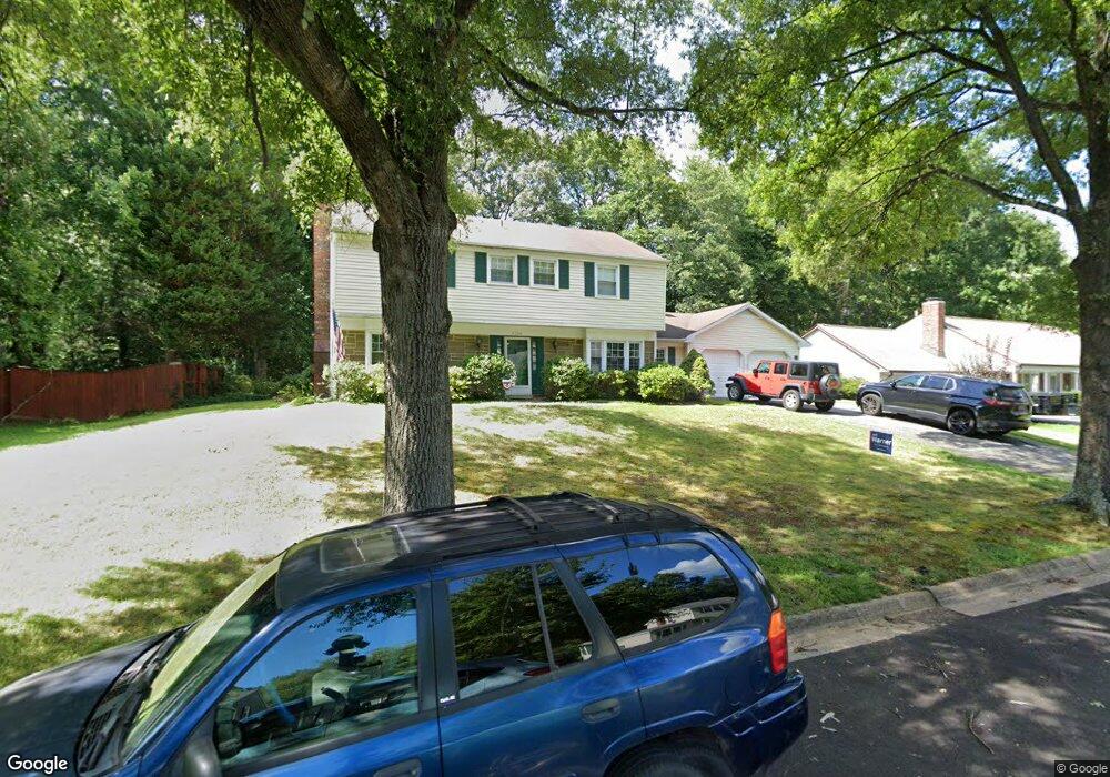
8704 Crystal Rock Ln Laurel, MD 20708
South Laurel NeighborhoodEstimated Value: $469,342 - $578,000
Studio
3
Baths
2,228
Sq Ft
$242/Sq Ft
Est. Value
About This Home
This home is located at 8704 Crystal Rock Ln, Laurel, MD 20708 and is currently estimated at $540,086, approximately $242 per square foot. 8704 Crystal Rock Ln is a home located in Prince George's County with nearby schools including Montpelier Elementary School, Dwight D. Eisenhower Middle School, and Laurel High School.
Ownership History
Date
Name
Owned For
Owner Type
Purchase Details
Closed on
May 25, 2001
Sold by
Stack Kenneth
Bought by
Stack Kenneth F and Stack Jane
Current Estimated Value
Purchase Details
Closed on
Apr 4, 2001
Sold by
Stark Dennis R
Bought by
Stack Kenneth
Purchase Details
Closed on
Jan 8, 1990
Sold by
Sutton Gary L
Bought by
Stark Dennis R and Stark Deanna L
Create a Home Valuation Report for This Property
The Home Valuation Report is an in-depth analysis detailing your home's value as well as a comparison with similar homes in the area
Home Values in the Area
Average Home Value in this Area
Purchase History
| Date | Buyer | Sale Price | Title Company |
|---|---|---|---|
| Stack Kenneth F | -- | -- | |
| Stack Kenneth | $187,500 | -- | |
| Stark Dennis R | $182,900 | -- |
Source: Public Records
Tax History
| Year | Tax Paid | Tax Assessment Tax Assessment Total Assessment is a certain percentage of the fair market value that is determined by local assessors to be the total taxable value of land and additions on the property. | Land | Improvement |
|---|---|---|---|---|
| 2025 | $5,190 | $436,600 | $127,100 | $309,500 |
| 2024 | $5,190 | $409,533 | -- | -- |
| 2023 | $4,975 | $382,467 | $0 | $0 |
| 2022 | $4,714 | $355,400 | $102,100 | $253,300 |
| 2021 | $4,545 | $345,867 | $0 | $0 |
| 2020 | $4,474 | $336,333 | $0 | $0 |
| 2019 | $4,380 | $326,800 | $101,000 | $225,800 |
| 2018 | $4,238 | $311,933 | $0 | $0 |
| 2017 | $4,120 | $297,067 | $0 | $0 |
| 2016 | -- | $282,200 | $0 | $0 |
| 2015 | $3,552 | $276,067 | $0 | $0 |
| 2014 | $3,552 | $269,933 | $0 | $0 |
Source: Public Records
Map
Nearby Homes
- 8714 Granite Ln
- 8406 Snowden Loop Ct
- 8252 Imperial Dr
- 12505 Cedarbrook Ln
- 12600 Cedarbrook Ln
- 12803 Black Oak Dr
- 8493 Imperial Dr
- 12605 Cedarbrook Ln
- 0 Larchdale Rd Unit MDPG2200348
- 12201 Mount Pleasant Dr
- 12229 Shadetree Ln
- 13203 Clarington Ct
- 11907 Callow Terrace
- 7712 Blue Point Ave
- 13400 Oaklands Manor Dr
- 9423 Rosmarin Way
- 12106 Running Bull Way
- 12122 Running Bull Way
- 12124 Running Bull Way
- 12017 Apache Tears Cir
- 8702 Crystal Rock Ln
- 8706 Crystal Rock Ln
- 8707 Crestmont Ln
- 8708 Crystal Rock Ln
- 8703 Crystal Rock Ln
- 8705 Crystal Rock Ln
- 8705 Crestmont Ln
- 8758 Oxwell Ln
- 8760 Oxwell Ln
- 8709 Crestmont Ln
- 8707 Crystal Rock Ln
- 8766 Oxwell Ln
- 8710 Crystal Rock Ln
- 8756 Oxwell Ln
- 8709 Crystal Rock Ln
- 8711 Crestmont Ln
- 8770 Oxwell Ln
- 8703 Crestmont Ln
- 8706 Crestmont Ln
- 8774 Oxwell Ln
Your Personal Tour Guide
Ask me questions while you tour the home.