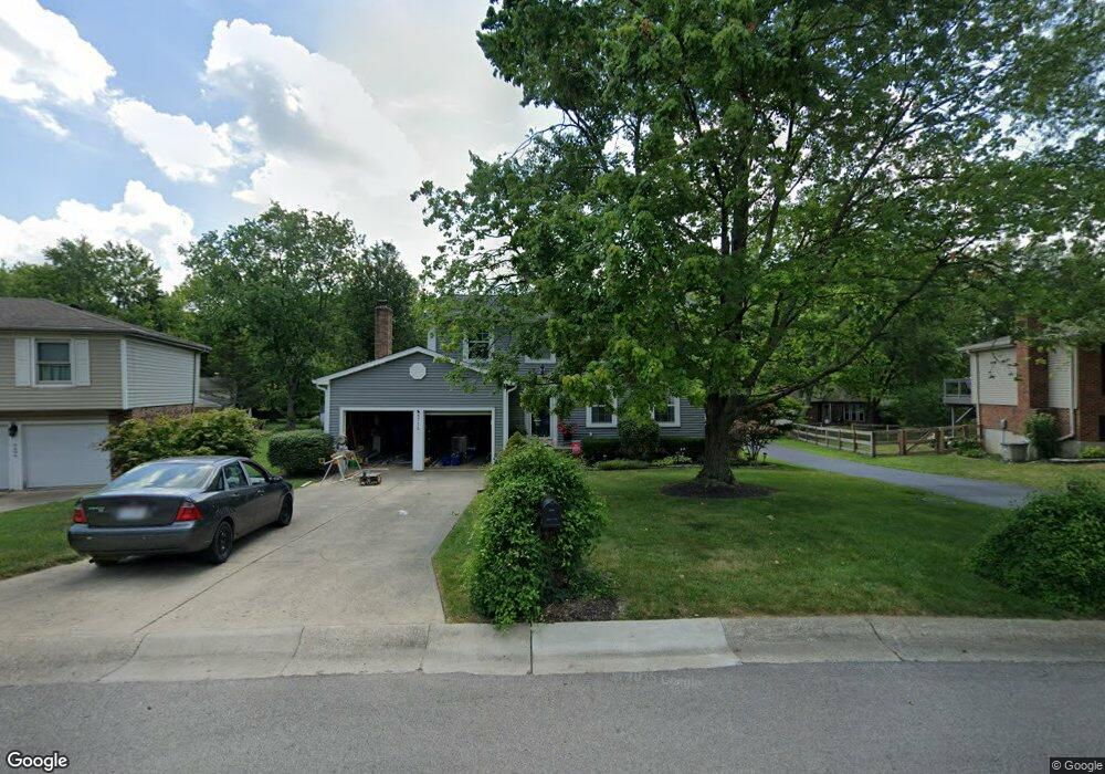
8714 Simpson Ct Mason, OH 45040
Landen NeighborhoodEstimated Value: $379,000 - $391,000
About This Home
This home is located at 8714 Simpson Ct, Mason, OH 45040 and is currently estimated at $385,199, approximately $197 per square foot. 8714 Simpson Ct is a home located in Warren County with nearby schools including Kings Junior High School, Kings High School, and King Of Kings Lutheran Early Childhood Education.
Ownership History
We collect this data history from publicly available records. To have your information removed, we recommend requesting removal directly through your county’s website.
Purchase Details
Purchase Details
Purchase Details
Purchase Details
Purchase Details
Purchase Details
Purchase Details
Purchase Details
Home Values in the Area
Average Home Value in this Area
Purchase History
We collect this data history from publicly available records. To have your information removed, we recommend requesting removal directly through your county’s website.
| Date | Buyer | Sale Price | Title Company |
|---|---|---|---|
| -- | Middletown Title | ||
| $106,500 | -- | ||
| $99,000 | -- | ||
| $84,000 | -- | ||
| -- | -- | ||
| $73,800 | -- | ||
| $21,300 | -- | ||
| -- | -- |
Tax History
We collect this data history from publicly available records. To have your information removed, we recommend requesting removal directly through your county’s website.
| Year | Tax Paid | Tax Assessment Tax Assessment Total Assessment is a certain percentage of the fair market value that is determined by local assessors to be the total taxable value of land and additions on the property. | Land | Improvement |
|---|---|---|---|---|
| 2025 | $5,279 | $101,220 | $24,500 | $76,720 |
| 2024 | $5,279 | $101,220 | $24,500 | $76,720 |
| 2023 | $4,695 | $80,860 | $12,915 | $67,945 |
| 2022 | $4,610 | $80,861 | $12,915 | $67,946 |
| 2021 | $3,862 | $80,861 | $12,915 | $67,946 |
| 2020 | $3,732 | $65,741 | $10,500 | $55,241 |
| 2019 | $3,777 | $65,741 | $10,500 | $55,241 |
| 2018 | $3,788 | $65,741 | $10,500 | $55,241 |
| 2017 | $3,930 | $60,879 | $10,371 | $50,509 |
| 2016 | $4,030 | $60,879 | $10,371 | $50,509 |
| 2015 | $3,426 | $60,879 | $10,371 | $50,509 |
| 2014 | $3,426 | $53,880 | $9,180 | $44,700 |
| 2013 | $3,432 | $61,640 | $10,500 | $51,140 |
Map
- 8846 Meadow Dr
- 8839 Pollard Place
- 3491 Simpson Trace
- 3986 Townsley Dr
- 3971 Everett Dr
- 8530 Cornetts Cove
- 8780 S Cove Dr
- 3237 S Cove Ct
- 9398 Carriage Run Cir
- 3222 Locust Ave
- 8188 Columbia Rd
- 9470 Carriage Run Cir
- 9490 Carriage Run Cir
- 8525 Landen Cove
- 9186 Yarmouth Dr
- 9282 Greenery Ct Unit 311E
- 9434 Greenery Ct
- 8442 Wick Ln
- 9570 Old Village Dr
- 2930 Millbank Row
- 8696 Simpson Ct
- 8716 Simpson Ct
- 8718 Simpson Ct
- 8700 Simpson Ct
- 8720 Simpson Ct
- 8740 Simpson Ct
- 8686 Simpson Ct
- 8711 Simpson Ct
- 8744 Simpson Ct
- 8693 Simpson Ct
- 8698 Simpson Ct
- 8729 Simpson Ct
- 8742 Simpson Ct
- 8739 Simpson Ct
- 8746 Simpson Ct
- 8684 Simpson Ct
- 8675 Simpson Ct
- 8749 Simpson Ct
- 8688 Simpson Ct
- 8764 Simpson Ct
Ask me questions while you tour the home.