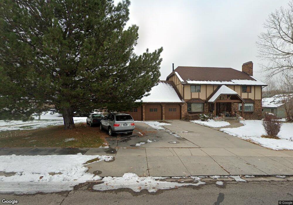
872 E 100 S American Fork, UT 84003
Estimated Value: $1,150,000 - $1,306,000
4
Beds
4
Baths
3,679
Sq Ft
$331/Sq Ft
Est. Value
About This Home
This home is located at 872 E 100 S, American Fork, UT 84003 and is currently estimated at $1,216,722, approximately $330 per square foot. 872 E 100 S is a home located in Utah County with nearby schools including Alpine School, Timberline Middle School, and Lone Peak High School.
Ownership History
Date
Name
Owned For
Owner Type
Purchase Details
Closed on
Mar 17, 2025
Sold by
Doreen M Wanlass Trust and Jarvis Annette Wanlass
Bought by
Wanlass Brent Cravens
Current Estimated Value
Purchase Details
Closed on
Jul 8, 2015
Sold by
Wanlass Doreen M and Wanlass 1984 Trust
Bought by
Wanlass Doreen M and Doreen M Wanlass Trust
Purchase Details
Closed on
Nov 30, 1998
Sold by
Wanlass Cravens L and Wanlass Doreen M
Bought by
Wanlass Cravens L and Wanlass Doreen M
Create a Home Valuation Report for This Property
The Home Valuation Report is an in-depth analysis detailing your home's value as well as a comparison with similar homes in the area
Home Values in the Area
Average Home Value in this Area
Purchase History
We collect this data history from publicly available records. To have your information removed, we recommend requesting removal directly through your county’s website.
| Date | Buyer | Sale Price | Title Company |
|---|---|---|---|
| Wanlass Brent Cravens | -- | None Listed On Document | |
| Wanlass Doreen M | -- | None Available | |
| Wanlass Cravens L | -- | -- |
Source: Public Records
Tax History
| Year | Tax Paid | Tax Assessment Tax Assessment Total Assessment is a certain percentage of the fair market value that is determined by local assessors to be the total taxable value of land and additions on the property. | Land | Improvement |
|---|---|---|---|---|
| 2025 | $3,273 | $533,830 | -- | -- |
| 2024 | $3,273 | $498,025 | $0 | $0 |
| 2023 | $3,936 | $492,525 | $0 | $0 |
| 2022 | $3,717 | $451,715 | $0 | $0 |
| 2021 | $3,197 | $603,400 | $260,200 | $343,200 |
| 2020 | $3,123 | $562,800 | $226,300 | $336,500 |
| 2019 | $2,691 | $518,900 | $226,300 | $292,600 |
| 2018 | $2,723 | $518,900 | $226,300 | $292,600 |
| 2017 | $2,505 | $254,045 | $0 | $0 |
| 2016 | $2,480 | $234,410 | $0 | $0 |
| 2015 | $2,614 | $233,805 | $0 | $0 |
| 2014 | -- | $208,010 | $0 | $0 |
Source: Public Records
Map
Nearby Homes
- 887 E Village Way
- 815 E Alpine Dr
- 202 E Alpine Dr
- 1201 E Preston Dr
- 550 Blackhawk Ln
- 971 E 300 N
- 355 Wood Dr
- 615 E 300 N
- 1296 Oakwood Cir
- 86 S Bald Mountain Dr
- 499 E 300 N
- 76 N Bald Mountain Dr
- 121 N 300 E
- 1190 E Wintergreen Ct
- 602 N Quail Hollow Dr
- 811 S High Ridge Dr
- 288 E 350 N
- 802 S East Mountain Cir
- 48 N 100 E
- 475 Grove Dr
- 844 E Village Way
- 844 E 100 S
- 923 E Alpine Dr
- 816 E Village Way
- 932 E Village Way
- 851 E 100 S
- 821 E 100 S
- 913 E Village Way
- 200 !Dnp! Residential Listing 2
- 950 E Village Way
- 165 S 800 E
- 941 E Village Way
- 871 E Alpine Dr
- 843 E Alpine Dr
- 874 E Meadowbrook Dr
- 770 E 100 S
- 767 E 100 S
- 949 E Alpine Dr
- 986 E Village Way
- 20 N Meadowbrook Dr
Your Personal Tour Guide
Ask me questions while you tour the home.