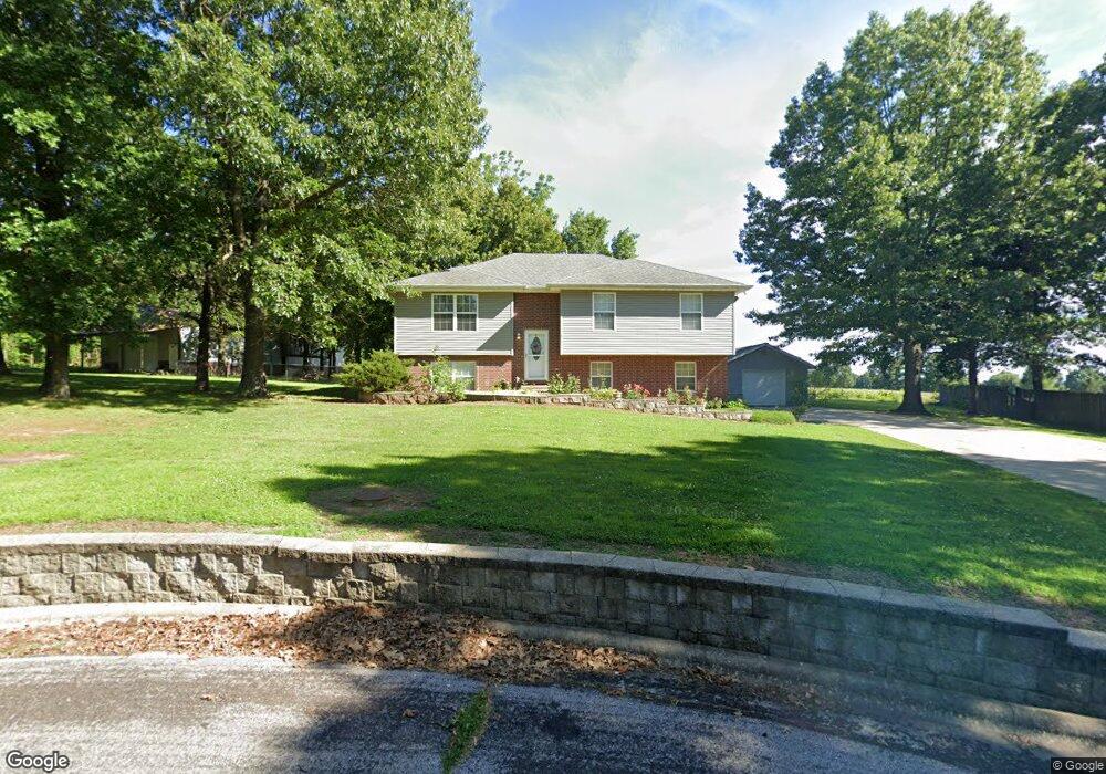
8723 Brookside Cir Monett, MO 65708
Estimated Value: $250,000 - $346,000
4
Beds
3
Baths
2,100
Sq Ft
$140/Sq Ft
Est. Value
About This Home
This home is located at 8723 Brookside Cir, Monett, MO 65708 and is currently estimated at $294,345, approximately $140 per square foot. 8723 Brookside Cir is a home located in Lawrence County with nearby schools including Monett Elementary School, Monett Intermediate School, and Central Park Elementary School.
Ownership History
Date
Name
Owned For
Owner Type
Purchase Details
Closed on
Mar 31, 2017
Sold by
Snyder Logan and Snyder Sarah
Bought by
Abramovitz Elaine I
Current Estimated Value
Home Financials for this Owner
Home Financials are based on the most recent Mortgage that was taken out on this home.
Original Mortgage
$94,500
Outstanding Balance
$48,740
Interest Rate
4.15%
Mortgage Type
New Conventional
Estimated Equity
$245,605
Purchase Details
Closed on
Sep 25, 2014
Sold by
Arnold John W
Bought by
Snyder Logan and Snyder Sarah
Home Financials for this Owner
Home Financials are based on the most recent Mortgage that was taken out on this home.
Original Mortgage
$133,200
Interest Rate
4.14%
Mortgage Type
New Conventional
Purchase Details
Closed on
Nov 8, 2012
Sold by
Arnold John W
Bought by
Arnold John W
Create a Home Valuation Report for This Property
The Home Valuation Report is an in-depth analysis detailing your home's value as well as a comparison with similar homes in the area
Home Values in the Area
Average Home Value in this Area
Purchase History
| Date | Buyer | Sale Price | Title Company |
|---|---|---|---|
| Abramovitz Elaine I | -- | None Available | |
| Snyder Logan | -- | Bcat | |
| Arnold John W | -- | Nations Title |
Source: Public Records
Mortgage History
| Date | Status | Borrower | Loan Amount |
|---|---|---|---|
| Open | Abramovitz Elaine I | $94,500 | |
| Previous Owner | Snyder Logan | $133,200 |
Source: Public Records
Tax History
| Year | Tax Paid | Tax Assessment Tax Assessment Total Assessment is a certain percentage of the fair market value that is determined by local assessors to be the total taxable value of land and additions on the property. | Land | Improvement |
|---|---|---|---|---|
| 2025 | $1,674 | $34,500 | $3,150 | $31,350 |
| 2024 | $1,535 | $31,420 | $3,150 | $28,270 |
| 2023 | $1,446 | $31,420 | $3,150 | $28,270 |
| 2022 | $1,424 | $29,370 | $3,150 | $26,220 |
| 2021 | $1,426 | $29,370 | $3,150 | $26,220 |
| 2020 | $1,418 | $28,960 | $2,740 | $26,220 |
| 2019 | $1,351 | $28,960 | $2,740 | $26,220 |
| 2018 | $1,286 | $28,960 | $2,740 | $26,220 |
| 2017 | $1,278 | $28,960 | $2,740 | $26,220 |
| 2016 | -- | $26,380 | $2,740 | $23,640 |
| 2015 | -- | $26,380 | $2,740 | $23,640 |
| 2014 | -- | $26,380 | $2,740 | $23,640 |
Source: Public Records
Map
Nearby Homes
- 3 Remington Dr
- 1703 Twin Oaks Dr
- Lot 276 Leon Ln
- 4 Remington Dr
- Lot 278 Leon Ln
- Lot 279 Leon Ln
- 8496 Lawrence 2230
- Lot 277 Leon Ln
- Lot 280 Leon Ln
- 23548 Lawrence 1090
- 1105 N 14th St
- 8954 Lawrence 2226p
- 000 County Road 1090
- 23394 Lawrence 1096
- 1401 6th St
- 1413 4th St
- 917 7th St
- 613 8th St
- 618 8th St
- 1401 E Broadway
- 8755 Brookside Cir
- 8675 Brookside Cir
- 8700 Brookside Cir
- 8765 Brookside Cir
- 8655 Brookside Cir
- 8686 Brookside Cir
- 8790 Brookside Cir
- 8660 Brookside Cir
- 8635 Brookside Cir
- 8775 Brookside Cir
- 8640 Brookside Cir
- 8830 Brookside Cir
- 8615 Brookside Cir
- 8785 Brookside Cir
- 20 Remington Dr
- 8795 Brookside Cir
- 19 Remington Dr Unit Lot 19 Woodland Hill
- 21 Remington Dr
- 8850 Brookside Cir
- 8620 Brookside Cir
Your Personal Tour Guide
Ask me questions while you tour the home.