Estimated Value: $264,346 - $287,000
3
Beds
1
Bath
1,073
Sq Ft
$253/Sq Ft
Est. Value
About This Home
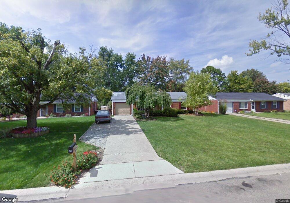
This home is located at 873 Brookcrest Dr, Mason, OH 45040 and is currently estimated at $271,087, approximately $252 per square foot. 873 Brookcrest Dr is a home located in Warren County with nearby schools including Mason Intermediate Elementary School, Mason Middle School, and William Mason High School.
Ownership History
Date
Name
Owned For
Owner Type
Purchase Details
Closed on
Mar 29, 2019
Sold by
Eastham Donnie L
Bought by
Eastham Lynn
Current Estimated Value
Home Financials for this Owner
Home Financials are based on the most recent Mortgage that was taken out on this home.
Original Mortgage
$112,700
Outstanding Balance
$98,063
Interest Rate
4.3%
Mortgage Type
New Conventional
Estimated Equity
$173,024
Purchase Details
Closed on
Aug 20, 2002
Sold by
Bare Robert M
Bought by
Eastham Donnie L
Home Financials for this Owner
Home Financials are based on the most recent Mortgage that was taken out on this home.
Original Mortgage
$108,600
Interest Rate
6.64%
Mortgage Type
FHA
Purchase Details
Closed on
Apr 1, 1996
Sold by
Jones Joanne
Bought by
Bare Robert M and Bare G
Home Financials for this Owner
Home Financials are based on the most recent Mortgage that was taken out on this home.
Original Mortgage
$55,200
Interest Rate
6.98%
Mortgage Type
New Conventional
Create a Home Valuation Report for This Property
The Home Valuation Report is an in-depth analysis detailing your home's value as well as a comparison with similar homes in the area
Home Values in the Area
Average Home Value in this Area
Purchase History
| Date | Buyer | Sale Price | Title Company |
|---|---|---|---|
| Eastham Lynn | -- | Wave Title Agency Inc | |
| Eastham Donnie L | $109,500 | -- | |
| Bare Robert M | $69,000 | -- |
Source: Public Records
Mortgage History
| Date | Status | Borrower | Loan Amount |
|---|---|---|---|
| Open | Eastham Lynn | $112,700 | |
| Closed | Eastham Donnie L | $108,600 | |
| Previous Owner | Bare Robert M | $55,200 |
Source: Public Records
Tax History
| Year | Tax Paid | Tax Assessment Tax Assessment Total Assessment is a certain percentage of the fair market value that is determined by local assessors to be the total taxable value of land and additions on the property. | Land | Improvement |
|---|---|---|---|---|
| 2025 | $3,010 | $74,170 | $24,500 | $49,670 |
| 2024 | $3,010 | $74,170 | $24,500 | $49,670 |
| 2023 | $2,842 | $59,150 | $15,067 | $44,082 |
| 2022 | $2,805 | $59,150 | $15,068 | $44,083 |
| 2021 | $2,657 | $59,150 | $15,068 | $44,083 |
| 2020 | $2,520 | $48,090 | $12,250 | $35,840 |
| 2019 | $2,316 | $48,090 | $12,250 | $35,840 |
| 2018 | $2,324 | $48,090 | $12,250 | $35,840 |
| 2017 | $1,916 | $37,006 | $8,750 | $28,256 |
| 2016 | $1,973 | $37,006 | $8,750 | $28,256 |
| 2015 | $1,978 | $37,006 | $8,750 | $28,256 |
| 2014 | $1,893 | $33,040 | $7,810 | $25,230 |
| 2013 | $1,897 | $37,000 | $8,750 | $28,250 |
Source: Public Records
Map
Nearby Homes
- 5988 Snider Cove Way
- 5670 Villas Creek Dr
- 6705 Willow Ln
- 986 Western Row Rd
- 607 Tylersville Rd
- 6176 Nicholas Way
- 6172 Nicholas Way
- 6168 Nicholas Way
- 6164 Nicholas Way
- 6160 Nicholas Way
- 6191 Nicholas Way
- 6187 Nicholas Way
- 6179 Nicholas Way
- 6175 Nicholas Way
- 6171 Nicholas Way
- 6390 Coverage Ct
- 6386 Coverage Ct
- 6382 Coverage Ct
- 6378 Coverage Ct
- 6130 Nicholas Way
- 865 Brookcrest Dr
- 881 Brookcrest Dr
- 889 Brookcrest Dr
- 855 Brookcrest Dr
- 897 Brookcrest Dr
- 864 Brookcrest Dr
- 870 Brookcrest Dr
- 847 Brookcrest Dr
- 854 Brookcrest Dr
- 878 Brookcrest Dr
- 848 Brookcrest Dr
- 903 Brookcrest Dr
- 886 Brookcrest Dr
- 845 Brookcrest Dr
- 896 Brookcrest Dr
- 911 Brookcrest Dr
- 836 Brookcrest Dr
- 902 Brookcrest Dr
- 909 Cherokee Dr
- 919 Brookcrest Dr
Your Personal Tour Guide
Ask me questions while you tour the home.