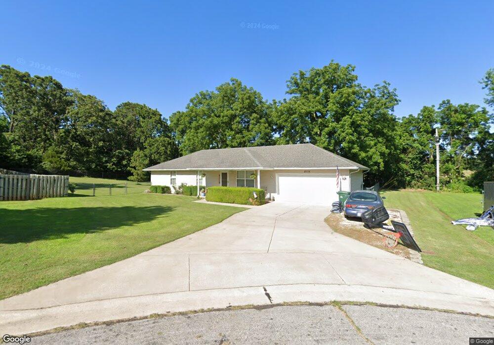
8775 Brookside Cir Monett, MO 65708
Estimated Value: $205,000 - $252,000
3
Beds
2
Baths
1,692
Sq Ft
$132/Sq Ft
Est. Value
About This Home
This home is located at 8775 Brookside Cir, Monett, MO 65708 and is currently estimated at $223,356, approximately $132 per square foot. 8775 Brookside Cir is a home located in Lawrence County with nearby schools including Monett Elementary School, Monett Intermediate School, and Central Park Elementary School.
Ownership History
Date
Name
Owned For
Owner Type
Purchase Details
Closed on
Jan 9, 2013
Sold by
Federal Home Loan Mortgage Corporation
Bought by
Weldy Heather L
Current Estimated Value
Home Financials for this Owner
Home Financials are based on the most recent Mortgage that was taken out on this home.
Original Mortgage
$71,734
Interest Rate
3.44%
Mortgage Type
New Conventional
Purchase Details
Closed on
Sep 10, 2012
Sold by
Pope Patsy J and Adams Michael A
Bought by
Federal Home Loan Mortgage Corporation
Purchase Details
Closed on
Dec 29, 2008
Sold by
Meadows Stacy R
Bought by
Adams Michael A and Pope Patsy J
Home Financials for this Owner
Home Financials are based on the most recent Mortgage that was taken out on this home.
Original Mortgage
$99,750
Interest Rate
6.08%
Mortgage Type
New Conventional
Create a Home Valuation Report for This Property
The Home Valuation Report is an in-depth analysis detailing your home's value as well as a comparison with similar homes in the area
Home Values in the Area
Average Home Value in this Area
Purchase History
| Date | Buyer | Sale Price | Title Company |
|---|---|---|---|
| Weldy Heather L | $105,000 | Continental Title | |
| Federal Home Loan Mortgage Corporation | $95,000 | None Available | |
| Adams Michael A | -- | None Available |
Source: Public Records
Mortgage History
| Date | Status | Borrower | Loan Amount |
|---|---|---|---|
| Previous Owner | Weldy Heather L | $71,734 | |
| Previous Owner | Adams Michael A | $99,750 |
Source: Public Records
Tax History
| Year | Tax Paid | Tax Assessment Tax Assessment Total Assessment is a certain percentage of the fair market value that is determined by local assessors to be the total taxable value of land and additions on the property. | Land | Improvement |
|---|---|---|---|---|
| 2025 | $1,102 | $22,710 | $2,360 | $20,350 |
| 2024 | $1,012 | $20,710 | $2,360 | $18,350 |
| 2023 | $953 | $20,710 | $2,360 | $18,350 |
| 2022 | $939 | $19,370 | $2,360 | $17,010 |
| 2021 | $940 | $19,370 | $2,360 | $17,010 |
| 2020 | $933 | $19,060 | $2,050 | $17,010 |
| 2019 | $889 | $19,060 | $2,050 | $17,010 |
| 2018 | $847 | $19,060 | $2,050 | $17,010 |
| 2017 | $841 | $19,060 | $2,050 | $17,010 |
| 2016 | -- | $17,400 | $2,050 | $15,350 |
| 2015 | -- | $17,400 | $2,050 | $15,350 |
| 2014 | -- | $17,400 | $2,050 | $15,350 |
Source: Public Records
Map
Nearby Homes
- 3 Remington Dr
- 8496 Lawrence 2230
- 4 Remington Dr
- 23492 Lawrence 1090
- 23548 Lawrence 1090
- 8954 Lawrence 2226p
- 1105 N 14th St
- 000 County Road 1090
- 23394 Lawrence 1096
- 1413 4th St
- 1407 4th St
- Tbd Lawrence 2220
- 917 7th St
- 314 Birch St
- 505 9th St
- 1401 E Broadway
- 21851 Lawrence 1090
- 906 E Cale St
- 102 Kingsley Dr
- 502 7th St
- 8785 Brookside Cir
- 8765 Brookside Cir
- 8795 Brookside Cir
- 8790 Brookside Cir
- 8815 Brookside Cir
- 8755 Brookside Cir
- 8700 Brookside Cir
- 8830 Brookside Cir
- 8835 Brookside Cir
- 8835 Brookside Cir
- 8686 Brookside Cir
- 8660 Brookside Cir
- 8850 Brookside Cir
- 8855 Brookside Cir
- 8723 Brookside Cir
- 8675 Brookside Cir
- 8640 Brookside Cir
- 8870 Brookside Cir
- 8655 Brookside Cir
- 8620 Brookside Cir
Your Personal Tour Guide
Ask me questions while you tour the home.