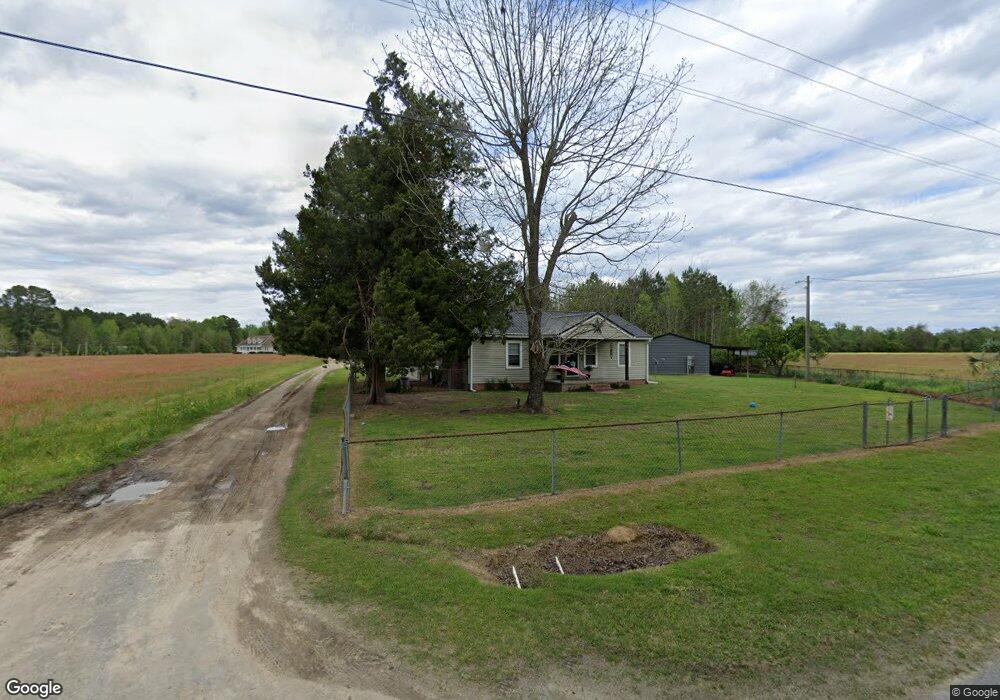
879 Borkowitz Rd Scranton, SC 29591
Estimated Value: $56,000 - $117,000
3
Beds
1
Bath
936
Sq Ft
$102/Sq Ft
Est. Value
About This Home
This home is located at 879 Borkowitz Rd, Scranton, SC 29591 and is currently estimated at $95,022, approximately $101 per square foot. 879 Borkowitz Rd is a home located in Florence County with nearby schools including Ronald E. McNair Junior High School and Lake City High School.
Ownership History
Date
Name
Owned For
Owner Type
Purchase Details
Closed on
Feb 22, 2006
Sold by
Wachovia Bank Na
Bought by
Barnett Scott G and Barnett Carrie M
Current Estimated Value
Home Financials for this Owner
Home Financials are based on the most recent Mortgage that was taken out on this home.
Original Mortgage
$28,900
Outstanding Balance
$15,848
Interest Rate
6.25%
Mortgage Type
Fannie Mae Freddie Mac
Estimated Equity
$79,174
Purchase Details
Closed on
Jan 11, 2006
Sold by
Kennedy Clifton and Kennedy Holly
Bought by
Wachovia Bank Na
Home Financials for this Owner
Home Financials are based on the most recent Mortgage that was taken out on this home.
Original Mortgage
$28,900
Outstanding Balance
$15,848
Interest Rate
6.25%
Mortgage Type
Fannie Mae Freddie Mac
Estimated Equity
$79,174
Create a Home Valuation Report for This Property
The Home Valuation Report is an in-depth analysis detailing your home's value as well as a comparison with similar homes in the area
Purchase History
| Date | Buyer | Sale Price | Title Company |
|---|---|---|---|
| Barnett Scott G | $28,900 | None Available | |
| Wachovia Bank Na | $31,053 | None Available |
Source: Public Records
Mortgage History
| Date | Status | Borrower | Loan Amount |
|---|---|---|---|
| Open | Barnett Scott G | $28,900 |
Source: Public Records
Tax History
| Year | Tax Paid | Tax Assessment Tax Assessment Total Assessment is a certain percentage of the fair market value that is determined by local assessors to be the total taxable value of land and additions on the property. | Land | Improvement |
|---|---|---|---|---|
| 2025 | $263 | $2,632 | $199 | $2,433 |
| 2024 | $350 | $2,632 | $199 | $2,433 |
| 2023 | $184 | $2,016 | $200 | $1,816 |
| 2022 | $323 | $2,016 | $200 | $1,816 |
| 2021 | $194 | $2,020 | $0 | $0 |
| 2020 | $322 | $2,020 | $0 | $0 |
| 2019 | $324 | $2,016 | $200 | $1,816 |
| 2018 | $284 | $2,020 | $0 | $0 |
| 2017 | $293 | $2,020 | $0 | $0 |
| 2016 | $159 | $1,590 | $0 | $0 |
| 2015 | $159 | $1,590 | $0 | $0 |
| 2014 | $144 | $1,587 | $200 | $1,387 |
Source: Public Records
Map
Nearby Homes
- Tract 4 State Road S-21-881
- TBD Borkowitz Road Red Barn Tract
- TBD Red Barn Tr State Road S-21-881
- Tract 3 State Road S-21-881
- Tract 6 State Road S-21-881
- TBD Tract 1 Trinidad Ard Rd
- TBD Trinidad Ard Tract 6
- TBD Trinidad Ard Tract 3
- TBD Trinindad Ard Tract 5
- TBD Tract 6 Trinidad Ard Rd
- TBD Tract 3 Trinidad Ard Rd
- TBD Tract 4 Trinidad Ard Rd
- TBD Trinidad Ard Tract 2
- TBD Trinidad Ard Tract 1
- TBD Trinidad Ard Tract 4
- TBD Tract 5 Trinidad Ard Rd
- TBD Tract 2 Trinidad Ard Rd
- 2999 Fish Hawk Ln
- 512 E Myrtle Beach Hwy
- Sandridge Rd
- Tract 7 State Road S-21-881
- 835 Borkowitz Rd
- 873 Borkowitz Rd
- 873 Borkowitz Rd
- 832 Borkowitz Rd
- 808 Borkowitz Rd
- 2403 Ernest Ln
- 817 Borkowitz Rd
- 810 Borkowitz Rd
- 752 Borkowitz Rd
- 817 Yarborough Rd
- 871 High Hill Rd
- 747 Borkowitz Rd
- 767 High Hill Rd
- 954 Yarborough Rd
- 924 Yarborough Rd
- 2515 Diamond Ln
- 995 Borkowitz Rd
- 944 Yarborough Rd
- 721 Borkowitz Rd
Your Personal Tour Guide
Ask me questions while you tour the home.