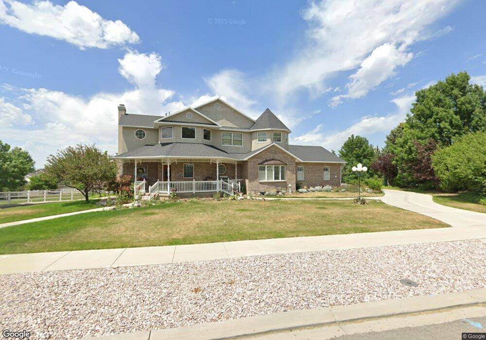
879 Southfork Dr Draper, UT 84020
Estimated Value: $1,050,000 - $1,395,000
4
Beds
4
Baths
2,723
Sq Ft
$473/Sq Ft
Est. Value
About This Home
This home is located at 879 Southfork Dr, Draper, UT 84020 and is currently estimated at $1,287,832, approximately $472 per square foot. 879 Southfork Dr is a home located in Salt Lake County with nearby schools including Draper Elementary School, Draper Park Middle School, and Corner Canyon High School.
Ownership History
Date
Name
Owned For
Owner Type
Purchase Details
Closed on
May 26, 2023
Sold by
Fox Lori T
Bought by
Keith And Saundra Tripp Family Living Trust
Current Estimated Value
Purchase Details
Closed on
May 22, 2023
Sold by
Fox Lori T
Bought by
Keith And Saundra Tripp Family Living Trust and Tripp
Purchase Details
Closed on
Apr 1, 2010
Sold by
Tripp Keith L and Tripp Saundra M
Bought by
Tripp Keith L and Tripp Saundra M
Home Financials for this Owner
Home Financials are based on the most recent Mortgage that was taken out on this home.
Original Mortgage
$152,800
Interest Rate
4.88%
Mortgage Type
New Conventional
Purchase Details
Closed on
Dec 21, 2007
Sold by
Tripp Keith L and Tripp Saundra M
Bought by
Tripp Keith L and Tripp Saundra M
Home Financials for this Owner
Home Financials are based on the most recent Mortgage that was taken out on this home.
Original Mortgage
$80,000
Interest Rate
6.15%
Mortgage Type
Credit Line Revolving
Purchase Details
Closed on
Apr 24, 2006
Sold by
Tripp Keith L and Tripp Saundra M
Bought by
Tripp Keith L and Tripp Saundra M
Home Financials for this Owner
Home Financials are based on the most recent Mortgage that was taken out on this home.
Original Mortgage
$27,899
Interest Rate
6.35%
Mortgage Type
Purchase Money Mortgage
Purchase Details
Closed on
Apr 4, 2001
Sold by
Tripp Keith L and Tripp Saundra M
Bought by
Tripp Keith L and Tripp Saundra M
Purchase Details
Closed on
Nov 4, 1998
Sold by
Tripp Keith L and Tripp Saundra M
Bought by
Tripp Keith L and Tripp Saundra M
Home Financials for this Owner
Home Financials are based on the most recent Mortgage that was taken out on this home.
Original Mortgage
$60,000
Interest Rate
6.61%
Purchase Details
Closed on
Feb 4, 1997
Sold by
Tripp Keith L and Tripp Saundra M
Bought by
Tripp Keith L and Tripp Saundra M
Create a Home Valuation Report for This Property
The Home Valuation Report is an in-depth analysis detailing your home's value as well as a comparison with similar homes in the area
Home Values in the Area
Average Home Value in this Area
Purchase History
| Date | Buyer | Sale Price | Title Company |
|---|---|---|---|
| Keith And Saundra Tripp Family Living Trust | -- | None Listed On Document | |
| Keith And Saundra Tripp Family Living Trust | -- | None Listed On Document | |
| Tripp Keith L | -- | Accommodation | |
| Tripp Keith L | -- | Metro National Title | |
| Tripp Keith L | -- | Metro National Title | |
| Tripp Keith L | -- | Metro National Title | |
| Tripp Keith L | -- | Metro National Title | |
| Tripp Keith L | -- | Metro National Title | |
| Tripp Keith L | -- | Metro National Title | |
| Tripp Keith L | -- | United Title Services | |
| Tripp Keith L | -- | -- | |
| Tripp Keith L | -- | -- | |
| Tripp Keith L | -- | -- |
Source: Public Records
Mortgage History
| Date | Status | Borrower | Loan Amount |
|---|---|---|---|
| Previous Owner | Tripp Keith L | $152,800 | |
| Previous Owner | Tripp Keith L | $80,000 | |
| Previous Owner | Tripp Keith L | $27,899 | |
| Previous Owner | Tripp Keith L | $60,000 |
Source: Public Records
Tax History
| Year | Tax Paid | Tax Assessment Tax Assessment Total Assessment is a certain percentage of the fair market value that is determined by local assessors to be the total taxable value of land and additions on the property. | Land | Improvement |
|---|---|---|---|---|
| 2025 | $5,950 | $1,247,490 | $390,890 | $856,600 |
| 2024 | $5,950 | $1,127,290 | $367,590 | $759,700 |
| 2023 | $5,367 | $1,039,190 | $322,690 | $716,500 |
| 2022 | $0 | $1,015,990 | $316,390 | $699,600 |
| 2021 | $5,742 | $892,100 | $257,500 | $634,600 |
| 2020 | $5,677 | $836,800 | $212,200 | $624,600 |
| 2019 | $4,794 | $689,490 | $212,190 | $477,300 |
| 2018 | $4,649 | $683,390 | $212,190 | $471,200 |
| 2017 | $4,439 | $625,090 | $191,090 | $434,000 |
| 2016 | $4,474 | $612,090 | $191,090 | $421,000 |
| 2015 | $4,836 | $612,690 | $186,190 | $426,500 |
| 2014 | $4,655 | $576,190 | $176,790 | $399,400 |
Source: Public Records
Map
Nearby Homes
- 919 E 13800 S
- 14119 S Senior Band Rd
- 835 E Canyon Breeze Ln
- 987 E Deer Arch Ln
- 994 E Deer Arch Ln
- 13920 Cromwell Ln
- 13856 S 620 E
- 1083 Skyler Dr E
- 14226 S Molasses Mill Dr
- 963 Old English Rd
- 528 E 13710 S
- 572 E Rockwell Vista
- 14116 S Timber Ridge Dr
- 14013 S Pine Mesa Dr
- 1306 E Victor Ln
- 14793 S Vintage View Ln Unit 14
- 1314 E Victor Ln
- 12890 S Blvd Unit 4
- 1349 E Elk Unit 33
- 14301 S Elsbrook Cir
- 864 Ranch Cir
- 888 Ranch Cir
- 927 Southfork Dr
- 857 E Southfork Dr
- 857 Southfork Dr
- 13925 Maple Hollow Cir
- 856 Ranch Cir
- 916 Ranch Cir
- 916 E Ranch Cir
- 13913 Maple Hollow Cir
- 855 Ranch Cir
- 942 E Ranch Cir
- 854 Southfork Dr
- 942 Ranch Cir
- 13885 S Corner Ridge Ct
- 13885 Corner Ridge Ct
- 875 Ranch Cir
- 859 Ranch Cir
- 13905 Corner Ridge Ct
- 13905 S Corner Ridge Ct
Your Personal Tour Guide
Ask me questions while you tour the home.