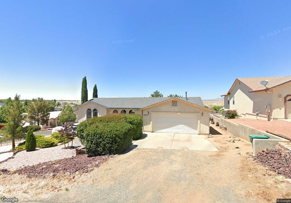
8866 E Nugget Cir Prescott Valley, AZ 86314
Estimated Value: $397,000 - $436,000
3
Beds
2
Baths
1,564
Sq Ft
$268/Sq Ft
Est. Value
About This Home
This home is located at 8866 E Nugget Cir, Prescott Valley, AZ 86314 and is currently estimated at $419,253, approximately $268 per square foot. 8866 E Nugget Cir is a home located in Yavapai County with nearby schools including Coyote Springs Elementary School, Glassford Hill Middle School, and Bradshaw Mountain High School.
Ownership History
Date
Name
Owned For
Owner Type
Purchase Details
Closed on
Jul 15, 2025
Sold by
Smith Steven
Bought by
Mokie Trust and Smith
Current Estimated Value
Purchase Details
Closed on
Jan 30, 2025
Sold by
Smith Steven M
Bought by
Smith Steven M
Purchase Details
Closed on
Jun 14, 2022
Sold by
Smith Steven and Vandeventer John
Bought by
Smith Steven and Vandeventer John
Purchase Details
Closed on
May 13, 2021
Sold by
Smith Steven and Smith Steven M
Bought by
Smith Steven and Vandeventer John
Home Financials for this Owner
Home Financials are based on the most recent Mortgage that was taken out on this home.
Original Mortgage
$242,946
Interest Rate
3%
Mortgage Type
New Conventional
Purchase Details
Closed on
May 10, 2016
Sold by
Vandeventer John M
Bought by
Smith Steven M
Home Financials for this Owner
Home Financials are based on the most recent Mortgage that was taken out on this home.
Original Mortgage
$206,600
Interest Rate
3.58%
Mortgage Type
VA
Purchase Details
Closed on
Aug 7, 2009
Sold by
Bushman James Virgil and Bushman Janet C
Bought by
Smith Steven M and Van Deventer John M
Home Financials for this Owner
Home Financials are based on the most recent Mortgage that was taken out on this home.
Original Mortgage
$162,011
Interest Rate
5.17%
Mortgage Type
FHA
Purchase Details
Closed on
Mar 29, 2000
Sold by
Riede Terry
Bought by
Bushman James Virgil and Bushman Janet C
Home Financials for this Owner
Home Financials are based on the most recent Mortgage that was taken out on this home.
Original Mortgage
$101,166
Interest Rate
8.25%
Mortgage Type
FHA
Purchase Details
Closed on
Mar 3, 1995
Sold by
Stephenson Don W and Stephenson Tanya L
Bought by
Riede Terry
Purchase Details
Closed on
Oct 18, 1993
Sold by
Cook Roy J and Cook Fern
Bought by
Stephenson Don W and Stephenson Tanya L
Home Financials for this Owner
Home Financials are based on the most recent Mortgage that was taken out on this home.
Original Mortgage
$56,500
Interest Rate
7.29%
Mortgage Type
New Conventional
Create a Home Valuation Report for This Property
The Home Valuation Report is an in-depth analysis detailing your home's value as well as a comparison with similar homes in the area
Purchase History
| Date | Buyer | Sale Price | Title Company |
|---|---|---|---|
| Mokie Trust | -- | None Listed On Document | |
| Smith Steven M | -- | None Listed On Document | |
| Smith Steven | -- | None Listed On Document | |
| Smith Steven | -- | Vantage Point Title Inc | |
| Smith Steven M | -- | Yavapai Title Agency Inc | |
| Smith Steven M | $165,000 | Yavapai Title Agency Inc | |
| Bushman James Virgil | $102,000 | Transnation Title Ins Co | |
| Riede Terry | $115,000 | Capital Title Agency | |
| Stephenson Don W | $93,000 | Capital Title Agency |
Source: Public Records
Mortgage History
| Date | Status | Borrower | Loan Amount |
|---|---|---|---|
| Previous Owner | Smith Steven | $242,946 | |
| Previous Owner | Smith Steven M | $206,600 | |
| Previous Owner | Smith Steven M | $162,011 | |
| Previous Owner | Bushman James Virgil | $101,166 | |
| Previous Owner | Stephenson Don W | $56,500 |
Source: Public Records
Tax History
| Year | Tax Paid | Tax Assessment Tax Assessment Total Assessment is a certain percentage of the fair market value that is determined by local assessors to be the total taxable value of land and additions on the property. | Land | Improvement |
|---|---|---|---|---|
| 2026 | $1,507 | $34,276 | -- | -- |
| 2024 | $1,382 | $35,975 | -- | -- |
| 2023 | $1,382 | $29,754 | $4,168 | $25,586 |
| 2022 | $1,359 | $24,208 | $2,868 | $21,340 |
| 2021 | $1,420 | $22,413 | $2,883 | $19,530 |
| 2020 | $1,365 | $0 | $0 | $0 |
| 2019 | $1,348 | $0 | $0 | $0 |
| 2018 | $1,281 | $0 | $0 | $0 |
| 2017 | $1,257 | $0 | $0 | $0 |
| 2016 | $1,214 | $0 | $0 | $0 |
| 2015 | $1,196 | $0 | $0 | $0 |
| 2014 | $1,160 | $0 | $0 | $0 |
Source: Public Records
Map
Nearby Homes
- 5575 E Magpie Dr
- 8901 E Rowel Dr
- 5491 N Roadrunner Dr
- 5440 N Roadrunner Dr
- 5317 N Cattlemen Dr
- 8517 Roundup Dr
- 8501 Roundup Dr
- 8485 Roundup Dr
- 5168 N Ranger Rd
- 5626 N Robert Rd
- 000 Moblie Home Portfolio
- 8835 E Totem Cir
- 8850 E Roadrunner Dr
- 5237 N Desert Ln
- 5089 N Village Dr
- 5301 N Robert Rd
- 5841-5859 N Hill Dr
- 5290 N Robert Rd
- 5259 N Long Rifle Rd
- 5261 N Robert Rd
- 8866 E Nugget Cir Unit 9
- 8900 E Nugget Cir Unit /6398
- 8886 E Nugget Cir
- 5651 N Pawnee Dr
- 5626 N Pawnee Dr
- 8885 E Nugget Cir
- 5650 N Pawnee Dr
- 5663 N Pawnee Dr
- 5600 N Pawnee Dr
- 5677 N Pawnee Dr Unit 9
- 5677 N Pawnee Dr
- 8901 E Nugget Cir
- 5579 N Pawnee Dr
- 5579 N Pawnee Dr Unit 9
- 5641 N Mission Ln
- 5661 N Mission Ln
- 8886 E Waco Ct
- 5580 N Pawnee Dr
- 5681 N Mission Ln
- 5701 N Pawnee Dr
Your Personal Tour Guide
Ask me questions while you tour the home.