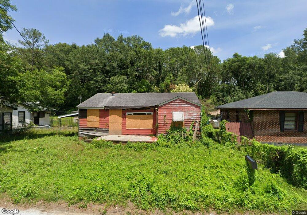
889 Sunnydale Dr Macon, GA 31217
Estimated Value: $51,334 - $86,000
About This Home
This home is located at 889 Sunnydale Dr, Macon, GA 31217 and is currently estimated at $65,584, approximately $48 per square foot. 889 Sunnydale Dr is a home located in Bibb County with nearby schools including Martin Luther King Jr. Elementary School, Appling Middle School, and Northeast High School.
Ownership History
We collect this data history from publicly available records. To have your information removed, we recommend requesting removal directly through your county’s website.
Purchase Details
Purchase Details
Purchase Details
Purchase History
We collect this data history from publicly available records. To have your information removed, we recommend requesting removal directly through your county’s website.
| Date | Buyer | Sale Price | Title Company |
|---|---|---|---|
| $15,500 | -- | ||
| $8,005 | -- | ||
| $16,000 | -- |
Tax History
We collect this data history from publicly available records. To have your information removed, we recommend requesting removal directly through your county’s website.
| Year | Tax Paid | Tax Assessment Tax Assessment Total Assessment is a certain percentage of the fair market value that is determined by local assessors to be the total taxable value of land and additions on the property. | Land | Improvement |
|---|---|---|---|---|
| 2025 | $247 | $10,044 | $1,700 | $8,344 |
| 2024 | $255 | $10,044 | $1,700 | $8,344 |
| 2023 | $789 | $8,792 | $1,700 | $7,092 |
| 2022 | $734 | $5,168 | $2,016 | $3,152 |
| 2021 | $124 | $3,260 | $1,008 | $2,252 |
| 2020 | $118 | $3,034 | $1,008 | $2,026 |
| 2019 | $123 | $3,148 | $896 | $2,252 |
| 2018 | $369 | $3,148 | $896 | $2,252 |
| 2017 | $193 | $5,149 | $896 | $4,253 |
| 2016 | $312 | $9,023 | $896 | $8,127 |
| 2015 | $386 | $7,873 | $896 | $6,977 |
| 2014 | $443 | $7,873 | $896 | $6,977 |
Map
- 921 Magnolia Dr
- 909 Johnson St
- 684 Reese St
- 1235 Boone St
- 1151 Boone St
- 2058 Melton Ave
- 2106 Melton Ave
- 1977 Thomas Dr
- 866 Roseview Dr
- 2256 Melton Ave
- 544 Hall St
- 774 Maynard St
- 735 Maynard St
- 768 Maynard St
- 1155 Mitchell St
- 1143 Smith St
- 873 Fort Hill St
- 917 Fort Hill St
- 722 Mitchell St
- 2350 Ollie Dr
- 875 Sunnydale Dr
- 907 Sunnydale Dr
- 855 Sunnydale Dr
- 890 Sunnydale Dr
- 882 Sunnydale Dr
- 923 Sunnydale Dr
- 912 Sunnydale Dr
- 851 Sunnydale Dr
- 870 Sunnydale Dr
- 930 Sunnydale Dr
- 836 Sunnydale Dr
- 817 Sunnydale Dr
- 951 Sunnydale Dr
- 946 Sunnydale Dr
- 885 Dorothy St
- 865 Dorothy St
- 824 Sunnydale Dr
- 855 Dorothy St
- 915 Dorothy St
- 967 Sunnydale Dr
Ask me questions while you tour the home.