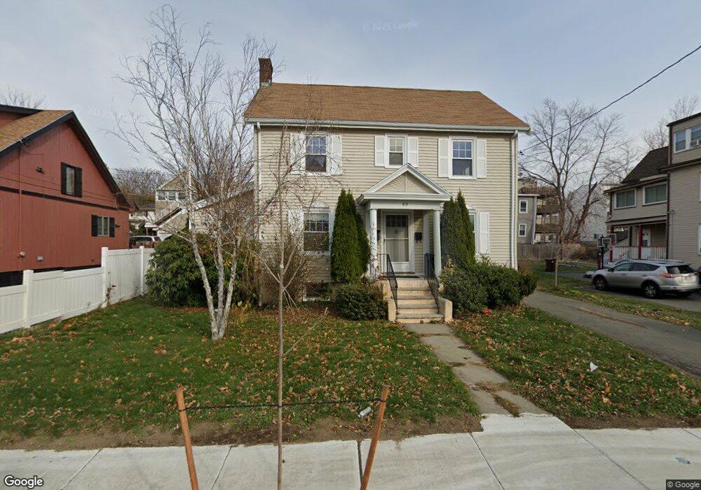
89 Eustis St Revere, MA 02151
Downtown Revere NeighborhoodEstimated Value: $974,000 - $1,145,000
6
Beds
4
Baths
2,977
Sq Ft
$352/Sq Ft
Est. Value
About This Home
This home is located at 89 Eustis St, Revere, MA 02151 and is currently estimated at $1,048,651, approximately $352 per square foot. 89 Eustis St is a home located in Suffolk County with nearby schools including Staff Sargent James J. Hill Elementary School, Rumney Marsh Academy, and Garfield Middle School.
Ownership History
Date
Name
Owned For
Owner Type
Purchase Details
Closed on
May 3, 2022
Sold by
Irani Zubin
Bought by
Hernandez Christian and Escobar Alejandra
Current Estimated Value
Home Financials for this Owner
Home Financials are based on the most recent Mortgage that was taken out on this home.
Original Mortgage
$976,978
Outstanding Balance
$906,250
Interest Rate
3.62%
Mortgage Type
FHA
Estimated Equity
$142,401
Purchase Details
Closed on
Dec 31, 2020
Sold by
Nilson Lois Est
Bought by
Irani Zubin
Home Financials for this Owner
Home Financials are based on the most recent Mortgage that was taken out on this home.
Original Mortgage
$435,000
Interest Rate
2.7%
Mortgage Type
Purchase Money Mortgage
Purchase Details
Closed on
Jul 8, 1985
Bought by
Nilson Lois
Create a Home Valuation Report for This Property
The Home Valuation Report is an in-depth analysis detailing your home's value as well as a comparison with similar homes in the area
Home Values in the Area
Average Home Value in this Area
Purchase History
| Date | Buyer | Sale Price | Title Company |
|---|---|---|---|
| Hernandez Christian | $995,000 | None Available | |
| Irani Zubin | $580,000 | None Available | |
| Nilson Lois | -- | -- |
Source: Public Records
Mortgage History
| Date | Status | Borrower | Loan Amount |
|---|---|---|---|
| Open | Hernandez Christian | $976,978 | |
| Previous Owner | Irani Zubin | $435,000 | |
| Previous Owner | Nilson Lois | $60,000 | |
| Previous Owner | Nilson Lois | $50,000 | |
| Previous Owner | Nilson Lois | $10,000 |
Source: Public Records
Tax History
| Year | Tax Paid | Tax Assessment Tax Assessment Total Assessment is a certain percentage of the fair market value that is determined by local assessors to be the total taxable value of land and additions on the property. | Land | Improvement |
|---|---|---|---|---|
| 2025 | $8,327 | $918,100 | $290,700 | $627,400 |
| 2024 | $8,196 | $899,700 | $274,500 | $625,200 |
| 2023 | $7,896 | $830,300 | $229,300 | $601,000 |
| 2022 | $6,259 | $601,800 | $218,000 | $383,800 |
| 2021 | $6,638 | $600,200 | $201,800 | $398,400 |
| 2020 | $6,571 | $583,600 | $201,800 | $381,800 |
| 2019 | $6,290 | $519,400 | $184,100 | $335,300 |
| 2018 | $5,504 | $424,700 | $166,300 | $258,400 |
| 2017 | $5,280 | $377,400 | $145,300 | $232,100 |
| 2016 | $4,738 | $327,900 | $132,400 | $195,500 |
| 2015 | $4,853 | $327,900 | $132,400 | $195,500 |
Source: Public Records
Map
Nearby Homes
- 70 Sprague St
- 58 Pleasant St
- 10 Franklin Ave Unit G10
- 10 Franklin Ave Unit g-20
- 10 Franklin Ave Unit 402
- 10 Franklin Ave Unit 107
- 10 Franklin Ave Unit 300
- 10 Franklin Ave Unit 400
- 10 Franklin Ave Unit 204
- 10 Franklin Ave Unit 406
- 10 Franklin Ave Unit 302
- 419 Lee Burbank Hwy
- 44 Mill St
- 473 Revere Beach Pkwy
- 19 Thornton St
- 26 Tapley Ave
- 83 Shirley Ave
- 71 Ambrose St
- 43 Kimball Ave Unit 2
- 82 Prospect Ave
- 89 Eustis St
- 89 Eustis St Unit 1
- 89 Eustis St Unit R
- 97 Eustis St
- 83 Eustis St
- 83 Eustis St Unit 1
- 101 Eustis St
- 313 Beach St
- 77 Eustis St
- 92 Eustis St
- 92 Eustis St Unit 1
- 321 Beach St
- 98 Eustis St
- 323 Beach St
- 323 Beach St Unit 1
- 102 Eustis St
- 88 Eustis St
- 88 Eustis St
- 88 Eustis St Unit 1
- 303 Beach St
Your Personal Tour Guide
Ask me questions while you tour the home.