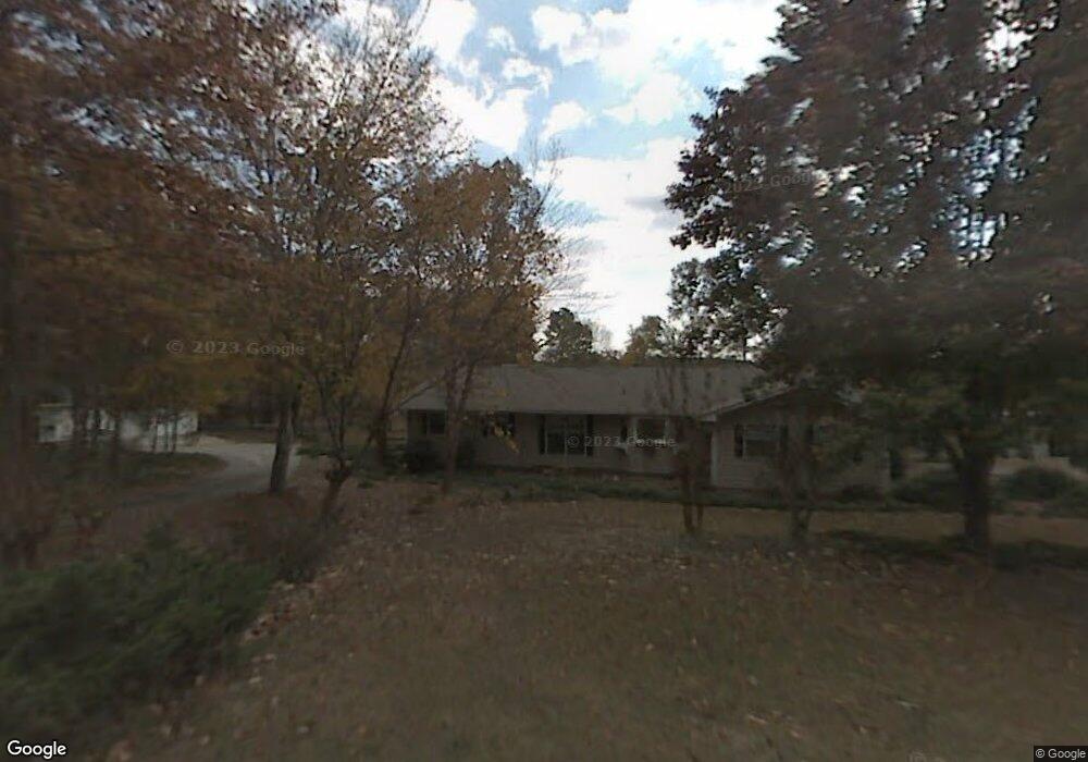
89 Redding Rd SW Cartersville, GA 30120
Estimated Value: $416,000 - $681,000
4
Beds
2
Baths
2,779
Sq Ft
$207/Sq Ft
Est. Value
About This Home
This home is located at 89 Redding Rd SW, Cartersville, GA 30120 and is currently estimated at $576,428, approximately $207 per square foot. 89 Redding Rd SW is a home located in Bartow County with nearby schools including Kingston Elementary School, Cass Middle School, and Cass High School.
Ownership History
Date
Name
Owned For
Owner Type
Purchase Details
Closed on
Nov 18, 2011
Sold by
Knight Patrick
Bought by
Knight Patrick
Current Estimated Value
Home Financials for this Owner
Home Financials are based on the most recent Mortgage that was taken out on this home.
Original Mortgage
$224,860
Outstanding Balance
$152,756
Interest Rate
4.17%
Mortgage Type
FHA
Estimated Equity
$423,672
Purchase Details
Closed on
Aug 18, 2005
Sold by
Williams Robert H
Bought by
Moore Charles Ronald
Home Financials for this Owner
Home Financials are based on the most recent Mortgage that was taken out on this home.
Original Mortgage
$248,000
Interest Rate
5.64%
Mortgage Type
New Conventional
Create a Home Valuation Report for This Property
The Home Valuation Report is an in-depth analysis detailing your home's value as well as a comparison with similar homes in the area
Home Values in the Area
Average Home Value in this Area
Purchase History
| Date | Buyer | Sale Price | Title Company |
|---|---|---|---|
| Knight Patrick | $224,860 | -- | |
| Knight Patrick | $224,860 | -- | |
| Moore Charles Ronald | $310,000 | -- |
Source: Public Records
Mortgage History
| Date | Status | Borrower | Loan Amount |
|---|---|---|---|
| Open | Knight Patrick | $224,860 | |
| Previous Owner | Moore Charles Ronald | $248,000 | |
| Previous Owner | Moore Charles Ronald | $62,000 |
Source: Public Records
Tax History
| Year | Tax Paid | Tax Assessment Tax Assessment Total Assessment is a certain percentage of the fair market value that is determined by local assessors to be the total taxable value of land and additions on the property. | Land | Improvement |
|---|---|---|---|---|
| 2025 | $5,309 | $220,745 | $62,722 | $158,023 |
| 2024 | $5,309 | $196,980 | $38,957 | $158,023 |
| 2023 | $4,787 | $168,443 | $27,939 | $140,504 |
| 2022 | $4,269 | $168,129 | $27,864 | $140,265 |
| 2021 | $3,437 | $128,836 | $27,864 | $100,972 |
| 2020 | $3,241 | $118,000 | $27,600 | $90,400 |
| 2019 | $2,976 | $107,200 | $11,600 | $95,600 |
| 2018 | $2,987 | $107,200 | $11,600 | $95,600 |
| 2017 | $3,002 | $107,200 | $11,600 | $95,600 |
| 2016 | $3,024 | $107,200 | $11,600 | $95,600 |
| 2015 | $2,737 | $96,840 | $11,600 | $85,240 |
| 2014 | $2,655 | $91,000 | $10,160 | $80,840 |
| 2013 | -- | $84,360 | $10,160 | $74,200 |
Source: Public Records
Map
Nearby Homes
- 16 Webb Dr SW
- 176 Innis Brook Cir
- 151 Chastain Dr
- 149 Chastain Dr
- 147 Chastain Dr
- 145 Chastain Dr
- 143 Chastain Dr
- 141 Chastain Dr
- 139 Chastain Dr
- 273 Old Gilliam Springs Rd SW
- 121 Chastain Dr SW
- 66 Arnold Rd
- 11 Berkshire Dr NW
- 12 Berkshire Dr NW
- 233 San Marino Way NW
- 17 Silversmith Trail NW
- 162 Oconee Rd Unit 270
- 74 Planters Dr NW
- 100 Colonial Cir NW
- 0 Highway 411 Unit 14214387
- 89 Redding Rd SW
- 78 Redding Rd SW
- 63 Redding Rd SW
- 64 Redding Rd SW
- 94 Redding Rd SW
- 47 Redding Rd SW
- 44 Redding Rd SW
- 25 Old Farm Rd SW
- 30 Redding Rd SW
- 70 Redding Rd SW
- 23 Redding Rd SW
- 24 Redding Rd SW
- 11 Lucille Rd SW
- 21 Old Farm Rd SW
- 80 Bailey Hill Rd SW
- 70 Bailey Hill Rd SW
- 70 Bailey Hill Rd SW
- 201 Oak Leaf Dr SW
- 52 Bailey Hill Rd SW
- 90 Bailey Hill Rd SW
Your Personal Tour Guide
Ask me questions while you tour the home.